 |
|
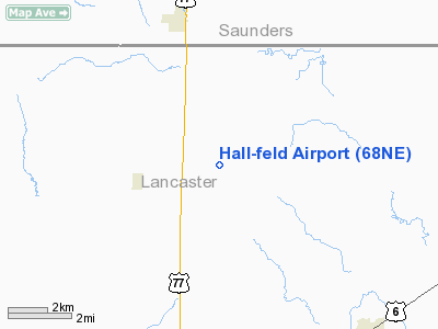
Location & QuickFacts
| FAA Information Effective: | 2008-09-25 |
| Airport Identifier: | 68NE |
| Airport Status: | Operational |
| Longitude/Latitude: | 096-37-11.0400W/40-59-28.9990N
-96.619733/40.991389 (Estimated) |
| Elevation: | 1355 ft / 413.00 m (Estimated) |
| Land: | 0 acres |
| From nearest city: | 2 nautical miles E of Davey, NE |
| Location: | Lancaster County, NE |
| Magnetic Variation: | 06E (1985) |
Owner & Manager
| Ownership: | Privately owned |
| Owner: | Wayne C. Halling |
| Address: | Box 16
Davey, NE 68017 |
| Phone number: | 402-785-7145 |
| Address: |
|
Airport Operations and Facilities
| Airport Use: | Private |
| Segmented Circle: | No |
| Control Tower: | No |
| Sectional chart: | Omaha |
| Region: | ACE - Central |
| Boundary ARTCC: | ZMP - Minneapolis |
| Tie-in FSS: | OLU - Columbus |
| FSS Toll Free: | 1-800-WX-BRIEF |
Runway Information
Runway 02/20
| Dimension: | 1700 x 60 ft / 518.2 x 18.3 m |
| Surface: | TURF, |
| |
Runway 02 |
Runway 20 |
| Traffic Pattern: | Left | Left |
| Obstruction: | 20 ft wires, 400.0 ft from runway | |
|
Radio Navigation Aids
| ID |
Type |
Name |
Ch |
Freq |
Var |
Dist |
| AHQ | NDB | Wahoo | | 400.00 | 07E | 14.9 nm |
| LN | NDB | Potts | | 385.00 | 06E | 16.1 nm |
| SWT | NDB | Seward | | 269.00 | 06E | 23.7 nm |
| MLE | NDB | Millard | | 371.00 | 06E | 26.0 nm |
| FET | NDB | Fremont | | 311.00 | 06E | 28.0 nm |
| PMV | NDB | Plattsmouth | | 329.00 | 06E | 32.2 nm |
| OM | NDB | Gerfi | | 320.00 | 05E | 37.6 nm |
| BJU | NDB | Big Blue | | 248.00 | 06E | 38.7 nm |
| AFK | NDB | Nebraska City | | 347.00 | 05E | 41.6 nm |
| HWB | NDB | Shaw | | 263.00 | 06E | 44.1 nm |
| JYR | NDB | York | | 257.00 | 06E | 45.6 nm |
| PLT | NDB | Platte Center | | 407.00 | 08E | 45.9 nm |
| FMZ | NDB | Beklof | | 392.00 | 07E | 49.4 nm |
| AYB | NDB | Auburn | | 430.00 | 05E | 49.9 nm |
| OFF | TACAN | Offutt | 054X | | 05E | 33.5 nm |
| BIE | VOR | Beatrice | | 110.60 | 07E | 41.9 nm |
| SCB | VOR/DME | Scribner | 47X | 111.00 | 06E | 36.9 nm |
| OLU | VOR/DME | Columbus | 055X | 111.80 | 08E | 42.7 nm |
| LNK | VORTAC | Lincoln | 108X | 116.10 | 09E | 6.9 nm |
| OVR | VORTAC | Omaha | 110X | 116.30 | 08E | 41.4 nm |
| OMA | VOT | Omaha | | 109.00 | | 37.9 nm |
Remarks
- PRVDD APCHS ARE MAINT FOR A 20:1 GLIDE SLOPE AND TRSNL SFCS FOR A 7:1 SLOPE.
Images and information placed above are from
http://www.airport-data.com/airport/68NE/
We thank them for the data!
| General Info
|
| Country |
United States
|
| State |
NEBRASKA
|
| FAA ID |
68NE
|
| Latitude |
40-59-28.999N
|
| Longitude |
096-37-11.040W
|
| Elevation |
1355 feet
|
| Near City |
DAVEY
|
We don't guarantee the information is fresh and accurate. The data may
be wrong or outdated.
For more up-to-date information please refer to other sources.
|
|


