 |
|
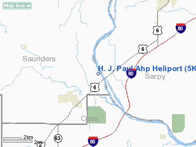
Location & QuickFacts
| FAA Information Effective: | 2008-09-25 |
| Airport Identifier: | 5K3 |
| Airport Status: | Operational |
| Longitude/Latitude: | 096-20-01.0530W/41-03-59.9950N
-96.333626/41.066665 (Estimated) |
| Elevation: | 1068 ft / 325.53 m (Estimated) |
| Land: | 0 acres |
| From nearest city: | 3 nautical miles NE of Camp Ashland(ashland), NE |
| Location: | Saunders County, NE |
| Magnetic Variation: | 06E (1985) |
Owner & Manager
| Ownership: | Army owned |
| Owner: | Nebraska National Guard |
| Address: |
|
| Manager: | James L Sweetman |
| Address: | Bldg 624 Lincoln Marpt
Lincoln, NE 68506 |
| Phone number: | 402-432-5050 |
Airport Operations and Facilities
| Airport Use: | Private |
| Wind indicator: | Yes |
| Segmented Circle: | No |
| Control Tower: | No |
| Lighting Schedule: | DUSK-DAWN
ACTIVATE HELIPOD LTG - 122.9. |
| Beacon Color: | Clear-Green (lighted land airport) |
| Landing fee charge: | No |
| Sectional chart: | Omaha |
| Region: | ACE - Central |
| Boundary ARTCC: | ZMP - Minneapolis |
| Tie-in FSS: | OLU - Columbus |
| FSS on Airport: | No |
| FSS Toll Free: | 1-800-WX-BRIEF |
Airport Services
| Airframe Repair: | NONE |
| Power Plant Repair: | NONE |
Runway Information
Helipad H1
| Dimension: | 3200 x 175 ft / 975.4 x 53.3 m |
| Surface: | TURF, |
| Edge Lights: | Low |
| |
Runway H1 |
Runway |
| Traffic Pattern: | Left | Left |
|
Radio Navigation Aids
| ID |
Type |
Name |
Ch |
Freq |
Var |
Dist |
| MLE | NDB | Millard | | 371.00 | 06E | 12.6 nm |
| AHQ | NDB | Wahoo | | 400.00 | 07E | 15.8 nm |
| PMV | NDB | Plattsmouth | | 329.00 | 06E | 20.5 nm |
| FET | NDB | Fremont | | 311.00 | 06E | 24.5 nm |
| OM | NDB | Gerfi | | 320.00 | 05E | 24.8 nm |
| LN | NDB | Potts | | 385.00 | 06E | 27.4 nm |
| AFK | NDB | Nebraska City | | 347.00 | 05E | 35.1 nm |
| SWT | NDB | Seward | | 269.00 | 06E | 37.4 nm |
| AYB | NDB | Auburn | | 430.00 | 05E | 44.9 nm |
| SDA | NDB | Shenandoah | | 411.00 | 05E | 46.1 nm |
| BJU | NDB | Big Blue | | 248.00 | 06E | 47.6 nm |
| RDK | NDB | Red Oak | | 230.00 | 04E | 49.1 nm |
| OFF | TACAN | Offutt | 054X | | 05E | 19.9 nm |
| TQE | VOR | Tekamah | | 108.40 | 07E | 42.2 nm |
| BIE | VOR | Beatrice | | 110.60 | 07E | 49.8 nm |
| SCB | VOR/DME | Scribner | 47X | 111.00 | 06E | 35.0 nm |
| LNK | VORTAC | Lincoln | 108X | 116.10 | 09E | 20.4 nm |
| OVR | VORTAC | Omaha | 110X | 116.30 | 08E | 27.7 nm |
| OMA | VOT | Omaha | | 109.00 | | 24.4 nm |
Remarks
- PLINE, TREES, BLDG-LM.
- CAUTION: WEAPONS FIRING ADJACENT TO RWY; CHECK FOR RED RANGE FIRING FLAG NE SIDE OF FIELD.
- WEST TRAFFIC PATTERN; FIXED WING ACFT PROHIBITED.
Images and information placed above are from
http://www.airport-data.com/airport/5K3/
We thank them for the data!
| General Info
|
| Country |
United States
|
| State |
NEBRASKA
|
| FAA ID |
5K3
|
| Latitude |
41-03-59.995N
|
| Longitude |
096-20-01.053W
|
| Elevation |
1068 feet
|
| Near City |
CAMP ASHLAND(ASHLAND)
|
We don't guarantee the information is fresh and accurate. The data may
be wrong or outdated.
For more up-to-date information please refer to other sources.
|
|


