 |
|
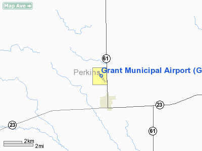
Location & QuickFacts
| FAA Information Effective: | 2008-09-25 |
| Airport Identifier: | GGF |
| Airport Status: | Operational |
| Longitude/Latitude: | 101-44-01.9659W/40-52-14.3881N
-101.733879/40.870663 (Estimated) |
| Elevation: | 3425 ft / 1043.94 m (Surveyed) |
| Land: | 95 acres |
| From nearest city: | 2 nautical miles N of Grant, NE |
| Location: | Perkins County, NE |
| Magnetic Variation: | 09E (1990) |
Owner & Manager
| Ownership: | Publicly owned |
| Owner: | City Of Grant |
| Address: | Po Box 614, 342 Central Avenue
Grant, NE 69140-0614 |
| Phone number: | 308-352-2100 |
| Manager: | William Besarick
CHAIRMAN, NO CURRENT MANAGER. |
| Address: | 76190 Highway 61
Grant, NE 69140-3203 |
| Phone number: | 308-352-4156
OR AMGR CELL 308-352-6364. |
Airport Operations and Facilities
| Airport Use: | Open to public |
| Wind indicator: | Yes |
| Segmented Circle: | Yes |
| Control Tower: | No |
| Lighting Schedule: | DUSK-DAWN
ACTVT MIRL RY 15/33 - CTAF. |
| Beacon Color: | Clear-Green (lighted land airport) |
| Landing fee charge: | No |
| Sectional chart: | Cheyenne |
| Region: | ACE - Central |
| Boundary ARTCC: | ZDV - Denver |
| Tie-in FSS: | OLU - Columbus |
| FSS on Airport: | No |
| FSS Toll Free: | 1-800-WX-BRIEF |
| NOTAMs Facility: | OLU (NOTAM-d service avaliable) |
| Federal Agreements: | NGY |
Airport Communications
| CTAF: | 122.800 |
| Unicom: | 122.800 |
Airport Services
| Fuel available: | 100LL |
| Airframe Repair: | MAJOR |
| Power Plant Repair: | MAJOR |
| Bottled Oxygen: | NONE |
| Bulk Oxygen: | NONE |
Runway Information
Runway 15/33
| Dimension: | 4797 x 60 ft / 1462.1 x 18.3 m |
| Surface: | CONC, Good Condition |
| Weight Limit: | Single wheel: 30000 lbs.
Dual wheel: 30000 lbs. |
| Edge Lights: | Medium |
| |
Runway 15 |
Runway 33 |
| Longitude: | 101-44-19.4134W | 101-43-44.5214W |
| Latitude: | 40-52-34.0556N | 40-51-54.7292N |
| Elevation: | 3422.00 ft | 3422.00 ft |
| Alignment: | 127 | 127 |
| Traffic Pattern: | Left | Left |
| Markings: | Non-precision instrument, Good Condition | Non-precision instrument, Good Condition |
|
Radio Navigation Aids
| ID |
Type |
Name |
Ch |
Freq |
Var |
Dist |
| GGF | NDB | Grant | | 359.00 | 09E | 0.2 nm |
| IML | NDB | Imperial | | 283.00 | 09E | 22.1 nm |
| HEQ | NDB | Heginbotham | | 404.00 | 11E | 30.4 nm |
| CNP | NDB | Chappell | | 383.00 | 10E | 35.2 nm |
| OKS | NDB | Oshkosh | | 233.00 | 09E | 42.4 nm |
| SAE | VOR/DME | Searle | 39X | 110.20 | 11E | 15.1 nm |
| HCT | VORTAC | Hayes Center | 124X | 117.70 | 11E | 44.6 nm |
| LBF | VORTAC | North Platte | 121X | 117.40 | 11E | 46.1 nm |
Remarks
- ULTRALIGHTS 0N & INVOF ARPT.
- EXISTED PRIOR TO 1959.
Images and information placed above are from
http://www.airport-data.com/airport/GGF/
We thank them for the data!
| General Info
|
| Country |
United States
|
| State |
NEBRASKA
|
| FAA ID |
GGF
|
| Latitude |
40-52-10.300N
|
| Longitude |
101-43-58.300W
|
| Elevation |
3424 feet
|
| Near City |
GRANT
|
We don't guarantee the information is fresh and accurate. The data may
be wrong or outdated.
For more up-to-date information please refer to other sources.
|
|


