 |
|
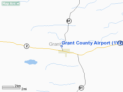
Location & QuickFacts
| FAA Information Effective: | 2008-09-25 |
| Airport Identifier: | 1V2 |
| Airport Status: | Operational |
| Longitude/Latitude: | 101-46-09.6380W/42-00-33.9460N
-101.769344/42.009429 (Estimated) |
| Elevation: | 3710 ft / 1130.81 m (Estimated) |
| Land: | 88 acres |
| From nearest city: | 1 nautical miles NW of Hyannis, NE |
| Location: | Grant County, NE |
| Magnetic Variation: | 10E (1985) |
Owner & Manager
| Ownership: | Publicly owned |
| Owner: | Grant County |
| Address: | Po Box 139
Hyannis, NE 69350-0139 |
| Phone number: | 308-458-2488
PHONE NO FOR GRANT COUNTY. |
| Manager: | Brian Brennemann |
| Address: | 64855 Brennemann Road
Hyannis, NE 69350-8842 |
| Phone number: | 308-458-2411 |
Airport Operations and Facilities
| Airport Use: | Open to public |
| Wind indicator: | Yes |
| Segmented Circle: | No |
| Control Tower: | No |
| Lighting Schedule: | DUSK-DAWN
ACTVT MIRL RY 17/35 - CTAF. |
| Beacon Color: | Clear-Green (lighted land airport)
BCN 2950' SE & TWR ON HILL EAST OF ARPT. |
| Landing fee charge: | No |
| Sectional chart: | Cheyenne |
| Region: | ACE - Central |
| Traffic Pattern Alt: | 800 ft |
| Boundary ARTCC: | ZDV - Denver |
| Tie-in FSS: | OLU - Columbus |
| FSS on Airport: | No |
| FSS Toll Free: | 1-800-WX-BRIEF |
| NOTAMs Facility: | OLU (NOTAM-d service avaliable) |
| Federal Agreements: | N |
Airport Communications
Airport Services
| Fuel available: | 100LL
FOR FUEL CALL 308-458-2488. |
| Airframe Repair: | NONE |
| Power Plant Repair: | NONE |
| Bottled Oxygen: | NONE |
| Bulk Oxygen: | NONE |
Runway Information
Runway 17/35
| Dimension: | 3975 x 50 ft / 1211.6 x 15.2 m |
| Surface: | ASPH, Good Condition |
| Edge Lights: | Medium |
| |
Runway 17 |
Runway 35 |
| Traffic Pattern: | Left | Left |
| Markings: | Basic, Fair Condition | Basic, Fair Condition |
| Displaced threshold: | 375.00 ft | 675.00 ft |
| Obstruction: | 10 ft road, 225.0 ft from runway
APCH RATIO 42:1 TO DSPLCD THR. | 23 ft pole, 130.0 ft from runway, 90 ft right of centerline
APCH RATIO 35:1 TO DSPLCD THLD. |
|
Radio Navigation Aids
| ID |
Type |
Name |
Ch |
Freq |
Var |
Dist |
| OKS | NDB | Oshkosh | | 233.00 | 09E | 44.9 nm |
| ALU | NDB | Alliance | | 380.00 | 11E | 46.0 nm |
| AIA | VOR/DME | Alliance | 055X | 111.80 | 11E | 46.3 nm |
| TDD | VOR/DME | Thedford | 023X | 108.60 | 09E | 46.9 nm |
Images and information placed above are from
http://www.airport-data.com/airport/1V2/
We thank them for the data!
| General Info
|
| Country |
United States
|
| State |
NEBRASKA
|
| FAA ID |
1V2
|
| Latitude |
42-00-33.946N
|
| Longitude |
101-46-09.638W
|
| Elevation |
3710 feet
|
| Near City |
HYANNIS
|
We don't guarantee the information is fresh and accurate. The data may
be wrong or outdated.
For more up-to-date information please refer to other sources.
|
|


