 |
|
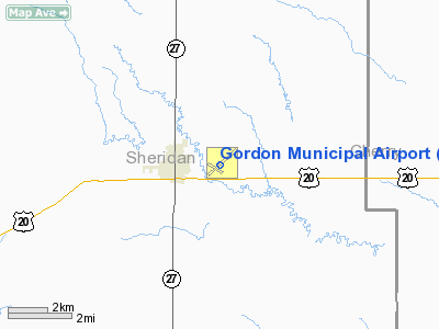
Location & QuickFacts
| FAA Information Effective: | 2008-09-25 |
| Airport Identifier: | GRN |
| Airport Status: | Operational |
| Longitude/Latitude: | 102-10-30.9000W/42-48-21.5000N
-102.175250/42.805972 (Estimated) |
| Elevation: | 3562 ft / 1085.70 m (Surveyed) |
| Land: | 289 acres |
| From nearest city: | 1 nautical miles E of Gordon, NE |
| Location: | Sheridan County, NE |
| Magnetic Variation: | 09E (2000) |
Owner & Manager
| Ownership: | Publicly owned |
| Owner: | Gordon Arpt Auth |
| Address: | Po Box 310
Gordon, NE 69343-0310 |
| Phone number: | 308-282-0214 |
| Manager: | Fred Hlava |
| Address: | Po Box 310
Gordon, NE 69343-0310 |
| Phone number: | 308-282-0837 |
Airport Operations and Facilities
| Airport Use: | Open to public |
| Wind indicator: | Yes |
| Segmented Circle: | No |
| Control Tower: | No |
| Lighting Schedule: | DUSK-DAWN
ACTVT MIRL RYS 11/29 & 04/22 - CTAF. |
| Beacon Color: | Clear-Green (lighted land airport) |
| Landing fee charge: | No |
| Sectional chart: | Cheyenne |
| Region: | ACE - Central |
| Boundary ARTCC: | ZDV - Denver |
| Tie-in FSS: | OLU - Columbus |
| FSS on Airport: | No |
| FSS Toll Free: | 1-800-WX-BRIEF |
| NOTAMs Facility: | OLU (NOTAM-d service avaliable) |
| Federal Agreements: | NGY |
Airport Communications
| CTAF: | 122.800 |
| Unicom: | 122.800 |
Airport Services
| Fuel available: | 100LL
AFT HRS CALL DON KAPLAN 308-282-1467 |
| Bottled Oxygen: | NONE |
| Bulk Oxygen: | NONE |
Runway Information
Runway 04/22
| Dimension: | 5196 x 75 ft / 1583.7 x 22.9 m |
| Surface: | ASPH, Good Condition |
| Weight Limit: | Single wheel: 12000 lbs. |
| Edge Lights: | Medium |
| |
Runway 04 |
Runway 22 |
| Longitude: | 102-10-52.1960W | 102-09-59.8271W |
| Latitude: | 42-48-07.1955N | 42-48-41.0495N |
| Elevation: | 3544.00 ft | 3562.00 ft |
| Alignment: | 49 | 127 |
| Traffic Pattern: | Left | Left |
| Markings: | Non-precision instrument, Good Condition | Non-precision instrument, Good Condition |
| Crossing Height: | 40.00 ft | 41.00 ft |
| VASI: | 2-light PAPI on left side | 2-light PAPI on left side |
| Visual Glide Angle: | 3.00° | 3.00° |
| Obstruction: | 38 ft trees, 1000.0 ft from runway, 75 ft left of centerline, 21:1 slope to clear | , 50:1 slope to clear |
|
Runway 11/29
| Dimension: | 2284 x 50 ft / 696.2 x 15.2 m |
| Surface: | ASPH, Good Condition |
| Weight Limit: | Single wheel: 12000 lbs. |
| Edge Lights: | Medium |
| |
Runway 11 |
Runway 29 |
| Longitude: | 102-10-54.9159W | 102-10-29.1442W |
| Latitude: | 42-48-21.6978N | 42-48-09.5026N |
| Elevation: | 3548.00 ft | 3542.00 ft |
| Alignment: | 123 | 127 |
| Traffic Pattern: | Left | Left |
| Markings: | Basic, Good Condition | Basic, Good Condition |
| Obstruction: | 33 ft pole, 945.0 ft from runway, 75 ft right of centerline, 22:1 slope to clear | , 50:1 slope to clear |
|
Radio Navigation Aids
| ID |
Type |
Name |
Ch |
Freq |
Var |
Dist |
| GRN | NDB | Gordon | | 414.00 | 09E | 0.3 nm |
| HIN | NDB | Whitney | | 275.00 | 11E | 40.5 nm |
Remarks
- LES EVERT, CHAIRMAN OF ARPT AUTH, 308-282-1784.
- ESTABLISHED PRIOR TO 1959.
Images and information placed above are from
http://www.airport-data.com/airport/GRN/
We thank them for the data!
| General Info
|
| Country |
United States
|
| State |
NEBRASKA
|
| FAA ID |
GRN
|
| Latitude |
42-48-21.500N
|
| Longitude |
102-10-30.900W
|
| Elevation |
3562 feet
|
| Near City |
GORDON
|
We don't guarantee the information is fresh and accurate. The data may
be wrong or outdated.
For more up-to-date information please refer to other sources.
|
|


