 |
|
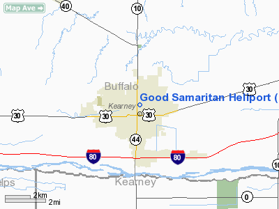
Location & QuickFacts
| FAA Information Effective: | 2008-09-25 |
| Airport Identifier: | 76NE |
| Airport Status: | Operational |
| Longitude/Latitude: | 099-04-53.3160W/40-42-27.0450N
-99.081477/40.707513 (Estimated) |
| Elevation: | 2146 ft / 654.10 m (Estimated) |
| Land: | 0 acres |
| From nearest city: | 0 nautical miles N of Kearney, NE |
| Location: | Buffalo County, NE |
| Magnetic Variation: | 08E (1980) |
Owner & Manager
| Ownership: | Privately owned |
| Owner: | Good Samaritan Hospital |
| Address: | 10 E. 31st St.
Kearney, NE 68847 |
| Phone number: | 308-865-7100 |
| Manager: | Paul O'connell/doug Wulf |
| Address: | 10 E. 31st St.
Kearney, NE 68847 |
| Phone number: | 308-865-7228 |
Airport Operations and Facilities
| Airport Use: | Private
MEDICAL. |
| Wind indicator: | Yes |
| Segmented Circle: | No |
| Control Tower: | No |
| Landing fee charge: | No |
| Sectional chart: | Omaha |
| Region: | ACE - Central |
| Boundary ARTCC: | ZDV - Denver |
| Tie-in FSS: | OLU - Columbus |
| FSS on Airport: | No |
| FSS Toll Free: | 1-800-WX-BRIEF |
Runway Information
Helipad H1
| Dimension: | 30 x 30 ft / 9.1 x 9.1 m |
| Surface: | CONC,
ROOFTOP. |
| |
Runway H1 |
Runway |
| Traffic Pattern: | Left | Left |
|
Radio Navigation Aids
| ID |
Type |
Name |
Ch |
Freq |
Var |
Dist |
| HDE | NDB | Holdrege | | 396.00 | 07E | 19.6 nm |
| PSS | NDB | Prosser | | 338.00 | 07E | 27.6 nm |
| RRX | NDB | Darr | | 326.00 | 07E | 36.2 nm |
| DWL | NDB | Willow | | 353.00 | 08E | 46.2 nm |
| EAR | VOR | Kearney | | 111.20 | 10E | 3.6 nm |
| OZB | VOR | Cozad | | 109.00 | 09E | 43.1 nm |
| HSI | VOR/DME | Hastings | 025X | 108.80 | 07E | 30.4 nm |
| GRI | VORTAC | Grand Island | 057X | 112.00 | 07E | 38.6 nm |
Remarks
- HELIPAD LGTD WITH PERIMETER LGTS.
- PROVIDED APP/DEP PATHS ARE A MINIMUM 8:1 GLIDE SLOPE & TRANSITIONAL SURFACE A 2:1 SLOPE.
Images and information placed above are from
http://www.airport-data.com/airport/76NE/
We thank them for the data!
| General Info
|
| Country |
United States
|
| State |
NEBRASKA
|
| FAA ID |
76NE
|
| Latitude |
40-42-27.045N
|
| Longitude |
099-04-53.316W
|
| Elevation |
2146 feet
|
| Near City |
KEARNEY
|
We don't guarantee the information is fresh and accurate. The data may
be wrong or outdated.
For more up-to-date information please refer to other sources.
|
|


