 |
|
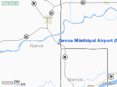
Location & QuickFacts
| FAA Information Effective: | 2008-09-25 |
| Airport Identifier: | 97Y |
| Airport Status: | Operational |
| Longitude/Latitude: | 097-42-31.1860W/41-24-15.0480N
-97.708663/41.404180 (Estimated) |
| Elevation: | 1570 ft / 478.54 m (Surveyed) |
| Land: | 69 acres |
| From nearest city: | 3 nautical miles SE of Genoa, NE |
| Location: | Nance County, NE |
| Magnetic Variation: | 07E (1985) |
Owner & Manager
| Ownership: | Publicly owned |
| Owner: | Genoa Airport Authority |
| Address: | Po Box 501
Genoa, NE 68640 |
| Phone number: | 402-993-2324 |
| Manager: | Don Pearson |
| Address: | Genoa Arpt Auth, Po Box 501
Genoa, NE 68640 |
| Phone number: | 402-948-0067 |
Airport Operations and Facilities
| Airport Use: | Open to public |
| Wind indicator: | Yes |
| Segmented Circle: | No |
| Control Tower: | No |
| Landing fee charge: | No |
| Sectional chart: | Omaha |
| Region: | ACE - Central |
| Traffic Pattern Alt: | 800 ft |
| Boundary ARTCC: | ZMP - Minneapolis |
| Tie-in FSS: | OLU - Columbus |
| FSS on Airport: | No |
| FSS Toll Free: | 1-800-WX-BRIEF |
| NOTAMs Facility: | OLU (NOTAM-d service avaliable) |
Airport Communications
| CTAF: | 122.800 |
| Unicom: | 122.800 |
Airport Services
| Fuel available: | 100LL
FOR FUEL CALL (402) 933-6000/2324/2240. |
| Airframe Repair: | NONE |
| Power Plant Repair: | NONE |
| Bottled Oxygen: | NONE |
| Bulk Oxygen: | NONE |
Runway Information
Runway 11/29
| Dimension: | 2500 x 75 ft / 762.0 x 22.9 m |
| Surface: | TURF, Good Condition |
| |
Runway 11 |
Runway 29 |
| Traffic Pattern: | Left | Left |
| Obstruction: | 17 ft road, 290.0 ft from runway, 123 ft right of centerline, 17:1 slope to clear | 7 ft fence, 0.0 ft from runway, 125 ft left of centerline |
|
Radio Navigation Aids
| ID |
Type |
Name |
Ch |
Freq |
Var |
Dist |
| PLT | NDB | Platte Center | | 407.00 | 08E | 15.7 nm |
| BVN | NDB | Alaby | | 332.00 | 06E | 24.9 nm |
| JYR | NDB | York | | 257.00 | 06E | 30.7 nm |
| OF | NDB | Carsy | | 510.00 | 08E | 30.8 nm |
| SWT | NDB | Seward | | 269.00 | 06E | 42.4 nm |
| FMZ | NDB | Beklof | | 392.00 | 07E | 49.4 nm |
| OLU | VOR/DME | Columbus | 055X | 111.80 | 08E | 16.8 nm |
| OFK | VOR/DME | Norfolk | 033X | 109.60 | 08E | 37.2 nm |
| OBH | VORTAC | Wolbach | 095X | 114.80 | 07E | 29.1 nm |
| GRI | VORTAC | Grand Island | 057X | 112.00 | 07E | 37.3 nm |
Images and information placed above are from
http://www.airport-data.com/airport/97Y/
We thank them for the data!
| General Info
|
| Country |
United States
|
| State |
NEBRASKA
|
| FAA ID |
97Y
|
| Latitude |
41-24-15.048N
|
| Longitude |
097-42-31.186W
|
| Elevation |
1570 feet
|
| Near City |
GENOA
|
We don't guarantee the information is fresh and accurate. The data may
be wrong or outdated.
For more up-to-date information please refer to other sources.
|
|


