 |
|
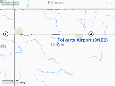
Location & QuickFacts
| FAA Information Effective: | 2008-09-25 |
| Airport Identifier: | 9NE2 |
| Airport Status: | Operational |
| Longitude/Latitude: | 097-43-21.1490W/40-17-30.0180N
-97.722541/40.291672 (Estimated) |
| Elevation: | 1610 ft / 490.73 m (Estimated) |
| Land: | 0 acres |
| From nearest city: | 3 nautical miles SW of Carleton, NE |
| Location: | Thayer County, NE |
| Magnetic Variation: | 07E (1985) |
Owner & Manager
| Ownership: | Privately owned |
| Owner: | Clarence C. Folkerts |
| Address: | 5441 Road W
Carleton, NE 68326-4109 |
| Phone number: | 02SEP90 |
| Manager: | Clarence C. Folkerts |
| Address: | 5441 Road W
Carleton, NE 68326-4109 |
| Phone number: | 402-364-2566 |
Airport Operations and Facilities
| Airport Use: | Private |
| Wind indicator: | Yes |
| Segmented Circle: | No |
| Control Tower: | No |
| Landing fee charge: | No |
| Sectional chart: | Omaha |
| Region: | ACE - Central |
| Boundary ARTCC: | ZMP - Minneapolis |
| Tie-in FSS: | OLU - Columbus |
| FSS on Airport: | No |
| FSS Toll Free: | 1-800-WX-BRIEF |
Runway Information
Runway 17/35
| Dimension: | 2340 x 80 ft / 713.2 x 24.4 m |
| Surface: | TURF, |
| |
Runway 17 |
Runway 35 |
| Traffic Pattern: | Left | Left |
|
Radio Navigation Aids
| ID |
Type |
Name |
Ch |
Freq |
Var |
Dist |
| HJH | NDB | Hebron | | 323.00 | 06E | 10.5 nm |
| FMZ | NDB | Beklof | | 392.00 | 07E | 19.3 nm |
| FBY | NDB | Fairbury | | 293.00 | 06E | 26.5 nm |
| RPB | NDB | Republican | | 414.00 | 07E | 28.9 nm |
| JYR | NDB | York | | 257.00 | 06E | 36.7 nm |
| PSS | NDB | Prosser | | 338.00 | 07E | 41.9 nm |
| BJU | NDB | Big Blue | | 248.00 | 06E | 41.9 nm |
| SWT | NDB | Seward | | 269.00 | 06E | 44.2 nm |
| HWB | NDB | Shaw | | 263.00 | 06E | 44.3 nm |
| CNK | NDB | Concordia | | 335.00 | 06E | 44.5 nm |
| DBX | NDB | Morrison | | 212.00 | 06E | 44.7 nm |
| BIE | VOR | Beatrice | | 110.60 | 07E | 44.4 nm |
| HSI | VOR/DME | Hastings | 025X | 108.80 | 07E | 37.4 nm |
| TKO | VORTAC | Mankato | 035X | 109.80 | 10E | 38.2 nm |
| GRI | VORTAC | Grand Island | 057X | 112.00 | 07E | 49.6 nm |
Remarks
- PROVIDED THAT THE APCH TO EACH RWY IS MAINTAINED FOR A MINIMUM 20:1 GLIDE SLOPE AND THE TRANSITIONAL SURFACE BE MAINTAINED FOR A 7:1 SLOPE.
Images and information placed above are from
http://www.airport-data.com/airport/9NE2/
We thank them for the data!
| General Info
|
| Country |
United States
|
| State |
NEBRASKA
|
| FAA ID |
9NE2
|
| Latitude |
40-17-30.018N
|
| Longitude |
097-43-21.149W
|
| Elevation |
1610 feet
|
| Near City |
CARLETON
|
We don't guarantee the information is fresh and accurate. The data may
be wrong or outdated.
For more up-to-date information please refer to other sources.
|
|


