 |
|
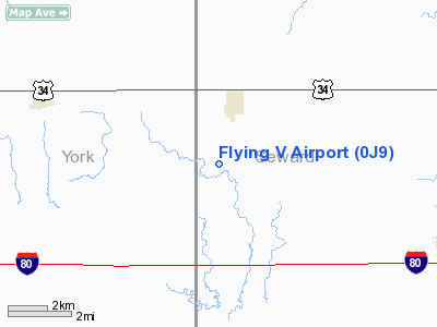
Location & QuickFacts
| FAA Information Effective: | 2008-09-25 |
| Airport Identifier: | 0J9 |
| Airport Status: | Operational |
| Longitude/Latitude: | 097-21-15.1600W/40-52-04.2000N
-97.354211/40.867833 (Estimated) |
| Elevation: | 1585 ft / 483.11 m (Estimated) |
| Land: | 195 acres |
| From nearest city: | 2 nautical miles S of Utica, NE |
| Location: | Seward County, NE |
| Magnetic Variation: | 07E (1985) |
Owner & Manager
| Ownership: | Privately owned |
| Owner: | Kenneth Volzke |
| Address: | Volzke Corporation
Utica, NE 68456 |
| Phone number: | 402-534-3131 |
| Manager: | Kenneth Volzke |
| Address: | Volzke Corporation
Utica, NE 68456 |
| Phone number: | 402-534-3131
RESIDENCE PHONE: 402-534-3132. |
Airport Operations and Facilities
| Airport Use: | Open to public |
| Wind indicator: | Yes |
| Segmented Circle: | No |
| Control Tower: | No |
| Landing fee charge: | No |
| Sectional chart: | Omaha |
| Region: | ACE - Central |
| Boundary ARTCC: | ZMP - Minneapolis |
| Tie-in FSS: | OLU - Columbus |
| FSS on Airport: | No |
| FSS Toll Free: | 1-800-WX-BRIEF |
| NOTAMs Facility: | OLU (NOTAM-d service avaliable) |
Airport Communications
Airport Services
| Bottled Oxygen: | NONE |
| Bulk Oxygen: | NONE |
Runway Information
Runway 17/35
| Dimension: | 3000 x 50 ft / 914.4 x 15.2 m |
| Surface: | CONC, Fair Condition |
| Weight Limit: | Single wheel: 12500 lbs. |
| |
Runway 17 |
Runway 35 |
| Traffic Pattern: | Left | Left |
| Markings: | Nonstandard, Poor Condition
17/35 MKD WITH SMALL NRS AND CNTRLN STRIPE; MARKINGS FADED. | Nonstandard, Poor Condition |
| Displaced threshold: | 200.00 ft | 0.00 ft |
| Obstruction: | 14 ft road, 330.0 ft from runway, 9:1 slope to clear
APCH SLOPE 37:1 FROM DSPLCD THR. | , 50:1 slope to clear |
|
Radio Navigation Aids
| ID |
Type |
Name |
Ch |
Freq |
Var |
Dist |
| SWT | NDB | Seward | | 269.00 | 06E | 11.0 nm |
| JYR | NDB | York | | 257.00 | 06E | 12.1 nm |
| FMZ | NDB | Beklof | | 392.00 | 07E | 19.3 nm |
| LN | NDB | Potts | | 385.00 | 06E | 27.9 nm |
| PLT | NDB | Platte Center | | 407.00 | 08E | 37.8 nm |
| BJU | NDB | Big Blue | | 248.00 | 06E | 39.1 nm |
| AHQ | NDB | Wahoo | | 400.00 | 07E | 40.9 nm |
| FBY | NDB | Fairbury | | 293.00 | 06E | 42.4 nm |
| HJH | NDB | Hebron | | 323.00 | 06E | 44.4 nm |
| HWB | NDB | Shaw | | 263.00 | 06E | 45.3 nm |
| BIE | VOR | Beatrice | | 110.60 | 07E | 43.7 nm |
| OLU | VOR/DME | Columbus | 055X | 111.80 | 08E | 35.0 nm |
| LNK | VORTAC | Lincoln | 108X | 116.10 | 09E | 28.0 nm |
| GRI | VORTAC | Grand Island | 057X | 112.00 | 07E | 44.2 nm |
Remarks
- PROVIDED APCH TO EACH RWY IS MAINTAINED FOR A MINIMUM 20:1 GLIDE SLOPE AND TRANSITIONAL SURFACE BE MAINTAINED FOR A 7:1 SLOPE.
Images and information placed above are from
http://www.airport-data.com/airport/0J9/
We thank them for the data!
| General Info
|
| Country |
United States
|
| State |
NEBRASKA
|
| FAA ID |
0J9
|
| Latitude |
40-52-10.036N
|
| Longitude |
097-21-06.169W
|
| Elevation |
1585 feet
|
| Near City |
UTICA
|
We don't guarantee the information is fresh and accurate. The data may
be wrong or outdated.
For more up-to-date information please refer to other sources.
|
|


