 |
|
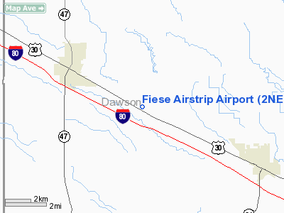
Location & QuickFacts
| FAA Information Effective: | 2008-09-25 |
| Airport Identifier: | 2NE5 |
| Airport Status: | Operational |
| Longitude/Latitude: | 100-05-41.4490W/40-54-00.0250N
-100.094847/40.900007 (Estimated) |
| Elevation: | 2535 ft / 772.67 m (Estimated) |
| Land: | 12 acres |
| From nearest city: | 3 nautical miles SE of Gothenburg, NE |
| Location: | Dawson County, NE |
| Magnetic Variation: | 09E (1985) |
Owner & Manager
| Ownership: | Privately owned |
| Owner: | Larry Fiese |
| Address: | 76361 Road 415
Gothenburg, NE 69138 |
| Phone number: | 308-537-3321 |
| Manager: | Larry Fiese |
| Address: | 76361 Road 415
Gothenburg, NE 69138 |
| Phone number: | 308-537-3321 |
Airport Operations and Facilities
| Airport Use: | Private |
| Wind indicator: | Yes |
| Segmented Circle: | No |
| Control Tower: | No |
| Landing fee charge: | No |
| Sectional chart: | Omaha |
| Region: | ACE - Central |
| Boundary ARTCC: | ZDV - Denver |
| Tie-in FSS: | OLU - Columbus |
| FSS on Airport: | No |
| FSS Toll Free: | 1-800-WX-BRIEF |
Airport Services
Runway Information
Runway N/S
| Dimension: | 2000 x 50 ft / 609.6 x 15.2 m |
| Surface: | TURF, |
| |
Runway N |
Runway S |
| Traffic Pattern: | Right | Left |
|
Radio Navigation Aids
| ID |
Type |
Name |
Ch |
Freq |
Var |
Dist |
| MCK | FAN MARKER | Mc Cook | | | 11E | 47.9 nm |
| DWL | NDB | Willow | | 353.00 | 08E | 1.9 nm |
| RRX | NDB | Darr | | 326.00 | 07E | 11.3 nm |
| CSB | NDB | Harry Strunk | | 389.00 | 08E | 35.9 nm |
| BBW | NDB | Broken Bow | | 265.00 | 08E | 38.2 nm |
| HDE | NDB | Holdrege | | 396.00 | 07E | 43.8 nm |
| OZB | VOR | Cozad | | 109.00 | 09E | 4.5 nm |
| CUZ | VOR/DME | Custer County | 19X | 108.20 | 08E | 39.6 nm |
| MCK | VOR/DME | Mc Cook | 100X | 115.30 | 08E | 47.7 nm |
| LBF | VORTAC | North Platte | 121X | 117.40 | 11E | 30.9 nm |
| HCT | VORTAC | Hayes Center | 124X | 117.70 | 11E | 46.3 nm |
Images and information placed above are from
http://www.airport-data.com/airport/2NE5/
We thank them for the data!
| General Info
|
| Country |
United States
|
| State |
NEBRASKA
|
| FAA ID |
2NE5
|
| Latitude |
40-54-00.025N
|
| Longitude |
100-05-41.449W
|
| Elevation |
2535 feet
|
| Near City |
GOTHENBURG
|
We don't guarantee the information is fresh and accurate. The data may
be wrong or outdated.
For more up-to-date information please refer to other sources.
|
|


