|
 |
|
||||
|
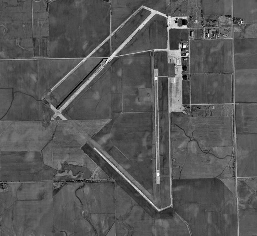
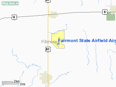
Fairmont State Airfield (ICAO: KFMZ, FAA LID: FMZ) is a public use airport located three nautical miles (6 km) south of the central business district of Fairmont, in Fillmore County, Nebraska, United States. It is owned by the Nebraska Department of Aeronautics. The airport serves the general aviation community, with no scheduled commercial airline service. Although most U.S. airports use the same three-letter location identifier for the FAA and IATA, this airport is assigned FMZ by the FAA but has no designation from the IATA. HistoryConstruction of Fairmont State Airfield began on 17 September 1942. The airfield was built by the United States Army Air Forces as a military airfield. It was one of eleven training airfields built in Nebraska during World War II. Shortly after construction began, a railroad spur was built from Fairmont to the base site to haul materials for the construction. Approximately 1,000 laborers were hired to construct the base, and the small towns of Geneva (pop. 1,888) and Fairmont (pop. 800) were hard pressed to find housing for the workers. Early in the construction, the facility was referred to as the Fairmont Satellite Airfield, and was designated a satellite of the Topeka Army Air Base in Kansas, however by early 1943, the name was changed to the Fairmont Army Airfield, as its mission was determined to be a training facility for heavy bomber groups. The first military personnel arrived in November 1942 The airfield was under the command of Second Air Force Headquarters, Colorado Springs, Colorado. The 241st Army Air Force Base Unit was the Operational Training Unit at the airfield. It was assigned to the 15th Bombardment Training Wing (September 1943 - March 1944), then transferred to the 17th Bombardment Training Wing in March 1944 for B-29 training. The 511th Army Air Force Base Unit commanded the support elements at Fairmont as part of Air Technical Service Command. Fairmont Army Airfield was a training installation for twenty-seven bombardment squadrons. Complete engine and airframe repairs were available for Consolidated B-24 Liberator and eventually in the more technologically advanced Boeing B-29 Superfortress bombers at the five hangars on the field. Extensive concrete runways and other structures were built. A 350 bed hospital served personnel from Fairmont along with Harvard AAF and Bruning AAF. The cantonment area provided quarters for nearly 6,000 officers and enlisted men. Known units that trained at Fairmont AAF were:
In September 1944 Lt. Col. Paul Tibbets visited Fairmont and selected the 393d Bombardment Squadron of the 504th to join the 509th Composite Group at Wendover AAF, Utah. This group dropped both atomic bombs on Japan. The base was inactivated on 31 December 1945. In the spring of 1946, the War Assets Administration declared the property surplus in the spring of 1946. Buildings were sold and dismantled or moved. The chapel was moved to Friend, Nebraska. The Enlisted Men's Service Club was dismantled and rebuilt in Shickley, Nebraska as St. Mary's Church. In 1946 Nebraska Department of Aeronautics acquired the Airfield from the U.S. Government for use as a state-owned civilian airport. The Fairmont Army Airfield, with its well maintained hangars, support buildings, and commander's house, was the best remaining example, as a collection of buildings, of the Army Airfields in the State of Nebraska. Due to the rural location, unencumbered by surrounding development, and the high level of physical integrity of the remaining buildings, particularly the hangars, the Fairmont Army Airfield was placed on the National Register of Historic Places as an historic district. The District includes the hardstands, aprons and existing runways, all remaining buildings, extending to the edges of the roads where extant buildings exist. This encompasses historic landscape features such as roads and World War II-era planted trees. Facilities and aircraftFairmont State Airfield Airport covers an area of 687 acres (278 ha) at an elevation of 1,636 feet (499 m) above mean sea level. It has two runways with concrete surfaces: 17/35 is 4,316 by 75 feet (1,316 x 23 m) and 12/30 is 3,021 by 60 feet (921 x 18 m). For the 12-month period ending May 10, 2005, the airport had 1,665 aircraft operations, an average of 138 per month: 99.7% general aviation and 0.3% military. The above content comes from Wikipedia and is published under free licenses – click here to read more.
Location & QuickFacts
Owner & Manager
Airport Operations and Facilities
Airport Communications
Airport Services
Runway InformationRunway 12/30
Runway 17/35
Radio Navigation Aids
Remarks
Images and information placed above are from We thank them for the data!
We don't guarantee the information is fresh and accurate. The data may
be wrong or outdated.
|
||||||||||||||||||||||||||||||||||||||||||||||||||||||||||||||||||||||||||||||||||||||||||||||||||||||||||||||||||||||||||||||||||||||||||||||||||||||||||||||||||||||||||||||||||||||||||||||||||||||||||||||||||||||||||||||||||||||||||||||||||||||||||||||||||||||||||||||||||||||||||||||||||||||||||||||||||||||||||||||||||||||||||||||||||||||||||||||||||||||||||||||||||

 |
|
Copyright 2004-2026 © by Airports-Worldwide.com, Vyshenskoho st. 36, Lviv 79010, Ukraine Legal Disclaimer |