 |
|
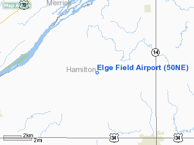
Location & QuickFacts
| FAA Information Effective: | 2008-09-25 |
| Airport Identifier: | 50NE |
| Airport Status: | Operational |
| Longitude/Latitude: | 098-04-41.2050W/40-56-24.0460N
-98.078113/40.940013 (Estimated) |
| Elevation: | 1800 ft / 548.64 m (Estimated) |
| Land: | 0 acres |
| From nearest city: | 6 nautical miles NW of Aurora, NE |
| Location: | Hamilton County, NE |
| Magnetic Variation: | 07E (1995) |
Owner & Manager
| Ownership: | Privately owned |
| Owner: | Ronald E Elge |
| Address: | 1105 W 18th Road
Aurora, NE 68818 |
| Phone number: | 402-854-3341 |
| Manager: | Ronald E Elge |
| Address: | 1105 W 18th Road
Aurora, NE 68818 |
| Phone number: | 402-854-3341 |
Airport Operations and Facilities
| Airport Use: | Private |
| Segmented Circle: | No |
| Control Tower: | No |
| Landing fee charge: | No |
| Sectional chart: | Omaha |
| Region: | ACE - Central |
| Boundary ARTCC: | ZMP - Minneapolis |
| Tie-in FSS: | OLU - Columbus |
| FSS on Airport: | No |
| FSS Toll Free: | 1-800-WX-BRIEF |
Runway Information
Runway N/S
| Dimension: | 1750 x 90 ft / 533.4 x 27.4 m |
| Surface: | TURF, |
| |
Runway N |
Runway S |
| Traffic Pattern: | Left | Left |
|
Radio Navigation Aids
| ID |
Type |
Name |
Ch |
Freq |
Var |
Dist |
| JYR | NDB | York | | 257.00 | 06E | 21.1 nm |
| PSS | NDB | Prosser | | 338.00 | 07E | 23.7 nm |
| FMZ | NDB | Beklof | | 392.00 | 07E | 31.3 nm |
| SWT | NDB | Seward | | 269.00 | 06E | 44.1 nm |
| PLT | NDB | Platte Center | | 407.00 | 08E | 45.9 nm |
| BVN | NDB | Alaby | | 332.00 | 06E | 47.5 nm |
| EAR | VOR | Kearney | | 111.20 | 10E | 44.1 nm |
| HSI | VOR/DME | Hastings | 025X | 108.80 | 07E | 25.7 nm |
| OLU | VOR/DME | Columbus | 055X | 111.80 | 08E | 45.3 nm |
| GRI | VORTAC | Grand Island | 057X | 112.00 | 07E | 11.1 nm |
| OBH | VORTAC | Wolbach | 095X | 114.80 | 07E | 29.0 nm |
Images and information placed above are from
http://www.airport-data.com/airport/50NE/
We thank them for the data!
| General Info
|
| Country |
United States
|
| State |
NEBRASKA
|
| FAA ID |
50NE
|
| Latitude |
40-56-24.046N
|
| Longitude |
098-04-41.205W
|
| Elevation |
1800 feet
|
| Near City |
AURORA
|
We don't guarantee the information is fresh and accurate. The data may
be wrong or outdated.
For more up-to-date information please refer to other sources.
|
|


