 |
|
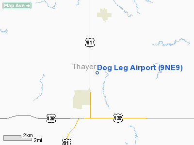
Location & QuickFacts
| FAA Information Effective: | 2008-09-25 |
| Airport Identifier: | 9NE9 |
| Airport Status: | Operational |
| Longitude/Latitude: | 097-34-01.1500W/40-11-40.0130N
-97.566986/40.194448 (Estimated) |
| Elevation: | 1500 ft / 457.20 m (Estimated) |
| Land: | 7 acres |
| From nearest city: | 1 nautical miles NE of Hebron, NE |
| Location: | Thayer County, NE |
| Magnetic Variation: | 07E (1985) |
Owner & Manager
| Ownership: | Privately owned |
| Owner: | Gene Davenport |
| Address: | Rt 1 Box 6a
Belvidere, NE 68315 |
| Phone number: | 402-768-6429 |
| Manager: | Gene Davenport |
| Address: | Rt 1 Box 6a
Belvidere, NE 68315 |
| Phone number: | 402-768-6429 |
Airport Operations and Facilities
| Airport Use: | Private |
| Segmented Circle: | No |
| Control Tower: | No |
| Sectional chart: | Omaha |
| Region: | ACE - Central |
| Boundary ARTCC: | ZMP - Minneapolis |
| Tie-in FSS: | OLU - Columbus |
| FSS on Airport: | No |
| FSS Toll Free: | 1-800-WX-BRIEF |
Runway Information
Runway 07/25
| Dimension: | 2300 x 100 ft / 701.0 x 30.5 m |
| Surface: | TURF, |
| |
Runway 07 |
Runway 25 |
| Traffic Pattern: | Left | Left |
|
Radio Navigation Aids
| ID |
Type |
Name |
Ch |
Freq |
Var |
Dist |
| HJH | NDB | Hebron | | 323.00 | 06E | 2.8 nm |
| FBY | NDB | Fairbury | | 293.00 | 06E | 18.5 nm |
| RPB | NDB | Republican | | 414.00 | 07E | 23.3 nm |
| FMZ | NDB | Beklof | | 392.00 | 07E | 23.8 nm |
| DBX | NDB | Morrison | | 212.00 | 06E | 35.5 nm |
| BJU | NDB | Big Blue | | 248.00 | 06E | 36.0 nm |
| HWB | NDB | Shaw | | 263.00 | 06E | 37.4 nm |
| CNK | NDB | Concordia | | 335.00 | 06E | 38.7 nm |
| JYR | NDB | York | | 257.00 | 06E | 42.3 nm |
| SWT | NDB | Seward | | 269.00 | 06E | 45.2 nm |
| MYZ | NDB | Marysville | | 341.00 | 06E | 47.6 nm |
| LN | NDB | Potts | | 385.00 | 06E | 49.6 nm |
| BIE | VOR | Beatrice | | 110.60 | 07E | 37.8 nm |
| HSI | VOR/DME | Hastings | 025X | 108.80 | 07E | 46.5 nm |
| TKO | VORTAC | Mankato | 035X | 109.80 | 10E | 39.5 nm |
Remarks
- OWNER DESIRES ARPT NOT BE CHARTED.
- DETERMINATION PENDING.
Images and information placed above are from
http://www.airport-data.com/airport/9NE9/
We thank them for the data!
| General Info
|
| Country |
United States
|
| State |
NEBRASKA
|
| FAA ID |
9NE9
|
| Latitude |
40-11-40.013N
|
| Longitude |
097-34-01.150W
|
| Elevation |
1500 feet
|
| Near City |
HEBRON
|
We don't guarantee the information is fresh and accurate. The data may
be wrong or outdated.
For more up-to-date information please refer to other sources.
|
|


