 |
|
Location & QuickFacts
| FAA Information Effective: | 2008-09-25 |
| Airport Identifier: | 18NE |
| Airport Status: | Operational |
| Longitude/Latitude: | 097-36-38.1730W/40-30-50.0240N
-97.610604/40.513896 (Estimated) |
| Elevation: | 1640 ft / 499.87 m (Estimated) |
| Land: | 0 acres |
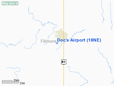
| From nearest city: | 1 nautical miles SW of Geneva, NE |
| Location: | Fillmore County, NE |
| Magnetic Variation: | 07E (1985) |
Owner & Manager
| Ownership: | Privately owned |
| Owner: | Carroll Verhage |
| Address: | Rt 1, Box 105a
Geneva, NE 68361 |
| Phone number: | 402-759-4431 |
| Address: |
|
Airport Operations and Facilities
| Airport Use: | Private |
| Wind indicator: | No |
| Segmented Circle: | No |
| Control Tower: | No |
| Landing fee charge: | No |
| Sectional chart: | Omaha |
| Region: | ACE - Central |
| Boundary ARTCC: | ZMP - Minneapolis |
| Tie-in FSS: | OLU - Columbus |
| FSS on Airport: | No |
| FSS Toll Free: | 1-800-WX-BRIEF |
Runway Information
Runway 04/22
| Dimension: | 3700 x 100 ft / 1127.8 x 30.5 m |
| Surface: | TURF, |
| |
Runway 04 |
Runway 22 |
| Traffic Pattern: | Left | Left |
| Displaced threshold: | 0.00 ft | 700.00 ft |
| Obstruction: | 22 ft pline, 20.0 ft from runway | 35 ft bldg, 150.0 ft from runway |
|
Radio Navigation Aids
| ID |
Type |
Name |
Ch |
Freq |
Var |
Dist |
| FMZ | NDB | Beklof | | 392.00 | 07E | 5.0 nm |
| HJH | NDB | Hebron | | 323.00 | 06E | 21.9 nm |
| JYR | NDB | York | | 257.00 | 06E | 23.1 nm |
| FBY | NDB | Fairbury | | 293.00 | 06E | 28.7 nm |
| SWT | NDB | Seward | | 269.00 | 06E | 30.9 nm |
| BJU | NDB | Big Blue | | 248.00 | 06E | 37.6 nm |
| PSS | NDB | Prosser | | 338.00 | 07E | 40.9 nm |
| LN | NDB | Potts | | 385.00 | 06E | 41.2 nm |
| HWB | NDB | Shaw | | 263.00 | 06E | 41.8 nm |
| RPB | NDB | Republican | | 414.00 | 07E | 42.2 nm |
| BIE | VOR | Beatrice | | 110.60 | 07E | 41.2 nm |
| HSI | VOR/DME | Hastings | 025X | 108.80 | 07E | 37.8 nm |
| GRI | VORTAC | Grand Island | 057X | 112.00 | 07E | 42.7 nm |
| LNK | VORTAC | Lincoln | 108X | 116.10 | 09E | 46.6 nm |
Remarks
- E111 PRVDD THE APCH TO EACH RWY IS MAINTD FOR A MIN 20:1 GS & THE TRSNL SFC MAINTD FOR A 7:1 SLOPE.
Images and information placed above are from
http://www.airport-data.com/airport/18NE/
We thank them for the data!
| General Info
|
| Country |
United States
|
| State |
NEBRASKA
|
| FAA ID |
18NE
|
| Latitude |
40-30-50.024N
|
| Longitude |
097-36-38.173W
|
| Elevation |
1640 feet
|
| Near City |
GENEVA
|
We don't guarantee the information is fresh and accurate. The data may
be wrong or outdated.
For more up-to-date information please refer to other sources.
|
|


