 |
|
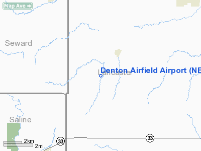
Location & QuickFacts
| FAA Information Effective: | 2008-09-25 |
| Airport Identifier: | NE40 |
| Airport Status: | Operational |
| Longitude/Latitude: | 096-52-04.0870W/40-42-57.0130N
-96.867802/40.715837 (Estimated) |
| Elevation: | 1270 ft / 387.10 m (Estimated) |
| Land: | 0 acres |
| From nearest city: | 2 nautical miles SW of Denton, NE |
| Location: | Lancaster County, NE |
| Magnetic Variation: | 06E (1985) |
Owner & Manager
| Ownership: | Privately owned |
| Owner: | Don Shoemaker |
| Address: | 11115 W. Yankee Hill Rd
Denton, NE 68339 |
| Phone number: | 402-797-7200 |
| Manager: | Don Shoemaker |
| Address: | 11115 W. Yankee Hill Rd
Denton, NE 68339 |
| Phone number: | 402-797-7200 |
Airport Operations and Facilities
| Airport Use: | Private |
| Wind indicator: | Yes |
| Segmented Circle: | No |
| Control Tower: | No |
| Landing fee charge: | No |
| Sectional chart: | Omaha |
| Region: | ACE - Central |
| Boundary ARTCC: | ZMP - Minneapolis |
| Tie-in FSS: | OLU - Columbus |
| FSS on Airport: | No |
| FSS Toll Free: | 1-800-WX-BRIEF |
Airport Services
| Airframe Repair: | MINOR |
| Power Plant Repair: | MAJOR |
Runway Information
Runway 01/19
| Dimension: | 2500 x 30 ft / 762.0 x 9.1 m |
| Surface: | ASPH, |
| |
Runway 01 |
Runway 19 |
| Traffic Pattern: | Left | Left |
|
Radio Navigation Aids
| ID |
Type |
Name |
Ch |
Freq |
Var |
Dist |
| LN | NDB | Potts | | 385.00 | 06E | 5.2 nm |
| SWT | NDB | Seward | | 269.00 | 06E | 14.1 nm |
| BJU | NDB | Big Blue | | 248.00 | 06E | 21.3 nm |
| HWB | NDB | Shaw | | 263.00 | 06E | 27.6 nm |
| FMZ | NDB | Beklof | | 392.00 | 07E | 32.8 nm |
| AHQ | NDB | Wahoo | | 400.00 | 07E | 33.7 nm |
| FBY | NDB | Fairbury | | 293.00 | 06E | 35.2 nm |
| JYR | NDB | York | | 257.00 | 06E | 35.8 nm |
| MLE | NDB | Millard | | 371.00 | 06E | 44.7 nm |
| PMV | NDB | Plattsmouth | | 329.00 | 06E | 45.6 nm |
| AFK | NDB | Nebraska City | | 347.00 | 05E | 46.4 nm |
| FET | NDB | Fremont | | 311.00 | 06E | 46.9 nm |
| HJH | NDB | Hebron | | 323.00 | 06E | 47.3 nm |
| BIE | VOR | Beatrice | | 110.60 | 07E | 25.4 nm |
| OLU | VOR/DME | Columbus | 055X | 111.80 | 08E | 49.1 nm |
| LNK | VORTAC | Lincoln | 108X | 116.10 | 09E | 13.7 nm |
| PWE | VORTAC | Pawnee City | 071X | 112.40 | 05E | 43.3 nm |
Images and information placed above are from
http://www.airport-data.com/airport/NE40/
We thank them for the data!
| General Info
|
| Country |
United States
|
| State |
NEBRASKA
|
| FAA ID |
NE40
|
| Latitude |
40-42-57.013N
|
| Longitude |
096-52-04.087W
|
| Elevation |
1270 feet
|
| Near City |
DENTON
|
We don't guarantee the information is fresh and accurate. The data may
be wrong or outdated.
For more up-to-date information please refer to other sources.
|
|


