 |
|
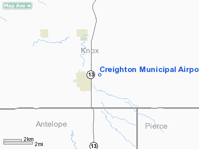
Location & QuickFacts
| FAA Information Effective: | 2008-09-25 |
| Airport Identifier: | 6K3 |
| Airport Status: | Operational |
| Longitude/Latitude: | 097-53-05.6350W/42-28-18.2400N
-97.884899/42.471733 (Estimated) |
| Elevation: | 1654 ft / 504.14 m (Surveyed) |
| Land: | 202 acres |
| From nearest city: | 1 nautical miles E of Creighton, NE |
| Location: | Knox County, NE |
| Magnetic Variation: | 07E (1985) |
Owner & Manager
| Ownership: | Publicly owned |
| Owner: | Creighton Airport Authority |
| Address: | Po Box 51
Creighton, NE 68729-0051 |
| Phone number: | 402-358-5252 |
| Manager: | Robert Borgmann
BOB BORGMANN, SECRETARY, CREIGHTON AIRPORT AUTHORITY |
| Address: | P.o. Box 51
Creighton, NE 68729-0051 |
| Phone number: | 402-358-5252 |
Airport Operations and Facilities
| Airport Use: | Open to public |
| Wind indicator: | Yes |
| Segmented Circle: | Yes |
| Control Tower: | No |
| Lighting Schedule: | DUSK-DAWN
ACTVT MIRL RY 13/31 - CTAF. |
| Beacon Color: | Clear-Green (lighted land airport) |
| Landing fee charge: | No |
| Sectional chart: | Omaha |
| Region: | ACE - Central |
| Boundary ARTCC: | ZMP - Minneapolis |
| Tie-in FSS: | OLU - Columbus |
| FSS on Airport: | No |
| FSS Toll Free: | 1-800-WX-BRIEF |
| NOTAMs Facility: | OLU (NOTAM-d service avaliable) |
| Federal Agreements: | NGY |
Airport Communications
Airport Services
| Fuel available: | 100LLMOGAS
24 HOUR CREDIT CARD SYSTEM |
| Airframe Repair: | NONE |
| Power Plant Repair: | NONE |
| Bottled Oxygen: | NONE |
| Bulk Oxygen: | NONE |
Runway Information
Runway 13/31
| Dimension: | 3700 x 60 ft / 1127.8 x 18.3 m |
| Surface: | CONC, |
| Weight Limit: | Single wheel: 12000 lbs. |
| Edge Lights: | Medium |
| |
Runway 13 |
Runway 31 |
| Longitude: | 097-53-24.4600W | 097-52-46.8100W |
| Latitude: | 42-28-30.0600N | 42-28-06.4200N |
| Elevation: | 1642.00 ft | 1644.00 ft |
| Traffic Pattern: | Left | Left |
| Markings: | Non-precision instrument, Good Condition | Non-precision instrument, Good Condition |
| Obstruction: | , 50:1 slope to clear | 23 ft pole, 1010.0 ft from runway, 110 ft left of centerline, 35:1 slope to clear
OBSTN LCTD 110' LEFT OF RWY CNTRLN EXTDD. |
|
Runway 18/36
| Dimension: | 2100 x 200 ft / 640.1 x 61.0 m |
| Surface: | TURF, Fair Condition |
| |
Runway 18 |
Runway 36 |
| Traffic Pattern: | Left | Left |
| Obstruction: | 10 ft fence, 200.0 ft from runway, 20:1 slope to clear
OBSTN LCTD 150' RGT OF RWY CNTRLN EXTDD. | 15 ft road, 320.0 ft from runway, 21:1 slope to clear
OBSTN LCTD EITHER SIDE OF RWY CNTRLN EXTDD. |
|
Radio Navigation Aids
| ID |
Type |
Name |
Ch |
Freq |
Var |
Dist |
| OF | NDB | Carsy | | 510.00 | 08E | 39.5 nm |
| AGZ | NDB | Wagner | | 392.00 | 08E | 39.8 nm |
| LCG | NDB | Wayne | | 389.00 | 06E | 42.3 nm |
| BVN | NDB | Alaby | | 332.00 | 06E | 45.2 nm |
| VMR | NDB | Vermillion | | 375.00 | 06E | 45.5 nm |
| YKN | VOR/DME | Yankton | 051X | 111.40 | 07E | 34.8 nm |
| OFK | VOR/DME | Norfolk | 033X | 109.60 | 08E | 35.3 nm |
| ONL | VORTAC | O'neill | 086X | 113.90 | 10E | 35.6 nm |
Images and information placed above are from
http://www.airport-data.com/airport/6K3/
We thank them for the data!
| General Info
|
| Country |
United States
|
| State |
NEBRASKA
|
| FAA ID |
6K3
|
| Latitude |
42-28-15.013N
|
| Longitude |
097-53-01.240W
|
| Elevation |
1653 feet
|
| Near City |
CREIGHTON
|
We don't guarantee the information is fresh and accurate. The data may
be wrong or outdated.
For more up-to-date information please refer to other sources.
|
|


