 |
|
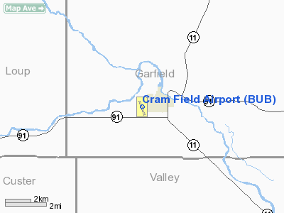
Location & QuickFacts
| FAA Information Effective: | 2008-09-25 |
| Airport Identifier: | BUB |
| Airport Status: | Operational |
| Longitude/Latitude: | 099-08-59.1000W/41-46-36.1000N
-99.149750/41.776694 (Estimated) |
| Elevation: | 2182 ft / 665.07 m (Surveyed) |
| Land: | 106 acres |
| From nearest city: | 1 nautical miles SW of Burwell, NE |
| Location: | Garfield County, NE |
| Magnetic Variation: | 07E (2000) |
Owner & Manager
| Ownership: | Publicly owned |
| Owner: | Burwell Airport Authority |
| Address: | Po Box 577
Burwell, NE 68823 |
| Phone number: | 308-346-4661 |
| Manager: | Paul Plock |
| Address: | Po Box 683
Burwell, NE 68823 |
| Phone number: | 308-346-4566 |
Airport Operations and Facilities
| Airport Use: | Open to public |
| Wind indicator: | Yes |
| Segmented Circle: | Yes |
| Control Tower: | No |
| Lighting Schedule: | DUSK-DAWN |
| Beacon Color: | Clear-Green (lighted land airport) |
| Landing fee charge: | No |
| Sectional chart: | Omaha |
| Region: | ACE - Central |
| Boundary ARTCC: | ZDV - Denver |
| Tie-in FSS: | OLU - Columbus |
| FSS on Airport: | No |
| FSS Toll Free: | 1-800-WX-BRIEF |
| NOTAMs Facility: | OLU (NOTAM-d service avaliable) |
| Federal Agreements: | NGY |
Airport Communications
Airport Services
| Fuel available: | 100LL
FOR FUEL CALL 308-346-4952/4014. |
| Bottled Oxygen: | NONE |
| Bulk Oxygen: | NONE |
Runway Information
Runway 15/33
| Dimension: | 3212 x 50 ft / 979.0 x 15.2 m |
| Surface: | ASPH, Good Condition |
| Weight Limit: | Single wheel: 10000 lbs. |
| Edge Lights: | Medium |
| |
Runway 15 |
Runway 33 |
| Longitude: | 099-09-06.6640W | 099-08-51.4850W |
| Latitude: | 41-46-50.9360N | 41-46-21.3070N |
| Elevation: | 2172.00 ft | 2182.00 ft |
| Alignment: | 127 | 127 |
| Traffic Pattern: | Left | Left |
| Markings: | Non-precision instrument, Good Condition | Non-precision instrument, Good Condition |
| Obstruction: | 53 ft trees, 2320.0 ft from runway, 280 ft right of centerline, 40:1 slope to clear | 44 ft pline, 1300.0 ft from runway, 200 ft right of centerline, 25:1 slope to clear |
|
Radio Navigation Aids
| ID |
Type |
Name |
Ch |
Freq |
Var |
Dist |
| BUB | NDB | Burwell | | 377.00 | 07E | 0.2 nm |
| ODX | NDB | Ord | | 356.00 | 07E | 12.9 nm |
| BBW | NDB | Broken Bow | | 265.00 | 08E | 30.0 nm |
| BVN | NDB | Alaby | | 332.00 | 06E | 49.3 nm |
| CUZ | VOR/DME | Custer County | 19X | 108.20 | 08E | 29.9 nm |
| OBH | VORTAC | Wolbach | 095X | 114.80 | 07E | 43.2 nm |
| ONL | VORTAC | O'neill | 086X | 113.90 | 10E | 46.5 nm |
Images and information placed above are from
http://www.airport-data.com/airport/BUB/
We thank them for the data!
| General Info
|
| Country |
United States
|
| State |
NEBRASKA
|
| FAA ID |
BUB
|
| Latitude |
41-46-36.100N
|
| Longitude |
099-08-59.100W
|
| Elevation |
2182 feet
|
| Near City |
BURWELL
|
We don't guarantee the information is fresh and accurate. The data may
be wrong or outdated.
For more up-to-date information please refer to other sources.
|
|


