 |
|
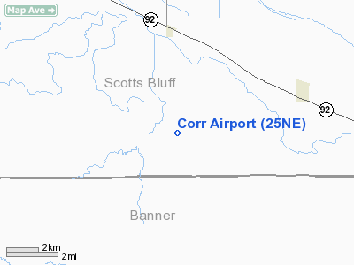
Location & QuickFacts
| FAA Information Effective: | 2008-09-25 |
| Airport Identifier: | 25NE |
| Airport Status: | Operational |
| Longitude/Latitude: | 103-30-40.7850W/41-43-26.8920N
-103.511329/41.724137 (Estimated) |
| Elevation: | 4000 ft / 1219.20 m (Estimated) |
| Land: | 0 acres |
| From nearest city: | 4 nautical miles S of Melbeta, NE |
| Location: | Scotts Bluff County, NE |
| Magnetic Variation: | 11E (1985) |
Owner & Manager
| Ownership: | Privately owned |
| Owner: | E L Corr |
| Address: | Route 1
Gering, NE 69341 |
| Address: |
|
| Phone number: | 308-783-1475 |
Airport Operations and Facilities
| Airport Use: | Private |
| Wind indicator: | No |
| Segmented Circle: | No |
| Control Tower: | No |
| Landing fee charge: | No |
| Sectional chart: | Cheyenne |
| Region: | ACE - Central |
| Boundary ARTCC: | ZDV - Denver |
| Tie-in FSS: | OLU - Columbus |
| FSS on Airport: | No |
| FSS Toll Free: | 1-800-WX-BRIEF |
Runway Information
Runway 08/26
| Dimension: | 2640 x 100 ft / 804.7 x 30.5 m |
| Surface: | TURF, |
| |
Runway 08 |
Runway 26 |
| Traffic Pattern: | Left | Left |
|
Runway 17/35
| Dimension: | 1600 x 50 ft / 487.7 x 15.2 m |
| Surface: | TURF, |
| |
Runway 17 |
Runway 35 |
| Traffic Pattern: | Left | Left |
| Obstruction: | 40 ft plines, 600.0 ft from runway | |
|
Radio Navigation Aids
| ID |
Type |
Name |
Ch |
Freq |
Var |
Dist |
| GIG | NDB | Gering | | 341.00 | 11E | 15.3 nm |
| IBM | NDB | Kimball | | 317.00 | 10E | 32.8 nm |
| TOR | NDB | Torrington | | 293.00 | 11E | 35.3 nm |
| ALU | NDB | Alliance | | 380.00 | 11E | 37.2 nm |
| AIA | VOR/DME | Alliance | 055X | 111.80 | 11E | 37.4 nm |
| BFF | VORTAC | Scottsbluff | 073X | 112.60 | 13E | 10.3 nm |
| SNY | VORTAC | Sidney | 106X | 115.90 | 13E | 44.6 nm |
Remarks
- PRVDD APCH TO EACH RWY IS MAINTD FOR MIN 20-1 GLIDE SLOPE & TRSNL SFC IS MAINTD FOR 7-1 SLOPE.
Images and information placed above are from
http://www.airport-data.com/airport/25NE/
We thank them for the data!
| General Info
|
| Country |
United States
|
| State |
NEBRASKA
|
| FAA ID |
25NE
|
| Latitude |
41-43-26.892N
|
| Longitude |
103-30-40.785W
|
| Elevation |
4000 feet
|
| Near City |
MELBETA
|
We don't guarantee the information is fresh and accurate. The data may
be wrong or outdated.
For more up-to-date information please refer to other sources.
|
|


