 |
|
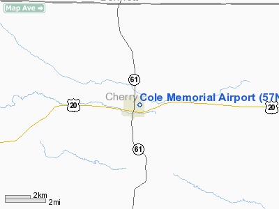
Location & QuickFacts
| FAA Information Effective: | 2008-09-25 |
| Airport Identifier: | 57NE |
| Airport Status: | Operational |
| Longitude/Latitude: | 101-41-37.5310W/42-55-27.0020N
-101.693759/42.924167 (Estimated) |
| Elevation: | 3259 ft / 993.34 m (Estimated) |
| Land: | 100 acres |
| From nearest city: | 1 nautical miles NE of Merriman, NE |
| Location: | Cherry County, NE |
| Magnetic Variation: | 10E (1985) |
Owner & Manager
| Ownership: | Publicly owned |
| Owner: | City Of Merriman |
| Address: | Box 233
Merriman, NE 69218 |
| Phone number: | 308-684-3330 |
| Manager: | Larry Ellis |
| Address: | Box 65
Merriman, NE 69218 |
| Phone number: | 308-684-3330 |
Airport Operations and Facilities
| Airport Use: | Private |
| Wind indicator: | Yes |
| Segmented Circle: | No |
| Control Tower: | No |
| Landing fee charge: | No |
| Sectional chart: | Cheyenne |
| Region: | ACE - Central |
| Boundary ARTCC: | ZDV - Denver |
| Tie-in FSS: | OLU - Columbus |
| FSS on Airport: | No |
| FSS Toll Free: | 1-800-WX-BRIEF |
Airport Services
| Airframe Repair: | NONE |
| Power Plant Repair: | NONE |
| Bottled Oxygen: | NONE |
| Bulk Oxygen: | NONE |
Runway Information
Runway 11/29
| Dimension: | 2400 x 50 ft / 731.5 x 15.2 m |
| Surface: | ASPH, Poor Condition |
| Weight Limit: | Single wheel: 4000 lbs. |
| |
Runway 11 |
Runway 29 |
| Traffic Pattern: | Left | Left |
| Markings: | None, | None, |
| Runway End Identifier: | No | No |
| Centerline Lights: | No | No |
| Touchdown Lights: | No | No |
| Obstruction: | 22 ft road, 425.0 ft from runway, 10:1 slope to clear | 39 ft trees, 915.0 ft from runway, 80 ft left of centerline, 18:1 slope to clear |
|
Radio Navigation Aids
| ID |
Type |
Name |
Ch |
Freq |
Var |
Dist |
| GRN | NDB | Gordon | | 414.00 | 09E | 22.6 nm |
Remarks
- ESTABLISHED PRIOR TO 1959.
Images and information placed above are from
http://www.airport-data.com/airport/57NE/
We thank them for the data!
| General Info
|
| Country |
United States
|
| State |
NEBRASKA
|
| FAA ID |
57NE
|
| Latitude |
42-55-27.002N
|
| Longitude |
101-41-37.531W
|
| Elevation |
3259 feet
|
| Near City |
MERRIMAN
|
We don't guarantee the information is fresh and accurate. The data may
be wrong or outdated.
For more up-to-date information please refer to other sources.
|
|


