 |
|
| Chadron Municipal Airport |
| IATA: CDR – ICAO: KCDR – FAA LID: CDR |
| Summary |
| Airport type |
Public |
| Owner |
City of Chadron |
| Serves |
Chadron, Nebraska |
| Elevation AMSL |
3,297 ft / 1,005 m |
| Coordinates |
42°50′15″N 103°05′44″W / 42.8375°N 103.09556°W / 42.8375; -103.09556 |
| Runways |
| Direction |
Length |
Surface |
| ft |
m |
| 2/20 |
6,001 |
1,829 |
Concrete |
| 11/29 |
4,401 |
1,341 |
Concrete |
| Statistics (2007) |
| Aircraft operations |
7,848 |
| Based aircraft |
21 |
| Source: Federal Aviation Administration |
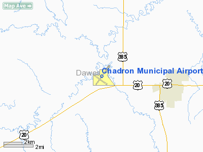
Chadron Municipal Airport (IATA: CDR, ICAO: KCDR, FAA LID: CDR) is a city-owned, public-use airport located four nautical miles (7 km) west of the central business district of the City of Chadron, in Dawes County, Nebraska, United States. It is served by one commercial airline, with service subsidized by the Essential Air Service program. Facilities and aircraft
Chadron Municipal Airport covers an area of 716 acres (290 ha) at an elevation of 3,297 feet (1,005 m) above mean sea level. It has two runways with concrete surfaces: 2/20 is 6,001 by 100 feet (1,829 x 30 m) and 11/29 is 4,401 by 75 feet (1,341 x 23 m).
For the 12-month period ending December 31, 2007, the airport had 7,848 aircraft operations, an average of 21 per day: 77% general aviation, 16% scheduled commercial, 6% military and 1% air taxi. At that time there were 21 aircraft based at this airport: 95% single-engine and 5% multi-engine.
Airlines and destinations
Scheduled commercial service to Denver International Airport is provided by Great Lakes Airlines. Flights to or from destinations beyond Denver can be booked with United Airlines and Frontier Airlines, which both have a codeshare agreement with Great Lakes.
| Airlines |
Destinations |
| Great Lakes Airlines |
Denver, Williston |
The above content comes from Wikipedia and is published under free licenses – click here to read more.
Location & QuickFacts
| FAA Information Effective: | 2008-09-25 |
| Airport Identifier: | CDR |
| Airport Status: | Operational |
| Longitude/Latitude: | 103-05-43.5000W/42-50-15.2000N
-103.095417/42.837556 (Estimated) |
| Elevation: | 3297 ft / 1004.93 m (Surveyed) |
| Land: | 716 acres |
| From nearest city: | 4 nautical miles W of Chadron, NE |
| Location: | Dawes County, NE |
| Magnetic Variation: | 11E (1990) |
Owner & Manager
| Ownership: | Publicly owned |
| Owner: | City Of Chadron |
| Address: | P.o. Box 390
Chadron, NE 69337-0390 |
| Phone number: | 308-432-0505 |
| Manager: | Ms. Sandra K Powell
MARK HUTTON ON SITE AIRPORT OPERATIONS SUPERVISOR. |
| Address: | P.o. Box 390
Chadron, NE 69337-0390 |
| Phone number: | 308-432-0505 |
Airport Operations and Facilities
| Airport Use: | Open to public |
| Wind indicator: | Yes |
| Segmented Circle: | Yes |
| Control Tower: | No |
| Lighting Schedule: | DUSK-DAWN
ACTVT MIRL RY 11/29 & HIRL RY 02/20; REIL RYS 02; 20; 29; VASI RYS 02; 20 & MALSR RY 02 - CTAF. |
| Beacon Color: | Clear-Green (lighted land airport) |
| Landing fee charge: | No |
| Sectional chart: | Cheyenne |
| Region: | ACE - Central |
| Boundary ARTCC: | ZDV - Denver |
| Tie-in FSS: | OLU - Columbus |
| FSS on Airport: | No |
| FSS Toll Free: | 1-800-WX-BRIEF |
| NOTAMs Facility: | CDR (NOTAM-d service avaliable) |
| Certification type/date: | III A S 12/20 |
| Federal Agreements: | NGVY |
Airport Communications
| CTAF: | 122.800 |
| Unicom: | 122.800 |
Airport Services
| Fuel available: | 100LLA
FOR FUEL AFTER HRS CALL FBO PHONE 308-432-8128 ON CALL 24 HRS. |
| Airframe Repair: | MAJOR |
| Power Plant Repair: | MAJOR |
Runway Information
Runway 02/20
| Dimension: | 6001 x 100 ft / 1829.1 x 30.5 m |
| Surface: | CONC, |
| Weight Limit: | Single wheel: 30000 lbs.
Dual wheel: 55000 lbs.
Dual tandem wheel: 90000 lbs. |
| Edge Lights: | High |
| |
Runway 02 |
Runway 20 |
| Longitude: | 103-06-01.2030W | 103-05-14.9030W |
| Latitude: | 42-49-58.7250N | 42-50-47.2190N |
| Elevation: | 3296.00 ft | 3267.00 ft |
| Alignment: | 35 | 127 |
| ILS Type: | ILS
| |
| Traffic Pattern: | Left | Left |
| Markings: | Precision instrument, Good Condition | Non-precision instrument, Good Condition |
| Crossing Height: | 39.00 ft | 41.00 ft |
| Displaced threshold: | 290.00 ft | 500.00 ft |
| VASI: | 4-box on left side | 4-box on left side |
| Visual Glide Angle: | 3.00° | 3.00° |
| Approach lights: | MALSR | |
| Runway End Identifier: | Yes | Yes |
| Obstruction: | , 50:1 slope to clear
APCH RATIO 50+:1 FM DSPLCD THR. | 20 ft tree, 375.0 ft from runway, 375 ft left of centerline, 8:1 slope to clear |
| Decleard distances: | Take off run available 6002.00 ft
Take off distance available 6002.00 ft
Actual stop distance available 5502.00 ft
Landing distance available 5212.00 ft
| Take off run available 6002.00 ft
Take off distance available 6002.00 ft
Actual stop distance available 6002.00 ft
Landing distance available 5502.00 ft
|
|
Runway 11/29
| Dimension: | 4401 x 75 ft / 1341.4 x 22.9 m |
| Surface: | CONC, |
| Weight Limit: | Single wheel: 21000 lbs.
Dual wheel: 30000 lbs. |
| Edge Lights: | Medium |
| |
Runway 11 |
Runway 29 |
| Longitude: | 103-06-15.0090W | 103-05-26.5980W |
| Latitude: | 42-50-17.0580N | 42-49-52.1680N |
| Elevation: | 3294.00 ft | 3284.00 ft |
| Alignment: | 125 | 127 |
| Traffic Pattern: | Left | Left |
| Markings: | Non-precision instrument, Good Condition | Non-precision instrument, Good Condition |
| Crossing Height: | 42.00 ft | 40.00 ft |
| VASI: | 4-light PAPI on left side | 4-light PAPI on left side |
| Visual Glide Angle: | 3.00° | 3.00° |
| Runway End Identifier: | | Yes |
| Obstruction: | , 50:1 slope to clear | 35 ft road, 1400.0 ft from runway, 220 ft left of centerline, 34:1 slope to clear |
|
Radio Navigation Aids
| ID |
Type |
Name |
Ch |
Freq |
Var |
Dist |
| HIN | NDB | Whitney | | 275.00 | 11E | 0.5 nm |
| GRN | NDB | Gordon | | 414.00 | 09E | 40.4 nm |
| ALU | NDB | Alliance | | 380.00 | 11E | 49.5 nm |
| CDR | VOR/DME | Chadron | 081X | 113.40 | 13E | 19.3 nm |
| AIA | VOR/DME | Alliance | 055X | 111.80 | 11E | 48.7 nm |
Images and information placed above are from
http://www.airport-data.com/airport/CDR/
We thank them for the data!
| General Info
|
| Country |
United States
|
| State |
NEBRASKA
|
| FAA ID |
CDR
|
| Latitude |
42-50-15.200N
|
| Longitude |
103-05-43.500W
|
| Elevation |
3297 feet
|
| Near City |
CHADRON
|
We don't guarantee the information is fresh and accurate. The data may
be wrong or outdated.
For more up-to-date information please refer to other sources.
|
|


