 |
|
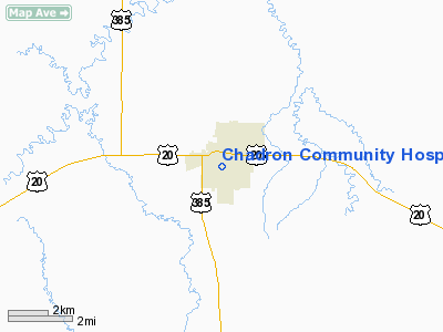
Chadron Community Hospital Heliport |
Location & QuickFacts
| FAA Information Effective: | 2008-09-25 |
| Airport Identifier: | 60NE |
| Airport Status: | Operational |
| Longitude/Latitude: | 103-00-19.1600W/42-49-24.4000N
-103.005322/42.823444 (Estimated) |
| Elevation: | 3500 ft / 1066.80 m (Estimated) |
| Land: | 0 acres |
| From nearest city: | 0 nautical miles N of Chadron, NE |
| Location: | Dawes County, NE |
| Magnetic Variation: | () |
Owner & Manager
| Ownership: | Privately owned |
| Owner: | Chadron Community Hospital |
| Address: | 821 Morehead St
Chadron, NE 69337 |
| Phone number: | 308-432-5586 |
| Manager: | Mike Harris |
| Address: | 821 Morehead St
Chadron, NE 69337 |
| Phone number: | 308-432-5586 |
Airport Operations and Facilities
| Airport Use: | Private |
| Segmented Circle: | No |
| Control Tower: | No |
| Region: | ACE - Central |
| Boundary ARTCC: | ZDV - Denver |
| Tie-in FSS: | OLU - Columbus |
| FSS Toll Free: | 1-800-WX-BRIEF |
Runway Information
Helipad H1
| Dimension: | 40 x 40 ft / 12.2 x 12.2 m |
| Surface: | CONC, |
| |
Runway H1 |
Runway |
| Traffic Pattern: | Left | Left |
|
Radio Navigation Aids
| ID |
Type |
Name |
Ch |
Freq |
Var |
Dist |
| HIN | NDB | Whitney | | 275.00 | 11E | 3.9 nm |
| GRN | NDB | Gordon | | 414.00 | 09E | 36.4 nm |
| ALU | NDB | Alliance | | 380.00 | 11E | 47.8 nm |
| CDR | VOR/DME | Chadron | 081X | 113.40 | 13E | 20.9 nm |
| AIA | VOR/DME | Alliance | 055X | 111.80 | 11E | 47.0 nm |
Remarks
- PRVDD THE FATO, HELIPORT APCH SFCS, & TRANSITIONAL SFCS ARE CLEAR OF OBSTNS.
Images and information placed above are from
http://www.airport-data.com/airport/60NE/
We thank them for the data!
|
|


