|
|
Central Nebraska Rgnl Airport |
| Central Nebraska Regional Airport |
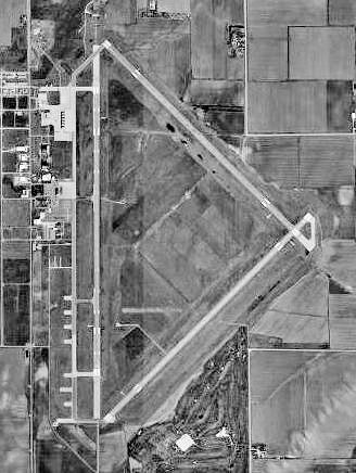 |
| USGS aerial photo - 7 Apr 1999 |
| IATA: GRI – ICAO: KGRI – FAA LID: GRI |
| Summary |
| Airport type |
Public |
| Operator |
Hall County Airport Authority |
| Serves |
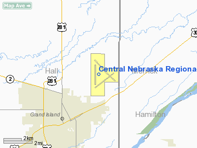
Grand Island, Nebraska |
| Elevation AMSL |
1,847 ft / 563 m |
| Coordinates |
40°58′03″N 098°18′35″W / 40.9675°N 98.30972°W / 40.9675; -98.30972 |
| Runways |
| Direction |
Length |
Surface |
| ft |
m |
| 17/35 |
7,002 |
2,134 |
Concrete |
| 13/31 |
6,608 |
2,014 |
Concrete |
| Statistics (2008) |
| Aircraft operations |
23,048 |
| Based aircraft |
37 |
| Source: Federal Aviation Administration |
Central Nebraska Regional Airport (IATA: GRI, ICAO: KGRI, FAA LID: GRI) is a public use airport located three nautical miles (6 km) northeast of the central business district of Grand Island, a city in Hall County, Nebraska, United States. It is owned by the Hall County Airport Authority and is served by one commercial airline, with service subsidized by the Essential Air Service program.
Air Midwest, operating as US Airways Express, commenced service on October 29, 2006, with two daily flights to Omaha Eppley Airfield and one daily flight to Kansas City International Airport. Air Midwest ended service in May 2008, and Island Air planned to take over service, but then backed out. Allegiant Air began commercial air service out of Grand Island to Las Vegas on September 4th, 2008, along with Great Lakes' service to Kansas City.
Central Nebraska Regional Airport was selected to be the site of a new Chinook Helicopter Base. The Nebraska National Guard has been on site since 2004, with ground scheduled to be broken in 2006 and the base opening in 2008.
The airport was formerly known as Grand Island Army Airfield before it was closed. HistoryToday, about a dozen military buildings still exist at Central Nebraska Regional Airport including several aircraft hangars, some former warehouses being used for commercial storage and several sheds along with the old parachute building.
Facilities and aircraft
Central Nebraska Regional Airport covers an area of 1,847 acres (747 ha) at an elevation of 1,847 feet (563 m) above mean sea level. It has two runways with concrete surfaces: 17/35 is 7,002 by 150 feet (2,134 x 46 m) and 13/31 is 6,608 by 100 feet (2,014 x 30 m).
For the 12-month period ending January 1, 2008, the airport had 23,048 aircraft operations, an average of 63 per day: 64% general aviation, 22% scheduled commercial and 15% military. At that time there were 37 aircraft based at this airport: 62% single-engine, 5% multi-engine, 5% jet and 27% military.
Airlines and destinations
| Airlines |
Destinations |
| Allegiant Air |
Las Vegas, Phoenix/Mesa |
| Great Lakes Airlines |
Denver |
The above content comes from Wikipedia and is published under free licenses – click here to read more.
 |
(Click on the photo to enlarge) |
Location & QuickFacts
| FAA Information Effective: | 2008-09-25 |
| Airport Identifier: | GRI |
| Airport Status: | Operational |
| Longitude/Latitude: | 098-18-34.7000W/40-58-03.1530N
-98.309639/40.967543 (Estimated) |
| Elevation: | 1847 ft / 562.97 m (Surveyed) |
| Land: | 1847 acres |
| From nearest city: | 3 nautical miles NE of Grand Island, NE |
| Location: | Hall County, NE |
| Magnetic Variation: | 07E (1995) |
Owner & Manager
| Ownership: | Publicly owned |
| Owner: | Hall County Arpt Auth |
| Address: | 3743 Sky Park Road
Grand Island, NE 68801 |
| Phone number: | 308-384-5170 |
| Manager: | Mr. Michael Olson, A.a.e. |
| Address: | 3743 Sky Park Road
Grand Island, NE 68801 |
| Phone number: | 308-385-5170
OR 308-385-5172. |
Airport Operations and Facilities
| Airport Use: | Open to public |
| Wind indicator: | Yes |
| Segmented Circle: | Yes |
| Control Tower: | Yes |
| Lighting Schedule: | DUSK-DAWN
WHEN ATCT CLSD ACTVT MALS RYS 13 & 17; MALSR RY 35; MIRL RY 13/31; HIRL RY 17/35; PAPI RYS 13, 31, 17 & 35 & REIL RY 31 - CTAF. |
| Beacon Color: | Clear-Green (lighted land airport) |
| Landing fee charge: | No |
| Sectional chart: | Omaha |
| Region: | ACE - Central |
| Boundary ARTCC: | ZMP - Minneapolis |
| Tie-in FSS: | OLU - Columbus |
| FSS on Airport: | No |
| FSS Toll Free: | 1-800-WX-BRIEF |
| NOTAMs Facility: | GRI (NOTAM-d service avaliable) |
| Certification type/date: | II A S 12/199
PPR 24 HRS FOR ACR OPNS WITH MORE THAN 30 PSGR SEATS CALL AMGR (308) 385-5170. INDEX B OR C LEVEL ARFF AVAILABLE UPON REQUEST. AIR CARRIER OPS OVER 9 PSGR SEATS NOT AUTHORIZED IN EXCESS OF 15 MINUTES BEFORE OR AFTER SCHEDULED ARRIVAL/DEPARTURE TIMES EXCEPT WITH PRIOR COORDINATION WITH ARPT MGR. |
| Federal Agreements: | NGPY3 |
Airport Communications
| CTAF: | 118.200 |
| Unicom: | 122.950 |
Airport Services
| Fuel available: | 100LLA |
| Airframe Repair: | MAJOR |
| Power Plant Repair: | MAJOR |
| Bottled Oxygen: | NONE |
| Bulk Oxygen: | HIGH/LOW |
Runway Information
Runway 13/31
| Dimension: | 6608 x 100 ft / 2014.1 x 30.5 m |
| Surface: | CONC, |
| Weight Limit: | Single wheel: 45000 lbs.
Dual wheel: 60000 lbs. |
| Edge Lights: | Medium |
| |
Runway 13 |
Runway 31 |
| Longitude: | 098-18-42.1900W | 098-17-41.6100W |
| Latitude: | 40-58-42.1200N | 40-57-55.7000N |
| Elevation: | 1840.00 ft | 1843.00 ft |
| Alignment: | 127 | 127 |
| Traffic Pattern: | Left | Left |
| Markings: | Non-precision instrument, Good Condition | Non-precision instrument, Good Condition |
| Crossing Height: | 35.00 ft | 42.00 ft |
| VASI: | 4-light PAPI on left side | 4-light PAPI on left side |
| Visual Glide Angle: | 3.00° | 3.00° |
| Approach lights: | MALS | |
| Runway End Identifier: | | Yes |
| Decleard distances: | Take off run available 6608.00 ft
Take off distance available 6608.00 ft
Actual stop distance available 6608.00 ft
Landing distance available 6608.00 ft
| Take off run available 6608.00 ft
Take off distance available 6608.00 ft
Actual stop distance available 6608.00 ft
Landing distance available 6608.00 ft
|
|
Runway 17/35
| Dimension: | 7002 x 150 ft / 2134.2 x 45.7 m |
| Surface: | CONC, |
| Weight Limit: | Single wheel: 75000 lbs.
Dual wheel: 110000 lbs.
Dual tandem wheel: 185000 lbs. |
| Edge Lights: | High |
| |
Runway 17 |
Runway 35 |
| Longitude: | 098-18-53.1770W | 098-18-53.6570W |
| Latitude: | 40-58-37.8270N | 40-57-28.6480N |
| Elevation: | 1844.00 ft | 1847.00 ft |
| Alignment: | 127 | 0 |
| ILS Type: | | ILS
|
| Traffic Pattern: | Left | Left |
| Markings: | Non-precision instrument, Good Condition | Precision instrument, Good Condition |
| Crossing Height: | 38.00 ft | 55.00 ft |
| VASI: | 4-light PAPI on left side | 4-light PAPI on left side
PAPI RESTRICTED BYD 6 DEG RIGHT OF CRS. |
| Visual Glide Angle: | 3.00° | 2.60° |
| RVR Equipment: | | touchdown |
| Approach lights: | MALS | MALSR |
| Decleard distances: | Take off run available 7002.00 ft
Take off distance available 7002.00 ft
Actual stop distance available 7002.00 ft
Landing distance available 7002.00 ft
| Take off run available 7002.00 ft
Take off distance available 7002.00 ft
Actual stop distance available 7002.00 ft
Landing distance available 7002.00 ft
|
|
Radio Navigation Aids
| ID |
Type |
Name |
Ch |
Freq |
Var |
Dist |
| PSS | NDB | Prosser | | 338.00 | 07E | 18.6 nm |
| JYR | NDB | York | | 257.00 | 06E | 31.7 nm |
| FMZ | NDB | Beklof | | 392.00 | 07E | 40.7 nm |
| BVN | NDB | Alaby | | 332.00 | 06E | 47.2 nm |
| ODX | NDB | Ord | | 356.00 | 07E | 48.9 nm |
| EAR | VOR | Kearney | | 111.20 | 10E | 34.8 nm |
| HSI | VOR/DME | Hastings | 025X | 108.80 | 07E | 22.5 nm |
| GRI | VORTAC | Grand Island | 057X | 112.00 | 07E | 1.0 nm |
| OBH | VORTAC | Wolbach | 095X | 114.80 | 07E | 24.6 nm |
Remarks
- COMPRESSED NITROGEN FOR STRUT INFLATION AVBL.
- INBOUND ACFT CTC OPS 10 MIN PRIOR TO LNDG.
- ARNG: OPR 0730-1600++MON-FRI; OCNL WKEND. PPR TO PRK ARNG RAMP. DSN 279-7271, C402-309-7271.
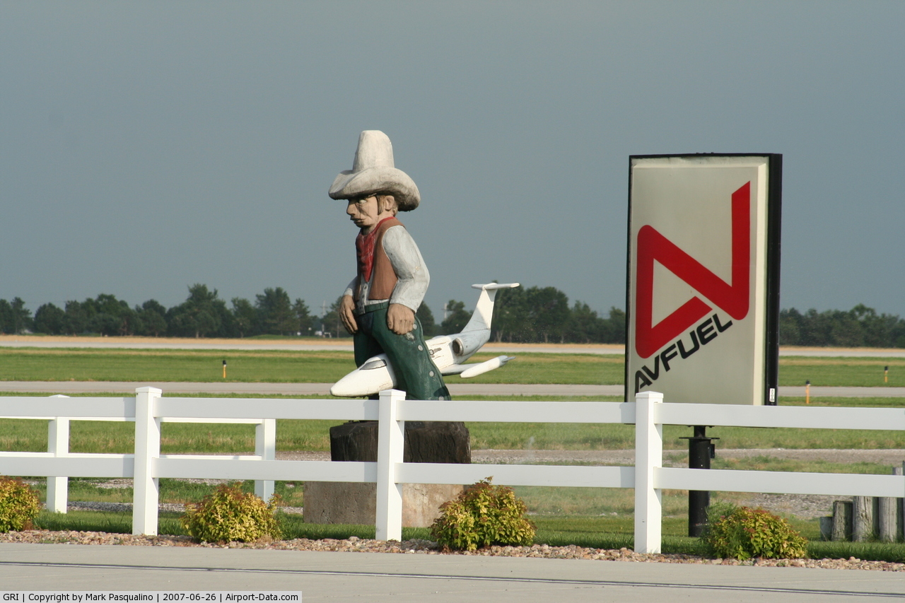
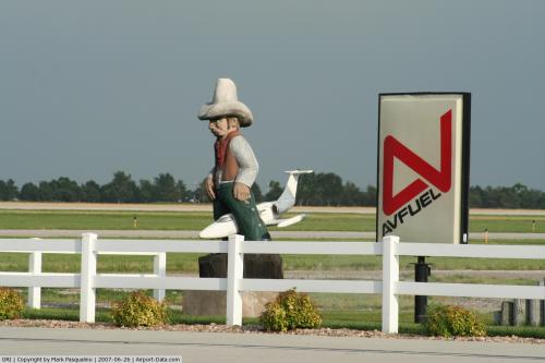
Images and information placed above are from
http://www.airport-data.com/airport/GRI/
We thank them for the data!
| General Info
|
| Country |
United States
|
| State |
NEBRASKA
|
| FAA ID |
GRI
|
| Latitude |
40-58-03.153N
|
| Longitude |
098-18-34.700W
|
| Elevation |
1847 feet
|
| Near City |
GRAND ISLAND
|
We don't guarantee the information is fresh and accurate. The data may
be wrong or outdated.
For more up-to-date information please refer to other sources.
|
|