 |
|
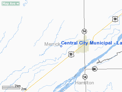
Central City Muni - Larry Reineke Field Airport |
Location & QuickFacts
| FAA Information Effective: | 2008-09-25 |
| Airport Identifier: | 07K |
| Airport Status: | Operational |
| Longitude/Latitude: | 098-03-06.2000W/41-06-45.4000N
-98.051722/41.112611 (Estimated) |
| Elevation: | 1717 ft / 523.34 m (Surveyed) |
| Land: | 124 acres |
| From nearest city: | 3 nautical miles W of Central City, NE |
| Location: | Merrick County, NE |
| Magnetic Variation: | 07E (1985) |
Owner & Manager
| Ownership: | Publicly owned |
| Owner: | City Of Central City |
| Address: | Po Box 418
Central City, NE 68826-0418 |
| Phone number: | 308-946-3806 |
| Manager: | Don Shorney |
| Address: | 1346 Ormsby Rd
Central City, NE 68826-8009 |
| Phone number: | 308-946-3450 |
Airport Operations and Facilities
| Airport Use: | Open to public |
| Wind indicator: | Yes |
| Segmented Circle: | No |
| Control Tower: | No |
| Lighting Schedule: | DUSK-DAWN
ACTVT MIRL RY 15/33 - CTAF. |
| Beacon Color: | Clear-Green (lighted land airport) |
| Landing fee charge: | No |
| Sectional chart: | Omaha |
| Region: | ACE - Central |
| Boundary ARTCC: | ZMP - Minneapolis |
| Tie-in FSS: | OLU - Columbus |
| FSS on Airport: | No |
| FSS Toll Free: | 1-800-WX-BRIEF |
| NOTAMs Facility: | OLU (NOTAM-d service avaliable) |
| Federal Agreements: | NGY |
Airport Communications
Airport Services
| Fuel available: | 100LL
FOR FUEL AFT HRS CALL POLICE 308-946-3003. |
| Airframe Repair: | MAJOR |
| Power Plant Repair: | MAJOR |
| Bottled Oxygen: | NONE |
| Bulk Oxygen: | NONE |
Runway Information
Runway 15/33
| Dimension: | 3700 x 60 ft / 1127.8 x 18.3 m |
| Surface: | ASPH, |
| Weight Limit: | Single wheel: 11000 lbs. |
| Edge Lights: | Medium |
| |
Runway 15 |
Runway 33 |
| Longitude: | 098-03-11.7781W | 098-02-57.8383W |
| Latitude: | 41-06-59.1215N | 41-06-24.1198N |
| Elevation: | 1715.00 ft | 1716.00 ft |
| Traffic Pattern: | Left | Left |
| Markings: | Basic, Good Condition | Basic, Good Condition |
| Obstruction: | 16 ft road, 850.0 ft from runway, 40:1 slope to clear | 3 ft fence, 300.0 ft from runway, 33:1 slope to clear |
|
Radio Navigation Aids
| ID |
Type |
Name |
Ch |
Freq |
Var |
Dist |
| JYR | NDB | York | | 257.00 | 06E | 23.6 nm |
| PSS | NDB | Prosser | | 338.00 | 07E | 32.1 nm |
| BVN | NDB | Alaby | | 332.00 | 06E | 37.1 nm |
| PLT | NDB | Platte Center | | 407.00 | 08E | 38.0 nm |
| FMZ | NDB | Beklof | | 392.00 | 07E | 38.3 nm |
| SWT | NDB | Seward | | 269.00 | 06E | 45.2 nm |
| EAR | VOR | Kearney | | 111.20 | 10E | 49.2 nm |
| HSI | VOR/DME | Hastings | 025X | 108.80 | 07E | 35.0 nm |
| OLU | VOR/DME | Columbus | 055X | 111.80 | 08E | 38.0 nm |
| GRI | VORTAC | Grand Island | 057X | 112.00 | 07E | 14.2 nm |
| OBH | VORTAC | Wolbach | 095X | 114.80 | 07E | 20.9 nm |
Remarks
- ROTG BCN & LGTD WIND SOCK ON SS-SR.
Images and information placed above are from
http://www.airport-data.com/airport/07K/
We thank them for the data!
| General Info
|
| Country |
United States
|
| State |
NEBRASKA
|
| FAA ID |
07K
|
| Latitude |
41-07-00.050N
|
| Longitude |
098-03-01.211W
|
| Elevation |
1715 feet
|
| Near City |
CENTRAL CITY
|
We don't guarantee the information is fresh and accurate. The data may
be wrong or outdated.
For more up-to-date information please refer to other sources.
|
|


