 |
|
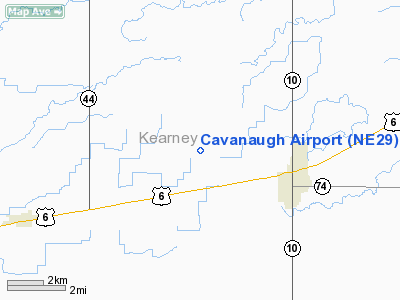
Location & QuickFacts
| FAA Information Effective: | 2008-09-25 |
| Airport Identifier: | NE29 |
| Airport Status: | Operational |
| Longitude/Latitude: | 099-00-43.3040W/40-30-50.0500N
-99.012029/40.513903 (Estimated) |
| Elevation: | 2175 ft / 662.94 m (Estimated) |
| Land: | 0 acres |
| From nearest city: | 3 nautical miles E of Minden, NE |
| Location: | Kearney County, NE |
| Magnetic Variation: | 08E (1990) |
Owner & Manager
| Ownership: | Privately owned |
| Owner: | Mike Cavanaugh |
| Address: | 972 M Rd
Minden, NE 68959 |
| Phone number: | 308-832-1966 |
| Address: |
|
Airport Operations and Facilities
| Airport Use: | Private |
| Wind indicator: | Yes |
| Segmented Circle: | No |
| Control Tower: | No |
| Sectional chart: | Omaha |
| Region: | ACE - Central |
| Boundary ARTCC: | ZMP - Minneapolis |
| Tie-in FSS: | OLU - Columbus |
| FSS on Airport: | No |
| FSS Toll Free: | 1-800-WX-BRIEF |
Runway Information
Runway 08/26
| Dimension: | 2600 x 100 ft / 792.5 x 30.5 m |
| Surface: | TURF, |
| |
Runway 08 |
Runway 26 |
| Traffic Pattern: | Left | Left |
| Obstruction: | | 20 ft road, 10.0 ft from runway |
|
Runway 17/35
| Dimension: | 2600 x 100 ft / 792.5 x 30.5 m |
| Surface: | TURF, |
| |
Runway 17 |
Runway 35 |
| Traffic Pattern: | Left | Left |
| Obstruction: | | 20 ft road, 10.0 ft from runway |
|
Radio Navigation Aids
| ID |
Type |
Name |
Ch |
Freq |
Var |
Dist |
| HDE | NDB | Holdrege | | 396.00 | 07E | 15.5 nm |
| PSS | NDB | Prosser | | 338.00 | 07E | 26.5 nm |
| RRX | NDB | Darr | | 326.00 | 07E | 43.3 nm |
| EAR | VOR | Kearney | | 111.20 | 10E | 12.7 nm |
| HSI | VOR/DME | Hastings | 025X | 108.80 | 07E | 27.1 nm |
| GRI | VORTAC | Grand Island | 057X | 112.00 | 07E | 42.5 nm |
Remarks
- PRVDD PR USE; 20:1 GLIDE SLOPE TO THE APCH TO EACH RY; 7:1 SLOPE FOR TRANSITIONAL SFC.
Images and information placed above are from
http://www.airport-data.com/airport/NE29/
We thank them for the data!
| General Info
|
| Country |
United States
|
| State |
NEBRASKA
|
| FAA ID |
NE29
|
| Latitude |
40-30-50.050N
|
| Longitude |
099-00-43.304W
|
| Elevation |
2175 feet
|
| Near City |
MINDEN
|
We don't guarantee the information is fresh and accurate. The data may
be wrong or outdated.
For more up-to-date information please refer to other sources.
|
|


