 |
|
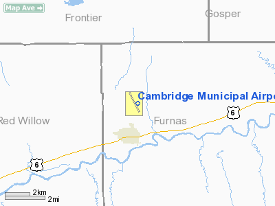
Location & QuickFacts
| FAA Information Effective: | 2008-09-25 |
| Airport Identifier: | CSB |
| Airport Status: | Operational |
| Longitude/Latitude: | 100-09-43.5000W/40-18-23.7000N
-100.162083/40.306583 (Estimated) |
| Elevation: | 2414 ft / 735.79 m (Surveyed) |
| Land: | 213 acres |
| From nearest city: | 2 nautical miles NE of Cambridge, NE |
| Location: | Furnas County, NE |
| Magnetic Variation: | 08E (1995) |
Owner & Manager
| Ownership: | Publicly owned |
| Owner: | Cambridge Airport Authority |
| Address: | P.o. Box 250
Cambridge, NE 69022 |
| Phone number: | 308-697-3737 |
| Manager: | Joe Sides |
| Address: | 72275 Road 410
Cambridge, NE 69022 |
| Phone number: | 308-697-3677 |
Airport Operations and Facilities
| Airport Use: | Open to public |
| Wind indicator: | Yes |
| Segmented Circle: | Yes |
| Control Tower: | No |
| Lighting Schedule: | DUSK-DAWN
MIRL RY 14/32 PRESET ON LOW INTST; TO INCR INTST ACTVT - CTAF. |
| Beacon Color: | Clear-Green (lighted land airport) |
| Landing fee charge: | No |
| Sectional chart: | Omaha |
| Region: | ACE - Central |
| Boundary ARTCC: | ZDV - Denver |
| Tie-in FSS: | OLU - Columbus |
| FSS on Airport: | No |
| FSS Toll Free: | 1-800-WX-BRIEF |
| NOTAMs Facility: | OLU (NOTAM-d service avaliable) |
| Federal Agreements: | NGY |
Airport Communications
| CTAF: | 122.800 |
| Unicom: | 122.800 |
Airport Services
| Fuel available: | 100LL
FOR FUEL AFTER HRS CALL 308-695-0551. |
| Airframe Repair: | NONE |
| Power Plant Repair: | NONE |
| Bottled Oxygen: | NONE |
| Bulk Oxygen: | NONE |
Runway Information
Runway 14/32
| Dimension: | 4099 x 60 ft / 1249.4 x 18.3 m |
| Surface: | ASPH, Poor Condition
WIDE TRANSVERSE CRACKS ON RY. |
| Weight Limit: | Single wheel: 12000 lbs. |
| Edge Lights: | Medium |
| |
Runway 14 |
Runway 32 |
| Longitude: | 100-09-54.6900W | 100-09-32.2360W |
| Latitude: | 40-18-42.0370N | 40-18-05.3700N |
| Elevation: | 2413.00 ft | 2396.00 ft |
| Alignment: | 127 | 127 |
| Traffic Pattern: | Left | Left |
| Markings: | Non-precision instrument, Good Condition | Non-precision instrument, Good Condition |
| Crossing Height: | 40.00 ft | 40.00 ft |
| VASI: | 2-light PAPI on left side | 2-light PAPI on left side |
| Visual Glide Angle: | 3.00° | 3.00° |
| Obstruction: | , 50:1 slope to clear | 14 ft tree, 650.0 ft from runway, 32:1 slope to clear |
|
Radio Navigation Aids
| ID |
Type |
Name |
Ch |
Freq |
Var |
Dist |
| MCK | FAN MARKER | Mc Cook | | | 11E | 19.1 nm |
| CSB | NDB | Harry Strunk | | 389.00 | 08E | 0.2 nm |
| NRN | NDB | Norton | | 230.00 | 08E | 29.9 nm |
| OIN | NDB | Oberlin | | 341.00 | 09E | 33.5 nm |
| DWL | NDB | Willow | | 353.00 | 08E | 34.3 nm |
| RRX | NDB | Darr | | 326.00 | 07E | 35.2 nm |
| HDE | NDB | Holdrege | | 396.00 | 07E | 38.6 nm |
| ADT | NDB | Atwood | | 365.00 | 09E | 49.4 nm |
| OZB | VOR | Cozad | | 109.00 | 09E | 34.7 nm |
| MCK | VOR/DME | Mc Cook | 100X | 115.30 | 08E | 20.8 nm |
| HCT | VORTAC | Hayes Center | 124X | 117.70 | 11E | 36.0 nm |
Images and information placed above are from
http://www.airport-data.com/airport/CSB/
We thank them for the data!
| General Info
|
| Country |
United States
|
| State |
NEBRASKA
|
| FAA ID |
CSB
|
| Latitude |
40-18-23.700N
|
| Longitude |
100-09-43.500W
|
| Elevation |
2414 feet
|
| Near City |
CAMBRIDGE
|
We don't guarantee the information is fresh and accurate. The data may
be wrong or outdated.
For more up-to-date information please refer to other sources.
|
|


