 |
|
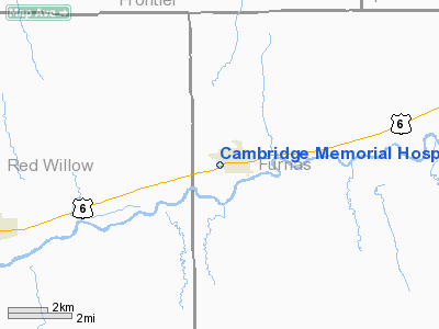
Cambridge Memorial Hospital Heliport |
Location & QuickFacts
| FAA Information Effective: | 2008-09-25 |
| Airport Identifier: | 79NE |
| Airport Status: | Operational |
| Longitude/Latitude: | 100-10-44.4930W/40-16-51.0230N
-100.179026/40.280840 (Estimated) |
| Elevation: | 2268 ft / 691.29 m (Estimated) |
| Land: | 0 acres |
| From nearest city: | 0 nautical miles W of Cambridge, NE |
| Location: | Furnas County, NE |
| Magnetic Variation: | 09E (1985) |
Owner & Manager
| Ownership: | Privately owned |
| Owner: | Cambridge Memorial Hospital |
| Address: | West Highways 6 & 34
Cambridge, NE 69022 |
| Phone number: | 308-697-3329 |
| Address: |
|
Airport Operations and Facilities
| Airport Use: | Private
MEDICAL. |
| Segmented Circle: | No |
| Control Tower: | No |
| Sectional chart: | Wichita |
| Region: | ACE - Central |
| Boundary ARTCC: | ZDV - Denver |
| Tie-in FSS: | OLU - Columbus |
| FSS Toll Free: | 1-800-WX-BRIEF |
Runway Information
Helipad H1
| Dimension: | 40 x 40 ft / 12.2 x 12.2 m |
| Surface: | ASPH, |
| |
Runway H1 |
Runway |
| Traffic Pattern: | Left | Left |
|
Radio Navigation Aids
| ID |
Type |
Name |
Ch |
Freq |
Var |
Dist |
| MCK | FAN MARKER | Mc Cook | | | 11E | 17.8 nm |
| CSB | NDB | Harry Strunk | | 389.00 | 08E | 1.7 nm |
| NRN | NDB | Norton | | 230.00 | 08E | 28.8 nm |
| OIN | NDB | Oberlin | | 341.00 | 09E | 31.7 nm |
| DWL | NDB | Willow | | 353.00 | 08E | 35.9 nm |
| RRX | NDB | Darr | | 326.00 | 07E | 36.9 nm |
| HDE | NDB | Holdrege | | 396.00 | 07E | 39.7 nm |
| ADT | NDB | Atwood | | 365.00 | 09E | 47.9 nm |
| OZB | VOR | Cozad | | 109.00 | 09E | 36.3 nm |
| MCK | VOR/DME | Mc Cook | 100X | 115.30 | 08E | 19.6 nm |
| HCT | VORTAC | Hayes Center | 124X | 117.70 | 11E | 35.7 nm |
Remarks
- PRVDD APCH/DEP PATHS ARE A MINIMUM 8:1 GS & TRANSITIONAL SFCS FOR A 2:1 SLOPE; PLINE SW OF LDG AREA BE BURIED.
Images and information placed above are from
http://www.airport-data.com/airport/79NE/
We thank them for the data!
| General Info
|
| Country |
United States
|
| State |
NEBRASKA
|
| FAA ID |
79NE
|
| Latitude |
40-16-51.023N
|
| Longitude |
100-10-44.493W
|
| Elevation |
2268 feet
|
| Near City |
CAMBRIDGE
|
We don't guarantee the information is fresh and accurate. The data may
be wrong or outdated.
For more up-to-date information please refer to other sources.
|
|


