 |
|
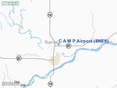
Location & QuickFacts
| FAA Information Effective: | 2008-09-25 |
| Airport Identifier: | 8NE9 |
| Airport Status: | Operational |
| Longitude/Latitude: | 097-57-52.2110W/41-23-25.0500N
-97.964503/41.390292 (Estimated) |
| Elevation: | 1675 ft / 510.54 m (Estimated) |
| Land: | 0 acres |
| From nearest city: | 2 nautical miles N of Fullerton, NE |
| Location: | Nance County, NE |
| Magnetic Variation: | 07E (1985) |
Owner & Manager
| Ownership: | Privately owned |
| Owner: | David L Nathan |
| Address: | 302 Fuller St.
Fullerton, NE 68638 |
| Phone number: | 308-536-2434 |
| Manager: | David L Nathan |
| Address: | 302 Fuller St.
Fullerton, NE 68638 |
| Phone number: | 308-536-2434 |
Airport Operations and Facilities
| Airport Use: | Private |
| Wind indicator: | Yes |
| Segmented Circle: | No |
| Control Tower: | No |
| Landing fee charge: | No |
| Sectional chart: | Omaha |
| Region: | ACE - Central |
| Boundary ARTCC: | ZMP - Minneapolis |
| Tie-in FSS: | OLU - Columbus |
| FSS on Airport: | No |
| FSS Toll Free: | 1-800-WX-BRIEF |
Airport Services
| Airframe Repair: | NONE |
| Power Plant Repair: | NONE |
Runway Information
Runway 17/35
| Dimension: | 3350 x 75 ft / 1021.1 x 22.9 m |
| Surface: | TURF, |
| |
Runway 17 |
Runway 35 |
| Traffic Pattern: | Left | Left |
|
Radio Navigation Aids
| ID |
Type |
Name |
Ch |
Freq |
Var |
Dist |
| BVN | NDB | Alaby | | 332.00 | 06E | 20.8 nm |
| PLT | NDB | Platte Center | | 407.00 | 08E | 27.0 nm |
| JYR | NDB | York | | 257.00 | 06E | 33.5 nm |
| OF | NDB | Carsy | | 510.00 | 08E | 37.0 nm |
| ODX | NDB | Ord | | 356.00 | 07E | 46.4 nm |
| PSS | NDB | Prosser | | 338.00 | 07E | 48.3 nm |
| OLU | VOR/DME | Columbus | 055X | 111.80 | 08E | 28.3 nm |
| OFK | VOR/DME | Norfolk | 033X | 109.60 | 08E | 43.1 nm |
| OBH | VORTAC | Wolbach | 095X | 114.80 | 07E | 17.6 nm |
| GRI | VORTAC | Grand Island | 057X | 112.00 | 07E | 29.1 nm |
Images and information placed above are from
http://www.airport-data.com/airport/8NE9/
We thank them for the data!
| General Info
|
| Country |
United States
|
| State |
NEBRASKA
|
| FAA ID |
8NE9
|
| Latitude |
41-23-25.050N
|
| Longitude |
097-57-52.211W
|
| Elevation |
1675 feet
|
| Near City |
FULLERTON
|
We don't guarantee the information is fresh and accurate. The data may
be wrong or outdated.
For more up-to-date information please refer to other sources.
|
|


