 |
|
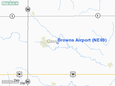
Location & QuickFacts
| FAA Information Effective: | 2008-09-25 |
| Airport Identifier: | NE69 |
| Airport Status: | Operational |
| Longitude/Latitude: | 096-06-36.0360W/40-52-03.0020N
-96.110010/40.867501 (Estimated) |
| Elevation: | 1183 ft / 360.58 m (Estimated) |
| Land: | 50 acres |
| From nearest city: | 2 nautical miles E of Weeping Water, NE |
| Location: | Cass County, NE |
| Magnetic Variation: | 06E (1985) |
Owner & Manager
| Ownership: | Privately owned |
| Owner: | Lincoln Sport Parachute Club |
| Address: | 12617 Weeping Water Road
Weeping Water, NE 68463 |
| Phone number: | 402-267-9933 |
| Manager: | Lincoln Sport Parachute Club |
| Address: | 12617 Weeping Water Road
Weeping Water, NE 68463 |
| Phone number: | 402-267-9933 |
Airport Operations and Facilities
| Airport Use: | Private |
| Wind indicator: | Yes |
| Segmented Circle: | No |
| Control Tower: | No |
| Lighting Schedule: | NONE |
| Landing fee charge: | No |
| Sectional chart: | Omaha |
| Region: | ACE - Central |
| Boundary ARTCC: | ZMP - Minneapolis |
| Tie-in FSS: | OLU - Columbus |
| FSS on Airport: | No |
| FSS Toll Free: | 1-800-WX-BRIEF |
Airport Services
| Fuel available: | 100LL |
| Airframe Repair: | MAJOR |
| Power Plant Repair: | MAJOR |
| Bottled Oxygen: | NONE |
| Bulk Oxygen: | NONE |
Runway Information
Runway 11/29
| Dimension: | 1400 x 50 ft / 426.7 x 15.2 m |
| Surface: | TURF, Fair Condition
CENTER 15 FT OF RY IS TURF/GRASS
CENTER 15 FT OF RY IS TREATED LIMESTONE. |
| |
Runway 11 |
Runway 29 |
| Traffic Pattern: | Left | Left |
| Obstruction: | 19 ft other, 50 ft left of centerline | 28 ft tree, 133.0 ft from runway, 38 ft right of centerline, 4:1 slope to clear |
|
Runway 17/35
| Dimension: | 2200 x 60 ft / 670.6 x 18.3 m |
| Surface: | TURF-GRVL, Fair Condition
CENTER 15 FT OF RY IS TURF/GRASS
CENTER 15 FT OF RY IS TREATED LIMESTONE. |
| |
Runway 17 |
Runway 35 |
| Traffic Pattern: | Left | Left |
| Obstruction: | , 50:1 slope to clear | 102 ft trees, 2900.0 ft from runway, 28:1 slope to clear |
|
Radio Navigation Aids
| ID |
Type |
Name |
Ch |
Freq |
Var |
Dist |
| PMV | NDB | Plattsmouth | | 329.00 | 06E | 10.1 nm |
| AFK | NDB | Nebraska City | | 347.00 | 05E | 19.4 nm |
| MLE | NDB | Millard | | 371.00 | 06E | 19.7 nm |
| AYB | NDB | Auburn | | 430.00 | 05E | 29.5 nm |
| LN | NDB | Potts | | 385.00 | 06E | 30.6 nm |
| OM | NDB | Gerfi | | 320.00 | 05E | 30.8 nm |
| AHQ | NDB | Wahoo | | 400.00 | 07E | 31.4 nm |
| SDA | NDB | Shenandoah | | 411.00 | 05E | 32.7 nm |
| FET | NDB | Fremont | | 311.00 | 06E | 39.6 nm |
| RDK | NDB | Red Oak | | 230.00 | 04E | 39.9 nm |
| BJU | NDB | Big Blue | | 248.00 | 06E | 44.1 nm |
| SWT | NDB | Seward | | 269.00 | 06E | 45.5 nm |
| HWB | NDB | Shaw | | 263.00 | 06E | 46.7 nm |
| ICL | NDB | Clarinda | | 353.00 | 04E | 50.0 nm |
| OFF | TACAN | Offutt | 054X | | 05E | 17.8 nm |
| BIE | VOR | Beatrice | | 110.60 | 07E | 45.0 nm |
| OVR | VORTAC | Omaha | 110X | 116.30 | 08E | 24.7 nm |
| LNK | VORTAC | Lincoln | 108X | 116.10 | 09E | 28.9 nm |
| PWE | VORTAC | Pawnee City | 071X | 112.40 | 05E | 40.3 nm |
| OMA | VOT | Omaha | | 109.00 | | 27.6 nm |
Remarks
Images and information placed above are from
http://www.airport-data.com/airport/NE69/
We thank them for the data!
| General Info
|
| Country |
United States
|
| State |
NEBRASKA
|
| FAA ID |
NE69
|
| Latitude |
40-52-03.002N
|
| Longitude |
096-06-36.036W
|
| Elevation |
1183 feet
|
| Near City |
WEEPING WATER
|
We don't guarantee the information is fresh and accurate. The data may
be wrong or outdated.
For more up-to-date information please refer to other sources.
|
|


