 |
|
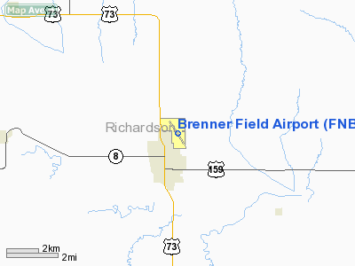
Location & QuickFacts
| FAA Information Effective: | 2008-09-25 |
| Airport Identifier: | FNB |
| Airport Status: | Operational |
| Longitude/Latitude: | 095-35-31.1700W/40-04-43.6300N
-95.591992/40.078786 (Estimated) |
| Elevation: | 984 ft / 299.92 m (Surveyed) |
| Land: | 152 acres |
| From nearest city: | 1 nautical miles NE of Falls City, NE |
| Location: | Richardson County, NE |
| Magnetic Variation: | 05E (1995) |
Owner & Manager
| Ownership: | Publicly owned |
| Owner: | Falls City Airport Authority |
| Address: | Po Box 158
Falls City, NE 68355-0158 |
| Phone number: | 402-245-2748 |
| Manager: | Philip Chaffee
MGR RESIDES AT ARPT. |
| Address: | Rr 2 Box 83
Falls City, NE 68355 |
| Phone number: | 402-245-3715 |
Airport Operations and Facilities
| Airport Use: | Open to public |
| Wind indicator: | Yes |
| Segmented Circle: | Yes |
| Control Tower: | No |
| Lighting Schedule: | DUSK-DAWN
PAPI RYS 14 & 32 OPER 24 HRS. |
| Beacon Color: | Clear-Green (lighted land airport) |
| Landing fee charge: | No |
| Sectional chart: | Omaha |
| Region: | ACE - Central |
| Traffic Pattern Alt: | 800 ft |
| Boundary ARTCC: | ZKC - Kansas City |
| Tie-in FSS: | OLU - Columbus |
| FSS on Airport: | No |
| FSS Toll Free: | 1-800-WX-BRIEF |
| NOTAMs Facility: | FNB (NOTAM-d service avaliable) |
| Federal Agreements: | NGY |
Airport Communications
| CTAF: | 122.800 |
| Unicom: | 122.800 |
Airport Services
| Fuel available: | 100LL |
| Airframe Repair: | MINOR |
| Power Plant Repair: | MINOR |
| Bottled Oxygen: | NONE |
| Bulk Oxygen: | NONE |
Runway Information
Runway 14/32
| Dimension: | 3999 x 60 ft / 1218.9 x 18.3 m |
| Surface: | CONC, Good Condition |
| Weight Limit: | Single wheel: 30000 lbs.
Dual wheel: 48000 lbs. |
| Edge Lights: | Medium |
| |
Runway 14 |
Runway 32 |
| Longitude: | 095-35-44.4647W | 095-35-17.8567W |
| Latitude: | 40-05-00.5333N | 40-04-26.7090N |
| Elevation: | 984.00 ft | 980.00 ft |
| Alignment: | 127 | 127 |
| Traffic Pattern: | Left | Left |
| Markings: | Non-precision instrument, Good Condition | Non-precision instrument, Good Condition |
| Crossing Height: | 24.00 ft | 33.00 ft |
| VASI: | 2-light PAPI on left side | 2-light PAPI on left side |
| Visual Glide Angle: | 3.00° | 3.00° |
|
Radio Navigation Aids
| ID |
Type |
Name |
Ch |
Freq |
Var |
Dist |
| FNB | NDB | Brenner | | 404.00 | 05E | 0.3 nm |
| AYB | NDB | Auburn | | 430.00 | 05E | 23.6 nm |
| AZN | NDB | Amazon | | 233.00 | 06E | 33.6 nm |
| AFK | NDB | Nebraska City | | 347.00 | 05E | 34.0 nm |
| EVU | NDB | Emville | | 317.00 | 05E | 35.0 nm |
| SDA | NDB | Shenandoah | | 411.00 | 05E | 41.3 nm |
| ICL | NDB | Clarinda | | 353.00 | 04E | 46.7 nm |
| MYZ | NDB | Marysville | | 341.00 | 06E | 49.9 nm |
| RBA | VOR/DME | Robinson | 019X | 108.20 | 04E | 15.8 nm |
| PWE | VORTAC | Pawnee City | 071X | 112.40 | 05E | 29.2 nm |
| STJ | VORTAC | St Joseph | 102X | 115.50 | 08E | 31.5 nm |
Images and information placed above are from
http://www.airport-data.com/airport/FNB/
We thank them for the data!
| General Info
|
| Country |
United States
|
| State |
NEBRASKA
|
| FAA ID |
FNB
|
| Latitude |
40-04-43.630N
|
| Longitude |
095-35-31.170W
|
| Elevation |
984 feet
|
| Near City |
FALLS CITY
|
We don't guarantee the information is fresh and accurate. The data may
be wrong or outdated.
For more up-to-date information please refer to other sources.
|
|


