 |
|
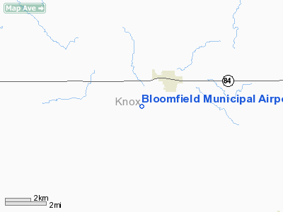
Location & QuickFacts
| FAA Information Effective: | 2008-09-25 |
| Airport Identifier: | 84Y |
| Airport Status: | Operational |
| Longitude/Latitude: | 097-40-25.2310W/42-34-47.0080N
-97.673675/42.579724 (Estimated) |
| Elevation: | 1673 ft / 509.93 m (Surveyed) |
| Land: | 94 acres |
| From nearest city: | 2 nautical miles SW of Bloomfield, NE |
| Location: | Knox County, NE |
| Magnetic Variation: | 07E (1985) |
Owner & Manager
| Ownership: | Publicly owned |
| Owner: | Bloomfield Airport Authority |
| Address: | P.o, Box 707
Bloomfield, NE 68718 |
| Phone number: | 402-373-4240
STEVEN L. ARCHBOLD, CHAIRMAN OF AIRPORT AUTHORITY RESIDENCE. PHONE 402-373-4237. |
| Manager: | Steve Barney |
| Address: | Box 281
Bloomfield, NE 68718 |
| Phone number: | 402-373-2452
RESIDENCE PHONE 402-373-4494. |
Airport Operations and Facilities
| Airport Use: | Open to public |
| Wind indicator: | Yes |
| Segmented Circle: | No |
| Control Tower: | No |
| Lighting Schedule: | DUSK-DAWN
ACTVT LIRL RY 14/32 - CTAF. |
| Beacon Color: | Clear-Green (lighted land airport) |
| Landing fee charge: | No |
| Sectional chart: | Omaha |
| Region: | ACE - Central |
| Boundary ARTCC: | ZMP - Minneapolis |
| Tie-in FSS: | OLU - Columbus |
| FSS on Airport: | No |
| FSS Toll Free: | 1-800-WX-BRIEF |
| NOTAMs Facility: | OLU (NOTAM-d service avaliable) |
| Federal Agreements: | 1 |
Airport Communications
Airport Services
| Airframe Repair: | NONE |
| Power Plant Repair: | NONE |
Runway Information
Runway 14/32
| Dimension: | 2700 x 50 ft / 823.0 x 15.2 m |
| Surface: | ASPH, Good Condition |
| Edge Lights: | Low
LGTD THR RY 14 RELCTD 200 FT; 2500 FT OF RY 14/32 USBL AT NGT. |
| |
Runway 14 |
Runway 32 |
| Traffic Pattern: | Left | Left |
| Markings: | Basic, Good Condition | Basic, Good Condition |
| Displaced threshold: | 200.00 ft | 0.00 ft |
| Obstruction: | 3 ft fence, 200.0 ft from runway, 70 ft right of centerline
+20 FT GRAVEL ROAD 675 FT FROM DSPLCD THR; APCH RATIO 33:1.
+3' FENCE 120' FROM RWY END 125'R. | 15 ft hill, 600.0 ft from runway, 205 ft right of centerline, 26:1 slope to clear |
|
Radio Navigation Aids
| ID |
Type |
Name |
Ch |
Freq |
Var |
Dist |
| VMR | NDB | Vermillion | | 375.00 | 06E | 34.5 nm |
| LCG | NDB | Wayne | | 389.00 | 06E | 36.7 nm |
| AGZ | NDB | Wagner | | 392.00 | 08E | 39.8 nm |
| OF | NDB | Carsy | | 510.00 | 08E | 42.5 nm |
| YKN | VOR/DME | Yankton | 051X | 111.40 | 07E | 24.0 nm |
| OFK | VOR/DME | Norfolk | 033X | 109.60 | 08E | 37.1 nm |
| ONL | VORTAC | O'neill | 086X | 113.90 | 10E | 45.4 nm |
Remarks
Images and information placed above are from
http://www.airport-data.com/airport/84Y/
We thank them for the data!
| General Info
|
| Country |
United States
|
| State |
NEBRASKA
|
| FAA ID |
84Y
|
| Latitude |
42-34-47.008N
|
| Longitude |
097-40-25.231W
|
| Elevation |
1673 feet
|
| Near City |
BLOOMFIELD
|
We don't guarantee the information is fresh and accurate. The data may
be wrong or outdated.
For more up-to-date information please refer to other sources.
|
|


