 |
|
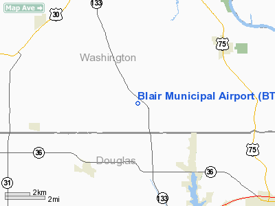
Location & QuickFacts
| FAA Information Effective: | 2008-09-25 |
| Airport Identifier: | BTA |
| Airport Status: | Operational |
| Longitude/Latitude: | 096-06-32.2650W/41-24-53.3150N
-96.108963/41.414810 (Estimated) |
| Elevation: | 1325 ft / 403.86 m (Surveyed) |
| Land: | 306 acres |
| From nearest city: | 7 nautical miles S of Blair, NE |
| Location: | Washington County, NE |
| Magnetic Variation: | 06E (1985) |
Owner & Manager
| Ownership: | Publicly owned |
| Owner: | Blair Airport Auth |
| Address: | 218 South 16th St
Blair, NE 68008-2000 |
| Phone number: | 402-426-4191 |
| Manager: | Rodney Storm
CITY ADMINISTRATOR |
| Address: | 218 South 16th St
Blair, NE 68008-2000 |
| Phone number: | 402-426-4191 |
Airport Operations and Facilities
| Airport Use: | Open to public |
| Wind indicator: | Yes |
| Segmented Circle: | No |
| Control Tower: | No |
| Lighting Schedule: | DUSK-DAWN |
| Beacon Color: | Clear-Green (lighted land airport) |
| Landing fee charge: | No |
| Sectional chart: | Omaha |
| Region: | ACE - Central |
| Boundary ARTCC: | ZMP - Minneapolis |
| Tie-in FSS: | OLU - Columbus |
| FSS on Airport: | No |
| FSS Toll Free: | 1-800-WX-BRIEF |
| NOTAMs Facility: | OLU (NOTAM-d service avaliable) |
| Federal Agreements: | N |
Airport Communications
Airport Services
| Fuel available: | 100LLA
24 HR SELF SVC FUEL AVBL VIA CREDIT CARD SYSTEM. |
| Airframe Repair: | NONE |
| Power Plant Repair: | NONE |
| Bottled Oxygen: | NONE |
| Bulk Oxygen: | NONE |
Runway Information
Runway 13/31
| Dimension: | 4200 x 100 ft / 1280.2 x 30.5 m |
| Surface: | CONC, Good Condition |
| Weight Limit: | Single wheel: 25000 lbs. |
| Edge Lights: | Medium |
| |
Runway 13 |
Runway 31 |
| Longitude: | 096-06-50.9900W | 096-06-13.5400W |
| Latitude: | 41-25-08.5400N | 41-24-38.0900N |
| Elevation: | 1318.00 ft | 1298.00 ft |
| Traffic Pattern: | Left | Left |
| Markings: | Non-precision instrument, Good Condition | Non-precision instrument, Good Condition |
| Runway End Identifier: | | Yes |
|
Radio Navigation Aids
| ID |
Type |
Name |
Ch |
Freq |
Var |
Dist |
| OM | NDB | Gerfi | | 320.00 | 05E | 7.5 nm |
| MLE | NDB | Millard | | 371.00 | 06E | 13.2 nm |
| FET | NDB | Fremont | | 311.00 | 06E | 18.6 nm |
| AHQ | NDB | Wahoo | | 400.00 | 07E | 24.5 nm |
| PMV | NDB | Plattsmouth | | 329.00 | 06E | 29.7 nm |
| HNR | NDB | Harlan | | 272.00 | 05E | 36.0 nm |
| RDK | NDB | Red Oak | | 230.00 | 04E | 45.5 nm |
| DNS | NDB | Denison | | 350.00 | 04E | 47.4 nm |
| AIO | NDB | Atlantic | | 365.00 | 04E | 47.9 nm |
| MEY | NDB | Mapleton | | 335.00 | 05E | 48.1 nm |
| LN | NDB | Potts | | 385.00 | 06E | 49.9 nm |
| AFK | NDB | Nebraska City | | 347.00 | 05E | 49.9 nm |
| OFF | TACAN | Offutt | 054X | | 05E | 20.2 nm |
| TQE | VOR | Tekamah | | 108.40 | 07E | 21.0 nm |
| SCB | VOR/DME | Scribner | 47X | 111.00 | 06E | 26.0 nm |
| OVR | VORTAC | Omaha | 110X | 116.30 | 08E | 22.4 nm |
| LNK | VORTAC | Lincoln | 108X | 116.10 | 09E | 41.1 nm |
| OMA | VOT | Omaha | | 109.00 | | 12.3 nm |
Remarks
- GLIDER ACTIVITY ON & INVOF ARPT.
- PARACHUTE JUMPING.
- ESTABLISHED PRIOR TO 1959.
Images and information placed above are from
http://www.airport-data.com/airport/BTA/
We thank them for the data!
| General Info
|
| Country |
United States
|
| State |
TEXAS
|
| FAA ID |
70TA
|
| Latitude |
31-59-48.444N
|
| Longitude |
102-04-50.494W
|
| Elevation |
2815 feet
|
| Near City |
MIDLAND
|
We don't guarantee the information is fresh and accurate. The data may
be wrong or outdated.
For more up-to-date information please refer to other sources.
|
|


