 |
|
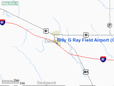
Billy G Ray Field Airport |
Location & QuickFacts
| FAA Information Effective: | 2008-09-25 |
| Airport Identifier: | CNP |
| Airport Status: | Operational |
| Longitude/Latitude: | 102-27-50.6000W/41-04-38.9000N
-102.464056/41.077472 (Estimated) |
| Elevation: | 3682 ft / 1122.27 m (Surveyed) |
| Land: | 116 acres |
| From nearest city: | 1 nautical miles S of Chappell, NE |
| Location: | Deuel County, NE |
| Magnetic Variation: | 10E (1990) |
Owner & Manager
| Ownership: | Publicly owned |
| Owner: | Chappell Airport Authority |
| Address: | Po Box 546
Chappell, NE 69129-0546 |
| Phone number: | 308-874-2708 |
| Manager: | Don Milburn |
| Address: | 202 4th St, Box 712
Chappell, NE 69129-0712 |
| Phone number: | 308-874-2647
OR 308-874-2554. |
Airport Operations and Facilities
| Airport Use: | Open to public |
| Wind indicator: | Yes |
| Segmented Circle: | No |
| Control Tower: | No |
| Lighting Schedule: | DUSK-DAWN
MIRL RY 02/20 PRESET ON LOW INTST; TO INCR INTST ACTVT - CTAF. |
| Beacon Color: | Clear-Green (lighted land airport) |
| Landing fee charge: | No |
| Sectional chart: | Cheyenne |
| Region: | ACE - Central |
| Boundary ARTCC: | ZDV - Denver |
| Tie-in FSS: | OLU - Columbus |
| FSS on Airport: | No |
| FSS Toll Free: | 1-800-WX-BRIEF |
| NOTAMs Facility: | OLU (NOTAM-d service avaliable) |
| Federal Agreements: | N |
Airport Communications
Airport Services
| Fuel available: | 100LL |
| Airframe Repair: | NONE |
| Power Plant Repair: | NONE |
| Bottled Oxygen: | NONE |
| Bulk Oxygen: | NONE |
Runway Information
Runway 12/30
| Dimension: | 4000 x 55 ft / 1219.2 x 16.8 m |
| Surface: | ASPH, Good Condition |
| Weight Limit: | Single wheel: 15000 lbs. |
| Edge Lights: | Medium |
| |
Runway 12 |
Runway 30 |
| Longitude: | 102-28-10.6400W | 102-27-30.5230W |
| Latitude: | 41-04-51.5110N | 41-04-26.2090N |
| Elevation: | 3681.00 ft | 3678.00 ft |
| Alignment: | 127 | 127 |
| Traffic Pattern: | Left | Left |
| Markings: | Non-precision instrument, Fair Condition | Non-precision instrument, Fair Condition |
| Displaced threshold: | 0.00 ft | 130.00 ft |
| Obstruction: | 31 ft road, 950.0 ft from runway, 200 ft right of centerline, 24:1 slope to clear | 11 ft road, 490.0 ft from runway, 145 ft right of centerline, 26:1 slope to clear
RUNWAY 30 APCH SLOPE 50:1 TO DSPLCD THLD. |
|
Radio Navigation Aids
| ID |
Type |
Name |
Ch |
Freq |
Var |
Dist |
| CNP | NDB | Chappell | | 383.00 | 10E | 0.2 nm |
| OKS | NDB | Oshkosh | | 233.00 | 09E | 20.1 nm |
| HEQ | NDB | Heginbotham | | 404.00 | 11E | 31.0 nm |
| GGF | NDB | Grant | | 359.00 | 09E | 35.5 nm |
| BAJ | NDB | Batten | | 392.00 | 11E | 47.8 nm |
| SAE | VOR/DME | Searle | 39X | 110.20 | 11E | 31.3 nm |
| SNY | VORTAC | Sidney | 106X | 115.90 | 13E | 23.5 nm |
Remarks
- PRVDD APCH TO EACH RWY IS MAINT FOR A 20:1 GLIDE SLOPE & TRSNL SFC MAINT FOR A 7:1 SLOPE.
Images and information placed above are from
http://www.airport-data.com/airport/CNP/
We thank them for the data!
| General Info
|
| Country |
United States
|
| State |
NEBRASKA
|
| FAA ID |
CNP
|
| Latitude |
41-04-38.900N
|
| Longitude |
102-27-50.600W
|
| Elevation |
3682 feet
|
| Near City |
CHAPPELL
|
We don't guarantee the information is fresh and accurate. The data may
be wrong or outdated.
For more up-to-date information please refer to other sources.
|
|


