 |
|
Location & QuickFacts
| FAA Information Effective: | 2008-09-25 |
| Airport Identifier: | NE20 |
| Airport Status: | Operational |
| Longitude/Latitude: | 096-12-41.0320W/40-11-10.0000N
-96.211398/40.186111 (Estimated) |
| Elevation: | 1290 ft / 393.19 m (Estimated) |
| Land: | 0 acres |
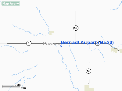
| From nearest city: | 2 nautical miles SE of Steinauer, NE |
| Location: | Pawnee County, NE |
| Magnetic Variation: | 06E (1985) |
Owner & Manager
| Ownership: | Privately owned |
| Owner: | Bruce Bernadt |
| Address: | 61909 Hwy #4
Steinauer, NE 68441 |
| Phone number: | 402-869-2397 |
| Manager: | Bruce Bernadt |
| Address: | 61909 Hwy #4
Steinauer, NE 68441 |
| Phone number: | 402-869-2397
OR 402-421-3653 |
Airport Operations and Facilities
| Airport Use: | Private |
| Wind indicator: | Yes |
| Segmented Circle: | No |
| Control Tower: | No |
| Landing fee charge: | No |
| Sectional chart: | Omaha |
| Region: | ACE - Central |
| Boundary ARTCC: | ZMP - Minneapolis |
| Tie-in FSS: | OLU - Columbus |
| FSS on Airport: | No |
| FSS Toll Free: | 1-800-WX-BRIEF |
Airport Services
| Fuel available: | 100 |
| Airframe Repair: | NONE |
| Power Plant Repair: | NONE |
Runway Information
Runway 17/35
| Dimension: | 2300 x 70 ft / 701.0 x 21.3 m |
| Surface: | TURF-GRVL, |
| |
Runway 17 |
Runway 35 |
| Traffic Pattern: | Left | Left |
| Obstruction: | 30 ft poles | 30 ft poles, 0.0 ft from runway |
|
Radio Navigation Aids
| ID |
Type |
Name |
Ch |
Freq |
Var |
Dist |
| AYB | NDB | Auburn | | 430.00 | 05E | 23.9 nm |
| HWB | NDB | Shaw | | 263.00 | 06E | 25.5 nm |
| MYZ | NDB | Marysville | | 341.00 | 06E | 27.9 nm |
| FNB | NDB | Brenner | | 404.00 | 05E | 29.4 nm |
| BJU | NDB | Big Blue | | 248.00 | 06E | 29.6 nm |
| AFK | NDB | Nebraska City | | 347.00 | 05E | 29.9 nm |
| LN | NDB | Potts | | 385.00 | 06E | 42.1 nm |
| FBY | NDB | Fairbury | | 293.00 | 06E | 43.8 nm |
| DBX | NDB | Morrison | | 212.00 | 06E | 46.0 nm |
| PMV | NDB | Plattsmouth | | 329.00 | 06E | 47.5 nm |
| BIE | VOR | Beatrice | | 110.60 | 07E | 25.9 nm |
| RBA | VOR/DME | Robinson | 019X | 108.20 | 04E | 41.5 nm |
| PWE | VORTAC | Pawnee City | 071X | 112.40 | 05E | 0.9 nm |
Remarks
- PRVDD APCH TO ARPT ARE MAINT FOR A MIN 20:1 GLIDE SLOPE & TRSNL SFC MAINT FOR A 7:1 SLOPE.
Images and information placed above are from
http://www.airport-data.com/airport/NE20/
We thank them for the data!
| General Info
|
| Country |
United States
|
| State |
NEBRASKA
|
| FAA ID |
NE20
|
| Latitude |
40-11-10.000N
|
| Longitude |
096-12-41.032W
|
| Elevation |
1290 feet
|
| Near City |
STEINAUER
|
We don't guarantee the information is fresh and accurate. The data may
be wrong or outdated.
For more up-to-date information please refer to other sources.
|
|


