 |
|
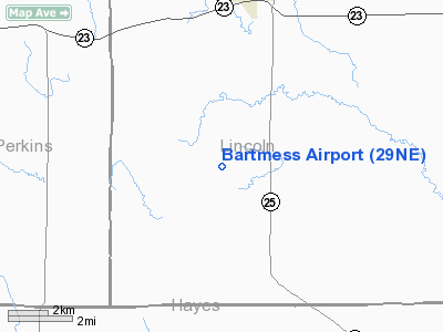
Location & QuickFacts
| FAA Information Effective: | 2008-09-25 |
| Airport Identifier: | 29NE |
| Airport Status: | Operational |
| Longitude/Latitude: | 101-10-50.5640W/40-45-40.0140N
-101.180712/40.761115 (Estimated) |
| Elevation: | 3150 ft / 960.12 m (Estimated) |
| Land: | 0 acres |
| From nearest city: | 5 nautical miles S of Wallace, NE |
| Location: | Lincoln County, NE |
| Magnetic Variation: | 09E (1985) |
Owner & Manager
| Ownership: | Privately owned |
| Owner: | Kenneth Bartmess |
| Address: | Rural Route
Wallace, NE 69169 |
| Phone number: | 308-387-4388 |
| Address: |
|
Airport Operations and Facilities
| Airport Use: | Private |
| Wind indicator: | No |
| Segmented Circle: | No |
| Control Tower: | No |
| Landing fee charge: | No |
| Sectional chart: | Cheyenne |
| Region: | ACE - Central |
| Boundary ARTCC: | ZDV - Denver |
| Tie-in FSS: | OLU - Columbus |
| FSS on Airport: | No |
| FSS Toll Free: | 1-800-WX-BRIEF |
Runway Information
Runway NW/SE
| Dimension: | 2400 x 60 ft / 731.5 x 18.3 m |
| Surface: | TURF, |
| |
Runway NW |
Runway SE |
| Traffic Pattern: | Left | Left |
| Obstruction: | 6 ft fence | |
|
Radio Navigation Aids
| ID |
Type |
Name |
Ch |
Freq |
Var |
Dist |
| MCK | FAN MARKER | Mc Cook | | | 11E | 45.5 nm |
| IML | NDB | Imperial | | 283.00 | 09E | 25.3 nm |
| GGF | NDB | Grant | | 359.00 | 09E | 25.9 nm |
| SAE | VOR/DME | Searle | 39X | 110.20 | 11E | 34.5 nm |
| MCK | VOR/DME | Mc Cook | 100X | 115.30 | 08E | 42.9 nm |
| HCT | VORTAC | Hayes Center | 124X | 117.70 | 11E | 21.9 nm |
| LBF | VORTAC | North Platte | 121X | 117.40 | 11E | 26.2 nm |
Remarks
- PRVDD OWNER/OPR BARTMESS ARPT INSURE ALL USERS OF ARPT FLY TFC PATS TO WEST OF ARPT; & PRVDD APCH TO EACH RWY IS MAINTD FOR MIN 20-1 GLIDE SLOPE & TRSNL SFC BE MAINTD FOR 7-1 SLOPE.
Images and information placed above are from
http://www.airport-data.com/airport/29NE/
We thank them for the data!
| General Info
|
| Country |
United States
|
| State |
NEBRASKA
|
| FAA ID |
29NE
|
| Latitude |
40-45-40.014N
|
| Longitude |
101-10-50.564W
|
| Elevation |
3150 feet
|
| Near City |
WALLACE
|
We don't guarantee the information is fresh and accurate. The data may
be wrong or outdated.
For more up-to-date information please refer to other sources.
|
|


