 |
|
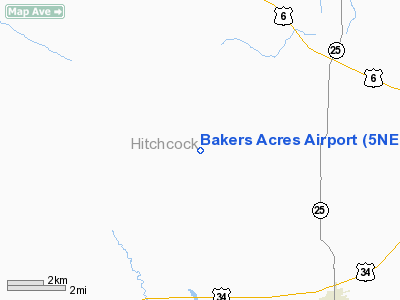
Location & QuickFacts
| FAA Information Effective: | 2008-09-25 |
| Airport Identifier: | 5NE6 |
| Airport Status: | Operational |
| Longitude/Latitude: | 101-06-01.5820W/40-14-59.9850N
-101.100439/40.249996 (Estimated) |
| Elevation: | 2950 ft / 899.16 m (Estimated) |
| Land: | 0 acres |
| From nearest city: | 5 nautical miles NW of Trenton, NE |
| Location: | Hitchcock County, NE |
| Magnetic Variation: | 09E (1985) |
Owner & Manager
| Ownership: | Privately owned |
| Owner: | Bernard R Baker |
| Address: | Bakers Acres
Trenton, NE 69044 |
| Phone number: | 308-334-5486 |
| Manager: | B R Baker |
| Address: | Bakers Acres
Trenton, NE 69044 |
| Phone number: | 308-334-5486 |
Airport Operations and Facilities
| Airport Use: | Private |
| Wind indicator: | Yes |
| Segmented Circle: | No |
| Control Tower: | No |
| Landing fee charge: | No |
| Sectional chart: | Cheyenne |
| Region: | ACE - Central |
| Boundary ARTCC: | ZDV - Denver |
| Tie-in FSS: | OLU - Columbus |
| FSS on Airport: | No |
| FSS Toll Free: | 1-800-WX-BRIEF |
Airport Services
| Fuel available: | MOGAS |
| Airframe Repair: | NONE |
| Power Plant Repair: | NONE |
Runway Information
Runway NW/SE
| Dimension: | 2000 x 80 ft / 609.6 x 24.4 m |
| Surface: | TURF, |
| |
Runway NW |
Runway SE |
| Traffic Pattern: | Left | Left |
| Obstruction: | , 500.0 ft from runway | 30 ft trees, 400.0 ft from runway |
|
Radio Navigation Aids
| ID |
Type |
Name |
Ch |
Freq |
Var |
Dist |
| MCK | FAN MARKER | Mc Cook | | | 11E | 25.8 nm |
| ADT | NDB | Atwood | | 365.00 | 09E | 24.9 nm |
| IML | NDB | Imperial | | 283.00 | 09E | 28.8 nm |
| OIN | NDB | Oberlin | | 341.00 | 09E | 36.2 nm |
| CSB | NDB | Harry Strunk | | 389.00 | 08E | 43.4 nm |
| SYF | NDB | St Francis | | 386.00 | 10E | 43.9 nm |
| JDM | NDB | Wheatfield | | 408.00 | 08E | 44.5 nm |
| GGF | NDB | Grant | | 359.00 | 09E | 47.1 nm |
| MCK | VOR/DME | Mc Cook | 100X | 115.30 | 08E | 23.4 nm |
| HCT | VORTAC | Hayes Center | 124X | 117.70 | 11E | 14.7 nm |
Images and information placed above are from
http://www.airport-data.com/airport/5NE6/
We thank them for the data!
| General Info
|
| Country |
United States
|
| State |
NEBRASKA
|
| FAA ID |
5NE6
|
| Latitude |
40-14-59.985N
|
| Longitude |
101-06-01.582W
|
| Elevation |
2950 feet
|
| Near City |
TRENTON
|
We don't guarantee the information is fresh and accurate. The data may
be wrong or outdated.
For more up-to-date information please refer to other sources.
|
|


