 |
|
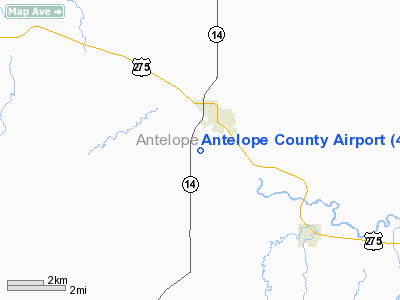
Location & QuickFacts
| FAA Information Effective: | 2008-09-25 |
| Airport Identifier: | 4V9 |
| Airport Status: | Operational |
| Longitude/Latitude: | 098-02-23.2000W/42-06-44.1000N
-98.039778/42.112250 (Estimated) |
| Elevation: | 1774 ft / 540.72 m (Estimated) |
| Land: | 296 acres |
| From nearest city: | 1 nautical miles SW of Neligh, NE |
| Location: | Antelope County, NE |
| Magnetic Variation: | 07E (1985) |
Owner & Manager
| Ownership: | Publicly owned |
| Owner: | Antelope Co Arpt Auth |
| Address: | 84773 Airport Rd
Neligh, NE 68756-5001 |
| Phone number: | 402-887-4326 |
| Manager: | Rick Schindler |
| Address: | 84775 Airport Rd
Neligh, NE 68756-5001 |
| Phone number: | 402-887-4827 |
Airport Operations and Facilities
| Airport Use: | Open to public |
| Wind indicator: | Yes |
| Segmented Circle: | No |
| Control Tower: | No |
| Lighting Schedule: | DUSK-DAWN
ACTVT MIRL RY 18/36; AFT 2000 ACTVT LIRL RY 12/30 - CTAF. |
| Beacon Color: | Clear-Green (lighted land airport) |
| Landing fee charge: | No |
| Sectional chart: | Omaha |
| Region: | ACE - Central |
| Boundary ARTCC: | ZMP - Minneapolis |
| Tie-in FSS: | OLU - Columbus |
| FSS on Airport: | No |
| FSS Toll Free: | 1-800-WX-BRIEF |
| NOTAMs Facility: | OLU (NOTAM-d service avaliable) |
| Federal Agreements: | NY1 |
Airport Communications
| CTAF: | 122.800 |
| Unicom: | 122.800 |
Airport Services
| Fuel available: | 100LL |
| Airframe Repair: | NONE |
| Power Plant Repair: | NONE |
| Bottled Oxygen: | NONE |
| Bulk Oxygen: | NONE |
Runway Information
Runway 12/30
| Dimension: | 3310 x 50 ft / 1008.9 x 15.2 m |
| Surface: | ASPH, Good Condition |
| Weight Limit: | Single wheel: 4000 lbs. |
| Edge Lights: | Low |
| |
Runway 12 |
Runway 30 |
| Longitude: | 098-02-40.7038W | 098-02-09.3713W |
| Latitude: | 42-07-04.0834N | 42-06-41.1691N |
| Elevation: | 1735.00 ft | 1730.00 ft |
| Traffic Pattern: | Left | Left |
| Markings: | Basic, Good Condition | Basic, Good Condition |
| Displaced threshold: | 405.00 ft | 405.00 ft |
| Obstruction: | 16 ft road, 234.0 ft from runway, 2:1 slope to clear
+16 FT ROAD 634 FT FROM DSPLCD THR; APCH RATIO 39:1. | 12 ft road, 201.0 ft from runway
+62' TREE 1939' FM DSPLCD THR; 285' RIGHT; APCH RATIO 31:1. |
| Decleard distances: | Take off run available 3310.00 ft
Take off distance available 3310.00 ft
Actual stop distance available 3310.00 ft
Landing distance available 2905.00 ft
| Take off run available 3310.00 ft
Take off distance available 3310.00 ft
Actual stop distance available 3310.00 ft
Landing distance available 2905.00 ft
|
|
Runway 18/36
| Dimension: | 3700 x 60 ft / 1127.8 x 18.3 m |
| Surface: | CONC, Good Condition |
| Edge Lights: | Medium |
| |
Runway 18 |
Runway 36 |
| Longitude: | 098-02-16.1203W | 098-02-26.7927W |
| Latitude: | 42-06-54.2379N | 42-06-18.5640N |
| Elevation: | 1731.00 ft | 1774.00 ft |
| Traffic Pattern: | Left | Left |
| Markings: | Non-precision instrument, Good Condition | Non-precision instrument, Good Condition |
| Obstruction: | 90 ft trees, 1840.0 ft from runway, 20:1 slope to clear | , 50:1 slope to clear |
|
Radio Navigation Aids
| ID |
Type |
Name |
Ch |
Freq |
Var |
Dist |
| BVN | NDB | Alaby | | 332.00 | 06E | 23.0 nm |
| OF | NDB | Carsy | | 510.00 | 08E | 28.4 nm |
| PLT | NDB | Platte Center | | 407.00 | 08E | 47.3 nm |
| LCG | NDB | Wayne | | 389.00 | 06E | 47.7 nm |
| OFK | VOR/DME | Norfolk | 033X | 109.60 | 08E | 28.0 nm |
| ONL | VORTAC | O'neill | 086X | 113.90 | 10E | 35.9 nm |
| OBH | VORTAC | Wolbach | 095X | 114.80 | 07E | 46.5 nm |
Remarks
Images and information placed above are from
http://www.airport-data.com/airport/4V9/
We thank them for the data!
| General Info
|
| Country |
United States
|
| State |
NEBRASKA
|
| FAA ID |
4V9
|
| Latitude |
42-06-44.024N
|
| Longitude |
098-02-19.239W
|
| Elevation |
1738 feet
|
| Near City |
NELIGH
|
We don't guarantee the information is fresh and accurate. The data may
be wrong or outdated.
For more up-to-date information please refer to other sources.
|
|


