 |
|
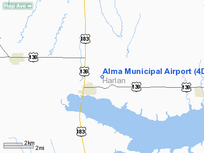
Location & QuickFacts
| FAA Information Effective: | 2008-09-25 |
| Airport Identifier: | 4D9 |
| Airport Status: | Operational |
| Longitude/Latitude: | 099-20-44.3510W/40-06-50.0390N
-99.345653/40.113900 (Estimated) |
| Elevation: | 2070 ft / 630.94 m (Estimated) |
| Land: | 100 acres |
| From nearest city: | 1 nautical miles NE of Alma, NE |
| Location: | Harlan County, NE |
| Magnetic Variation: | 08E (1990) |
Owner & Manager
| Ownership: | Publicly owned |
| Owner: | City Of Alma |
| Address: | Po Box 468
Alma, NE 68920-0468 |
| Phone number: | 308-928-2242 |
| Manager: | City Administrator |
| Address: | C/o City Of Alma, Po Box 468
Alma, NE 68920-0468 |
| Phone number: | 308-928-2242 |
Airport Operations and Facilities
| Airport Use: | Open to public |
| Wind indicator: | Yes |
| Segmented Circle: | No |
| Control Tower: | No |
| Sectional chart: | Omaha |
| Region: | ACE - Central |
| Boundary ARTCC: | ZDV - Denver |
| Tie-in FSS: | OLU - Columbus |
| FSS on Airport: | No |
| FSS Toll Free: | 1-800-WX-BRIEF |
| NOTAMs Facility: | OLU (NOTAM-d service avaliable) |
| Federal Agreements: | N |
Airport Communications
Airport Services
| Fuel available: | 100LL
24 HR SELF SERVICE FUEL AVAILBLE VIA CREDIT CARD SYSTEM. |
Runway Information
Runway 17/35
| Dimension: | 3280 x 120 ft / 999.7 x 36.6 m |
| Surface: | TURF, Good Condition |
| |
Runway 17 |
Runway 35 |
| Traffic Pattern: | Left | Left |
| Obstruction: | 15 ft road, 300.0 ft from runway, 20:1 slope to clear | 12 ft trees, 408.0 ft from runway, 34:1 slope to clear |
|
Radio Navigation Aids
| ID |
Type |
Name |
Ch |
Freq |
Var |
Dist |
| HDE | NDB | Holdrege | | 396.00 | 07E | 20.1 nm |
| PHG | NDB | Phillipsburg | | 368.00 | 08E | 24.7 nm |
| NRN | NDB | Norton | | 230.00 | 08E | 29.5 nm |
| CSB | NDB | Harry Strunk | | 389.00 | 08E | 39.0 nm |
| RRX | NDB | Darr | | 326.00 | 07E | 49.7 nm |
| EAR | VOR | Kearney | | 111.20 | 10E | 39.9 nm |
Remarks
- PROVIDED CLEAR APCH TO EACH RY END FOR MIN 20:1 GLIDE SLOPE; CLEAR TRANSITIONAL SFC FOR 7:1 SLOPE; OLD ALMA MUNI TO CLOSE CONCURRENTLY WITH COMMISSIONING.
Images and information placed above are from
http://www.airport-data.com/airport/4D9/
We thank them for the data!
| General Info
|
| Country |
United States
|
| State |
NEBRASKA
|
| FAA ID |
4D9
|
| Latitude |
40-06-50.039N
|
| Longitude |
099-20-44.351W
|
| Elevation |
2070 feet
|
| Near City |
ALMA
|
We don't guarantee the information is fresh and accurate. The data may
be wrong or outdated.
For more up-to-date information please refer to other sources.
|
|


