 |
|
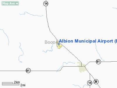
Location & QuickFacts
| FAA Information Effective: | 2008-09-25 |
| Airport Identifier: | BVN |
| Airport Status: | Operational |
| Longitude/Latitude: | 098-03-20.7350W/41-43-42.8770N
-98.055760/41.728577 (Estimated) |
| Elevation: | 1806 ft / 550.47 m (Surveyed) |
| Land: | 113 acres |
| From nearest city: | 3 nautical miles NW of Albion, NE |
| Location: | Boone County, NE |
| Magnetic Variation: | 06E (2000) |
Owner & Manager
| Ownership: | Publicly owned |
| Owner: | Albion Arpt Auth |
| Address: | P.o. Box 3
Albion, NE 68620-0003 |
| Phone number: | 402-395-2001 |
| Manager: | Bob Sandman |
| Address: | P.o. Box 3
Albion, NE 68620-0003 |
| Phone number: | 402-395-6049 |
Airport Operations and Facilities
| Airport Use: | Open to public |
| Wind indicator: | Yes |
| Segmented Circle: | Yes |
| Control Tower: | No |
| Lighting Schedule: | DUSK-DAWN
ACTVT MIRL RY 15/33 - CTAF. |
| Beacon Color: | Clear-Green (lighted land airport) |
| Landing fee charge: | No |
| Sectional chart: | Omaha |
| Region: | ACE - Central |
| Boundary ARTCC: | ZMP - Minneapolis |
| Tie-in FSS: | OLU - Columbus |
| FSS on Airport: | No |
| FSS Toll Free: | 1-800-WX-BRIEF |
| NOTAMs Facility: | BVN (NOTAM-d service avaliable) |
| Federal Agreements: | NGY |
Airport Communications
Airport Services
| Fuel available: | 100LL
FOR FUEL CALL 402-395-2001/5145. |
| Airframe Repair: | NONE |
| Power Plant Repair: | NONE |
| Bottled Oxygen: | NONE |
| Bulk Oxygen: | NONE |
Runway Information
Runway 15/33
| Dimension: | 3700 x 60 ft / 1127.8 x 18.3 m |
| Surface: | CONC, |
| Edge Lights: | Medium |
| |
Runway 15 |
Runway 33 |
| Longitude: | 098-03-31.5323W | 098-03-09.9392W |
| Latitude: | 41-43-59.2654N | 41-43-26.4904N |
| Elevation: | 1806.00 ft | 1778.00 ft |
| Alignment: | 127 | 127 |
| Traffic Pattern: | Left | Left |
| Markings: | Non-precision instrument, Good Condition | Non-precision instrument, Good Condition |
| Obstruction: | 28 ft road, 950.0 ft from runway, 320 ft left of centerline, 27:1 slope to clear | 53 ft tree, 633.0 ft from runway, 205 ft left of centerline, 8:1 slope to clear |
|
Radio Navigation Aids
| ID |
Type |
Name |
Ch |
Freq |
Var |
Dist |
| BVN | NDB | Alaby | | 332.00 | 06E | 0.2 nm |
| OF | NDB | Carsy | | 510.00 | 08E | 27.5 nm |
| PLT | NDB | Platte Center | | 407.00 | 08E | 33.3 nm |
| ODX | NDB | Ord | | 356.00 | 07E | 40.6 nm |
| BUB | NDB | Burwell | | 377.00 | 07E | 48.9 nm |
| OFK | VOR/DME | Norfolk | 033X | 109.60 | 08E | 31.9 nm |
| OLU | VOR/DME | Columbus | 055X | 111.80 | 08E | 36.2 nm |
| OBH | VORTAC | Wolbach | 095X | 114.80 | 07E | 25.1 nm |
| GRI | VORTAC | Grand Island | 057X | 112.00 | 07E | 46.3 nm |
Images and information placed above are from
http://www.airport-data.com/airport/BVN/
We thank them for the data!
| General Info
|
| Country |
United States
|
| State |
NEBRASKA
|
| FAA ID |
BVN
|
| Latitude |
41-43-42.880N
|
| Longitude |
098-03-20.735W
|
| Elevation |
1806 feet
|
| Near City |
ALBION
|
We don't guarantee the information is fresh and accurate. The data may
be wrong or outdated.
For more up-to-date information please refer to other sources.
|
|


