 |
|
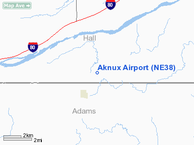
Location & QuickFacts
| FAA Information Effective: | 2008-09-25 |
| Airport Identifier: | NE38 |
| Airport Status: | Operational |
| Longitude/Latitude: | 098-33-36.2440W/40-42-34.0490N
-98.560068/40.709458 (Estimated) |
| Elevation: | 2025 ft / 617.22 m (Estimated) |
| Land: | 20 acres |
| From nearest city: | 2 nautical miles NE of Prosser, NE |
| Location: | Hall County, NE |
| Magnetic Variation: | 08E (1985) |
Owner & Manager
| Ownership: | Privately owned |
| Owner: | Muckel's Aerial Inc |
| Address: | 11544 W. Rosedale Rd.
Prosser, NE 68883 |
| Phone number: | 308-381-0135 |
| Manager: | Roger F. Muckel |
| Address: | 11544 W. Rosedale Rd.
Prosser, NE 68883 |
| Phone number: | 402-744-2050 |
Airport Operations and Facilities
| Airport Use: | Private |
| Wind indicator: | Yes |
| Segmented Circle: | No |
| Control Tower: | No |
| Sectional chart: | Omaha |
| Region: | ACE - Central |
| Boundary ARTCC: | ZMP - Minneapolis |
| Tie-in FSS: | OLU - Columbus |
| FSS on Airport: | No |
| FSS Toll Free: | 1-800-WX-BRIEF |
Runway Information
Runway 18/36
| Dimension: | 2545 x 30 ft / 775.7 x 9.1 m |
| Surface: | ASPH, |
| |
Runway 18 |
Runway 36 |
| Traffic Pattern: | Left | Left |
| Obstruction: | 20 ft pline, 400.0 ft from runway | 20 ft pline, 50.0 ft from runway |
|
Radio Navigation Aids
| ID |
Type |
Name |
Ch |
Freq |
Var |
Dist |
| PSS | NDB | Prosser | | 338.00 | 07E | 4.0 nm |
| HDE | NDB | Holdrege | | 396.00 | 07E | 38.9 nm |
| JYR | NDB | York | | 257.00 | 06E | 44.4 nm |
| FMZ | NDB | Beklof | | 392.00 | 07E | 45.8 nm |
| EAR | VOR | Kearney | | 111.20 | 10E | 20.3 nm |
| HSI | VOR/DME | Hastings | 025X | 108.80 | 07E | 8.7 nm |
| GRI | VORTAC | Grand Island | 057X | 112.00 | 07E | 19.9 nm |
| OBH | VORTAC | Wolbach | 095X | 114.80 | 07E | 41.1 nm |
Remarks
- PRVDD MAINTAIN CLEAR 20:1 APCH/DEP SFC AND 7:1 TRANS SFC; TFC PAT TO THE WEST & TPA AT/BLO 3200 FT MSL AND REMAIN UNDER/OUTSIDE APCH FOR HASTINGS ARPT.
Images and information placed above are from
http://www.airport-data.com/airport/NE38/
We thank them for the data!
| General Info
|
| Country |
United States
|
| State |
NEBRASKA
|
| FAA ID |
NE38
|
| Latitude |
40-42-34.049N
|
| Longitude |
098-33-36.244W
|
| Elevation |
2025 feet
|
| Near City |
PROSSER
|
We don't guarantee the information is fresh and accurate. The data may
be wrong or outdated.
For more up-to-date information please refer to other sources.
|
|


