 |
|
Location & QuickFacts
| FAA Information Effective: | 2008-09-25 |
| Airport Identifier: | MT51 |
| Airport Status: | Operational |
| Longitude/Latitude: | 105-57-42.0490W/48-16-37.0770N
-105.961680/48.276966 (Estimated) |
| Elevation: | 2720 ft / 829.06 m (Estimated) |
| Land: | 0 acres |
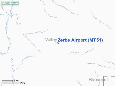
| From nearest city: | 16 nautical miles NE of Frazer, MT |
| Location: | Valley County, MT |
| Magnetic Variation: | 14E (1985) |
Owner & Manager
| Ownership: | Privately owned |
| Owner: | Grant N. Zerbe |
| Address: | Rt 266, Box 71
Frazer, MT 59225 |
| Phone number: | 409-392-5745 |
| Manager: | Grant N. Zerbe |
| Address: | Rt 266, Box 71
Frazer, MT 59225 |
| Phone number: | 406-392-5745 |
Airport Operations and Facilities
| Airport Use: | Private |
| Wind indicator: | Yes |
| Segmented Circle: | No |
| Control Tower: | No |
| Lighting Schedule: | PHONE REQ
FOR LIRL RY 16/34 CALL 406-392-5745. |
| Landing fee charge: | No |
| Sectional chart: | Billings |
| Region: | ANM - Northwest Mountain |
| Boundary ARTCC: | ZLC - Salt Lake City |
| Tie-in FSS: | GTF - Great Falls |
| FSS on Airport: | No |
| FSS Toll Free: | 1-800-WX-BRIEF |
Airport Services
Runway Information
Runway 07/25
| Dimension: | 2000 x 50 ft / 609.6 x 15.2 m |
| Surface: | TURF, |
| |
Runway 07 |
Runway 25 |
| Traffic Pattern: | Left | Left |
| Obstruction: | 20 ft pline, 500.0 ft from runway | |
|
Runway 16/34
| Dimension: | 2640 x 75 ft / 804.7 x 22.9 m |
| Surface: | TURF, |
| Edge Lights: | Low |
| |
Runway 16 |
Runway 34 |
| Traffic Pattern: | Left | Left |
|
Radio Navigation Aids
| ID |
Type |
Name |
Ch |
Freq |
Var |
Dist |
| OLF | NDB | Wolf Point | | 404.00 | 11E | 17.8 nm |
| MKR | NDB | Milk River | | 339.00 | 14E | 26.9 nm |
| SCO | NDB | Scobey | | 283.00 | 16E | 38.2 nm |
| GGW | VOR/DME | Glasgow | 086X | 113.90 | 14E | 26.8 nm |
Remarks
- FILED FOR RECORD PURPOSES.
Images and information placed above are from
http://www.airport-data.com/airport/MT51/
We thank them for the data!
| General Info
|
| Country |
United States
|
| State |
MONTANA
|
| FAA ID |
MT51
|
| Latitude |
48-16-37.077N
|
| Longitude |
105-57-42.049W
|
| Elevation |
2720 feet
|
| Near City |
FRAZER
|
We don't guarantee the information is fresh and accurate. The data may
be wrong or outdated.
For more up-to-date information please refer to other sources.
|
|


