 |
|
| Yellowstone Airport |
| IATA: WYS – ICAO: KWYS – FAA LID: WYS |
| Summary |
| Airport type |
Public |
| Owner |
State of Montana |
| Serves |
West Yellowstone, Montana |
| Elevation AMSL |
6,649 ft / 2,027 m |
| Coordinates |
44°41′18″N 111°07′04″W / 44.68833°N 111.11778°W / 44.68833; -111.11778 |
| Runways |
| Direction |
Length |
Surface |
| ft |
m |
| 1/19 |
8,400 |
2,560 |
Asphalt |
| Statistics (2008) |
| Aircraft operations |
7,360 |
| Source: Federal Aviation Administration |
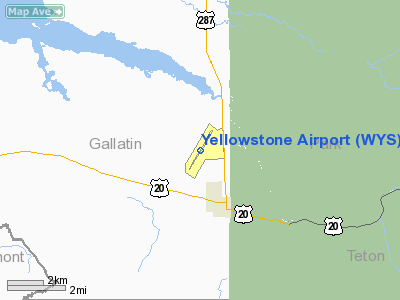
Yellowstone Airport (IATA: WYS, ICAO: KWYS, FAA LID: WYS) is a state-owned public-use airport located one nautical mile (1.85 km) north of the central business district of West Yellowstone, a town in Gallatin County, Montana, United States. This airport is included in the FAA's National Plan of Integrated Airport Systems for 2009–2013, which categorized it as commercial service - non-primary. Although only open from June through September, commercial service is available during those months. Service is subsidized by the Essential Air Service program.
The town of West Yellowstone is located at the west entrance to Yellowstone National Park. The airport should not be confused with Yellowstone Regional Airport in Cody, Wyoming, which is which is 104 miles (167 km) from this airport and about 53 miles (85 km) from the east entrance of Yellowstone National Park. Facilities and aircraft
Yellowstone Airport covers an area of 735 acres (297 ha) at an elevation of 6,649 feet (2,027 m) above mean sea level. It has one runway designated 1/19 with an asphalt surface measuring 8,400 by 150 feet (2,560 x 46 m). For the 12-month period ending December 31, 2008, the airport had 7,360 aircraft operations, an average of 20 per day: 95% general aviation, 4% air taxi, and 1% military.
Airline and destinations
| Airlines |
Destinations |
| Delta Connection operated by SkyWest Airlines |
Salt Lake City [seasonal] |
The above content comes from Wikipedia and is published under free licenses – click here to read more.
Location & QuickFacts
| FAA Information Effective: | 2008-09-25 |
| Airport Identifier: | WYS |
| Airport Status: | Operational |
| Longitude/Latitude: | 111-07-03.5000W/44-41-18.2000N
-111.117639/44.688389 (Estimated) |
| Elevation: | 6649 ft / 2026.62 m (Surveyed) |
| Land: | 735 acres |
| From nearest city: | 1 nautical miles N of West Yellowstone, MT |
| Location: | Gallatin County, MT |
| Magnetic Variation: | 14E (2005) |
Owner & Manager
| Ownership: | Publicly owned |
| Owner: | State Of Montana |
| Address: | Po Box 5178
Helena, MT 59604 |
| Phone number: | 406-444-2506 |
| Manager: | Anthony Bean |
| Address: | Po Box 306
West Yellowstone, MT 59758 |
| Phone number: | 406-646-7631
IF NO ANSWER CALL 406-444-2506/640-1648 |
Airport Operations and Facilities
| Airport Use: | Open to public |
| Wind indicator: | Yes |
| Segmented Circle: | Yes |
| Control Tower: | No |
| Lighting Schedule: | DUSK-DAWN
ACTVT HIRL RY 01/19 & MALSR RY 01 - CTAF; NOT AVBL 01 OCT-31 MAY . |
| Beacon Color: | Clear-Green (lighted land airport) |
| Landing fee charge: | No
LNDG FEE FOR ACFT OVER 11000 LBS. |
| Sectional chart: | Great Falls |
| Region: | ANM - Northwest Mountain |
| Boundary ARTCC: | ZLC - Salt Lake City |
| Tie-in FSS: | GTF - Great Falls |
| FSS on Airport: | No |
| FSS Toll Free: | 1-800-WX-BRIEF |
| NOTAMs Facility: | WYS (NOTAM-d service avaliable) |
| Certification type/date: | II A S 05/197
PPR FOR ACR OPNS WITH MORE THAN 30 PSGR SEATS CALL AMGR 406-646-7631 OR 406-646-9321. |
| Federal Agreements: | NGSY |
Airport Communications
| CTAF: | 123.000 |
| Unicom: | 123.000 |
Airport Services
| Fuel available: | 100LLA1+
FOR FUEL DURG OFF SEASON HRS, CALL 406-646-7359. |
| Airframe Repair: | NONE |
| Power Plant Repair: | NONE |
| Bottled Oxygen: | NONE |
| Bulk Oxygen: | NONE |
Runway Information
Runway 01/19
| Dimension: | 8400 x 150 ft / 2560.3 x 45.7 m |
| Surface: | ASPH, Good Condition |
| Surface Treatment: | Saw-cut or plastic Grooved |
| Weight Limit: | Single wheel: 90000 lbs.
Dual wheel: 150000 lbs.
Dual tandem wheel: 280000 lbs. |
| Edge Lights: | High |
| |
Runway 01 |
Runway 19 |
| Longitude: | 111-07-29.2700W | 111-06-37.8286W |
| Latitude: | 44-40-41.0107N | 44-41-55.3668N |
| Elevation: | 6649.00 ft | 6634.00 ft |
| Alignment: | 26 | 127 |
| ILS Type: | ILS
| |
| Traffic Pattern: | Left | Left |
| Markings: | Precision instrument, Good Condition | Basic, Good Condition |
| Crossing Height: | 49.00 ft | 53.00 ft |
| VASI: | 4-light PAPI on left side | 4-box on left side |
| Visual Glide Angle: | 3.00° | 3.00° |
| Approach lights: | MALSR | |
| Runway End Identifier: | | Yes |
|
Radio Navigation Aids
| ID |
Type |
Name |
Ch |
Freq |
Var |
Dist |
| ESY | NDB | Yellowstone | | 338.00 | 17E | 0.2 nm |
| LO | NDB | Targy | | 415.00 | 16E | 7.6 nm |
| EKS | NDB | Ennis | | 286.00 | 15E | 41.5 nm |
Remarks
- NO SNOW REMOVAL.
- ARPT AVBL AND STAFFED 1 JUNE - 30 SEPT; CTC FBO 406-646-7359 OR OWNER 406-444-2506 FOR INFO OTHER TIMES.
- HEAVY SNOWMOBILE USE ON/ADJACENT RY WINTER MOS.
- ARPT CLOSED FROM DEC 1 THROUGH MAY 31 EXCEPT WITH PPR. CALL 406-444-2506.
Images and information placed above are from
http://www.airport-data.com/airport/WYS/
We thank them for the data!
| General Info
|
| Country |
United States
|
| State |
MONTANA
|
| FAA ID |
WYS
|
| Latitude |
44-41-18.237N
|
| Longitude |
111-07-03.495W
|
| Elevation |
6644 feet
|
| Near City |
WEST YELLOWSTONE
|
We don't guarantee the information is fresh and accurate. The data may
be wrong or outdated.
For more up-to-date information please refer to other sources.
|
|


