 |
|
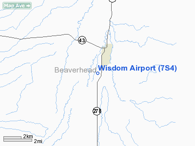
Location & QuickFacts
| FAA Information Effective: | 2008-09-25 |
| Airport Identifier: | 7S4 |
| Airport Status: | Operational |
| Longitude/Latitude: | 113-27-33.2120W/45-35-29.7230N
-113.459226/45.591590 (Estimated) |
| Elevation: | 6133 ft / 1869.34 m (Surveyed) |
| Land: | 36 acres |
| From nearest city: | 2 nautical miles S of Wisdom, MT |
| Location: | Beaverhead County, MT |
| Magnetic Variation: | 17E (1985) |
Owner & Manager
| Ownership: | Publicly owned |
| Owner: | Beaverhead County |
| Address: | County Courthouse
Dillon, MT 59725 |
| Phone number: | 406-683-5242 |
| Manager: | Dennis Devivo |
| Address: | 2400 Airport Rd
Dillon, MT 59725 |
| Phone number: | 406-683-3767 |
Airport Operations and Facilities
| Airport Use: | Open to public |
| Wind indicator: | Yes |
| Segmented Circle: | No |
| Control Tower: | No |
| Landing fee charge: | No |
| Sectional chart: | Great Falls |
| Region: | ANM - Northwest Mountain |
| Boundary ARTCC: | ZLC - Salt Lake City |
| Tie-in FSS: | GTF - Great Falls |
| FSS on Airport: | No |
| FSS Toll Free: | 1-800-WX-BRIEF |
| NOTAMs Facility: | GTF (NOTAM-d service avaliable) |
Airport Communications
Airport Services
| Airframe Repair: | NONE |
| Power Plant Repair: | NONE |
| Bottled Oxygen: | NONE |
| Bulk Oxygen: | NONE |
Runway Information
Runway 01/19
| Dimension: | 3445 x 60 ft / 1050.0 x 18.3 m |
| Surface: | TURF, Poor Condition
MULTIPLE GOPHER AND BADGER HOLES - ESPECIALLY IN SOUTHERN END OF RWY |
| |
Runway 01 |
Runway 19 |
| Traffic Pattern: | Left | Left |
| Displaced threshold: | 0.00 ft | 520.00 ft
DSPLCD THR MARKED WITH 4 RED CONES. |
| Obstruction: | 10 ft road, 40.0 ft from runway, 4:1 slope to clear | 17 ft road, 86.0 ft from runway, 5:1 slope to clear
APCH SLOPE 35:1 TO DSPLCD THR. |
|
Radio Navigation Aids
| ID |
Type |
Name |
Ch |
Freq |
Var |
Dist |
| HMM | NDB | Hamilton | | 410.00 | 19E | 48.9 nm |
| CPN | VOR/DME | Coppertown | 053X | 111.60 | 16E | 39.9 nm |
| LKT | VOR/DME | Salmon | 082X | 113.50 | 18E | 43.3 nm |
| DLN | VOR/DME | Dillon | 077X | 113.00 | 18E | 43.7 nm |
Remarks
- ARPT CLSD WINTER MONTHS.
- RY 19 +17' ROAD CROSSES RY CL EXTENDED AND IS 66' LEFT AT RY 19 END.
- RY 01/19 W EDGE FULL RY LENGTH - HAS 8 TO 14 INCH BERM.
- RY HAS 4 FT HIGH FENCE IN TRANS SFC 20 FT FM WEST SIDE EDGE OF RY.
- EST PRIOR TO 1959.
Images and information placed above are from
http://www.airport-data.com/airport/7S4/
We thank them for the data!
| General Info
|
| Country |
United States
|
| State |
MONTANA
|
| FAA ID |
7S4
|
| Latitude |
45-35-29.723N
|
| Longitude |
113-27-33.212W
|
| Elevation |
6133 feet
|
| Near City |
WISDOM
|
We don't guarantee the information is fresh and accurate. The data may
be wrong or outdated.
For more up-to-date information please refer to other sources.
|
|


