 |
|
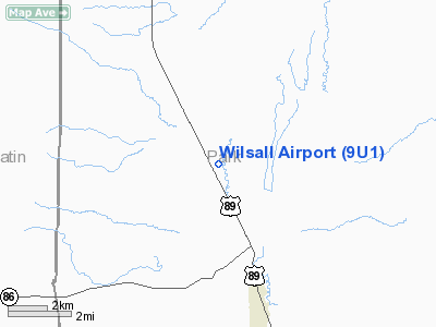
Location & QuickFacts
| FAA Information Effective: | 2008-09-25 |
| Airport Identifier: | 9U1 |
| Airport Status: | Operational |
| Longitude/Latitude: | 110-41-07.7500W/46-02-58.7630N
-110.685486/46.049656 (Estimated) |
| Elevation: | 5134 ft / 1564.84 m (Surveyed) |
| Land: | 15 acres |
| From nearest city: | 4 nautical miles NW of Wilsall, MT |
| Location: | Park County, MT |
| Magnetic Variation: | 16E (1985) |
Owner & Manager
| Ownership: | Publicly owned |
| Owner: | City Of Wilsall & Park County |
| Address: | County Bldg
Livingston, MT 59047 |
| Phone number: | 406-222-6120 |
| Manager: | Russel Ferguson
FOR CURRENT ARPT INFO CONTACT JERRY MILLER 406-222-0520 OR 406-686-4672. |
| Address: | 82 Airport Rd
Livingston, MT 59047 |
| Phone number: | 406-222-6504 |
Airport Operations and Facilities
| Airport Use: | Open to public |
| Wind indicator: | Yes |
| Segmented Circle: | Yes |
| Control Tower: | No |
| Landing fee charge: | No |
| Sectional chart: | Great Falls |
| Region: | ANM - Northwest Mountain |
| Boundary ARTCC: | ZLC - Salt Lake City |
| Tie-in FSS: | GTF - Great Falls |
| FSS on Airport: | No |
| FSS Toll Free: | 1-800-WX-BRIEF |
| NOTAMs Facility: | GTF (NOTAM-d service avaliable) |
Airport Communications
Airport Services
| Airframe Repair: | NONE |
| Power Plant Repair: | NONE |
| Bottled Oxygen: | NONE |
| Bulk Oxygen: | NONE |
Runway Information
Runway 01/19
| Dimension: | 3100 x 78 ft / 944.9 x 23.8 m |
| Surface: | TURF, Good Condition
SOFT WHEN WET; GOPHER HOLES ON RY. |
| |
Runway 01 |
Runway 19 |
| Traffic Pattern: | Left | Left |
| Obstruction: | 4 ft fence, 100.0 ft from runway, 25:1 slope to clear | 4 ft fence, 100.0 ft from runway, 25:1 slope to clear |
|
Radio Navigation Aids
| ID |
Type |
Name |
Ch |
Freq |
Var |
Dist |
| HWQ | NDB | Harlowton | | 242.00 | 17E | 42.4 nm |
| BZN | VOR/DME | Bozeman | 071X | 112.40 | 18E | 25.3 nm |
| LVM | VORTAC | Livingston | 108X | 116.10 | 15E | 23.2 nm |
Remarks
- FENCE PARALLEL TO RY BOTH SIDES 100 FT E & 105 FT W.
- WILDLIFE ON & INVOF ARPT.
- MODEL AIRPLANE USAGE INVOF AIRPORT.
Images and information placed above are from
http://www.airport-data.com/airport/9U1/
We thank them for the data!
| General Info
|
| Country |
United States
|
| State |
MONTANA
|
| FAA ID |
9U1
|
| Latitude |
46-02-58.763N
|
| Longitude |
110-41-07.750W
|
| Elevation |
5134 feet
|
| Near City |
WILSALL
|
We don't guarantee the information is fresh and accurate. The data may
be wrong or outdated.
For more up-to-date information please refer to other sources.
|
|


