 |
|
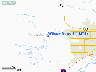
Location & QuickFacts
| FAA Information Effective: | 2008-09-25 |
| Airport Identifier: | 1MT9 |
| Airport Status: | Operational |
| Longitude/Latitude: | 108-41-04.0000W/45-47-21.0000N
-108.684444/45.789167 (Estimated) |
| Elevation: | 3390 ft / 1033.27 m (Estimated) |
| Land: | 15 acres |
| From nearest city: | 6 nautical miles W of Billings, MT |
| Location: | Yellowstone County, MT |
| Magnetic Variation: | () |
Owner & Manager
| Ownership: | Privately owned |
| Owner: | Stacy Wilcox |
| Address: | 1812 66th St. West
Billings, MT 59106 |
| Phone number: | 406-651-4362 |
| Manager: | Stacy Wilcox |
| Address: | 1812 66th St. West
Billings, MT 59106 |
| Phone number: | 406-651-4362 |
Airport Operations and Facilities
| Airport Use: | Private |
| Wind indicator: | Yes |
| Control Tower: | No |
| Sectional chart: | Billings |
| Region: | ANM - Northwest Mountain |
| Boundary ARTCC: | ZLC - Salt Lake City |
| Tie-in FSS: | GTF - Great Falls |
| FSS Toll Free: | 1-800-WX-BRIEF |
Runway Information
Runway 09/27
| Dimension: | 1900 x 40 ft / 579.1 x 12.2 m |
| Surface: | TURF, |
| |
Runway 09 |
Runway 27 |
| Traffic Pattern: | Left | Left |
|
Runway 18/36
| Dimension: | 800 x 40 ft / 243.8 x 12.2 m |
| Surface: | TURF, |
| |
Runway 18 |
Runway 36 |
| Traffic Pattern: | Left | Left |
|
Radio Navigation Aids
| ID |
Type |
Name |
Ch |
Freq |
Var |
Dist |
| RED | NDB | Red Lodge | | 203.00 | 17E | 41.1 nm |
| RPX | NDB | Roundup | | 362.00 | 17E | 41.8 nm |
| BIL | VORTAC | Billings | 092X | 114.50 | 14E | 2.8 nm |
Remarks
Images and information placed above are from
http://www.airport-data.com/airport/1MT9/
We thank them for the data!
We don't guarantee the information is fresh and accurate. The data may
be wrong or outdated.
For more up-to-date information please refer to other sources.
|
|


