 |
|
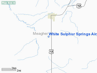
White Sulphur Springs Airport |
Location & QuickFacts
| FAA Information Effective: | 2008-09-25 |
| Airport Identifier: | 7S6 |
| Airport Status: | Operational |
| Longitude/Latitude: | 110-54-47.7600W/46-30-14.7860N
-110.913267/46.504107 (Estimated) |
| Elevation: | 5061 ft / 1542.59 m (Surveyed) |
| Land: | 352 acres |
| From nearest city: | 3 nautical miles S of White Sulphur Springs, MT |
| Location: | Meagher County, MT |
| Magnetic Variation: | 16E (1985) |
Owner & Manager
| Ownership: | Publicly owned |
| Owner: | City & Meagher County |
| Address: | Court House
Wh Sulphur Springs, MT 59645 |
| Phone number: | 206-547-3337 |
| Manager: | Wayne Mathis |
| Address: | Box 769
Wh Sulpher Springs, MT 59645 |
| Phone number: | 406-547-3512 |
Airport Operations and Facilities
| Airport Use: | Open to public |
| Wind indicator: | Yes |
| Segmented Circle: | Yes |
| Control Tower: | No |
| Lighting Schedule: | DUSK-DAWN
ACTVT MIRL RY 01/19 & PAPI RYS 01 & 19 - CTAF. |
| Beacon Color: | Clear-Green (lighted land airport) |
| Landing fee charge: | No |
| Sectional chart: | Great Falls |
| Region: | ANM - Northwest Mountain |
| Boundary ARTCC: | ZLC - Salt Lake City |
| Tie-in FSS: | GTF - Great Falls |
| FSS on Airport: | No |
| FSS Toll Free: | 1-800-WX-BRIEF |
| NOTAMs Facility: | GTF (NOTAM-d service avaliable) |
| Federal Agreements: | NGY |
Airport Communications
Airport Services
| Fuel available: | 100LL |
| Bottled Oxygen: | NONE |
| Bulk Oxygen: | NONE |
Runway Information
Runway 01/19
| Dimension: | 6100 x 60 ft / 1859.3 x 18.3 m |
| Surface: | ASPH, Good Condition |
| Weight Limit: | Single wheel: 12500 lbs. |
| Edge Lights: | Medium
MIRL RY 01/19 OTS INDEFLY. |
| |
Runway 01 |
Runway 19 |
| Traffic Pattern: | Left | Left |
| Markings: | Basic, Poor Condition
RY 01/19 MARKINGS FADED. | Basic, Poor Condition
RWY MARKINGS FADED |
| Crossing Height: | 38.00 ft | 37.00 ft |
| Displaced threshold: | 0.00 ft | 213.00 ft |
| VASI: | 2-light PAPI on left side | 2-light PAPI on left side |
| Visual Glide Angle: | 3.00° | 3.00° |
| Obstruction: | , 50:1 slope to clear | 55 ft pline, 2186.0 ft from runway, 36:1 slope to clear
CLEARANCE SLOPE FROM DSPL THLD 43:1 |
|
Runway 13/31
| Dimension: | 3200 x 90 ft / 975.4 x 27.4 m |
| Surface: | TURF, Fair Condition |
| |
Runway 13 |
Runway 31 |
| Traffic Pattern: | Left | Left |
| Obstruction: | 15 ft road, 224.0 ft from runway, 14:1 slope to clear | 49 ft pline, 930.0 ft from runway, 18:1 slope to clear |
|
Radio Navigation Aids
| ID |
Type |
Name |
Ch |
Freq |
Var |
Dist |
| HAU | NDB | Hauser | | 386.00 | 16E | 35.1 nm |
| CVP | NDB | Capitol | | 335.00 | 16E | 42.8 nm |
| HWQ | NDB | Harlowton | | 242.00 | 17E | 44.9 nm |
| BZN | VOR/DME | Bozeman | 071X | 112.40 | 18E | 44.4 nm |
| HLN | VORTAC | Helena | 124X | 117.70 | 16E | 43.4 nm |
Remarks
- PHONE LOCATED IN PILOTS LOUNGE.
- ANTELOPE & BIRDS FREQUENTLY ON & INVOF ARPT.
- IRRIGATION TWRS AER 13.
- EXISTED PRIOR TO 1959.
Images and information placed above are from
http://www.airport-data.com/airport/7S6/
We thank them for the data!
| General Info
|
| Country |
United States
|
| State |
MONTANA
|
| FAA ID |
7S6
|
| Latitude |
46-30-14.786N
|
| Longitude |
110-54-47.760W
|
| Elevation |
5061 feet
|
| Near City |
WHITE SULPHUR SPRINGS
|
We don't guarantee the information is fresh and accurate. The data may
be wrong or outdated.
For more up-to-date information please refer to other sources.
|
|


