 |
|
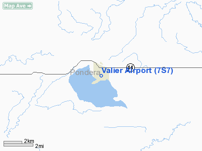
Location & QuickFacts
| FAA Information Effective: | 2008-09-25 |
| Airport Identifier: | 7S7 |
| Airport Status: | Operational |
| Longitude/Latitude: | 112-15-03.1360W/48-17-59.9130N
-112.250871/48.299976 (Estimated) |
| Elevation: | 3820 ft / 1164.34 m (Estimated) |
| Land: | 62 acres |
| From nearest city: | 1 nautical miles S of Valier, MT |
| Location: | Pondera County, MT |
| Magnetic Variation: | 18E (1985) |
Owner & Manager
| Ownership: | Publicly owned |
| Owner: | Pondera County |
| Address: | Pondera Cty Courthouse
Conrad, MT 59425 |
| Phone number: | 406-278-7681 |
| Manager: | Chuck Redd |
| Address: | Box 352
Valier, MT 59486 |
| Phone number: | 406-279-3342 |
Airport Operations and Facilities
| Airport Use: | Open to public |
| Wind indicator: | Yes |
| Segmented Circle: | Yes |
| Control Tower: | No |
| Landing fee charge: | No |
| Sectional chart: | Great Falls |
| Region: | ANM - Northwest Mountain |
| Boundary ARTCC: | ZLC - Salt Lake City |
| Tie-in FSS: | GTF - Great Falls |
| FSS on Airport: | No |
| FSS Toll Free: | 1-800-WX-BRIEF |
| NOTAMs Facility: | GTF (NOTAM-d service avaliable) |
| Federal Agreements: | N |
Airport Communications
Airport Services
| Fuel available: | 100LLA
FOR FUEL CALL (406) 279-3342. |
| Airframe Repair: | MAJOR |
| Power Plant Repair: | MAJOR |
| Bottled Oxygen: | NONE |
| Bulk Oxygen: | NONE |
Runway Information
Runway 04/22
| Dimension: | 2280 x 300 ft / 694.9 x 91.4 m |
| Surface: | TURF, Good Condition |
| |
Runway 04 |
Runway 22 |
| Traffic Pattern: | Left | Right |
| Obstruction: | 33 ft trees, 132.0 ft from runway, 4 ft right of centerline, 7:1 slope to clear
+10' TREES ON RWY CNTRLN EXTNDD. | 4 ft fence, 145.0 ft from runway, 50 ft left of centerline, 36:1 slope to clear |
|
Runway 07/25
| Dimension: | 3075 x 150 ft / 937.3 x 45.7 m |
| Surface: | TURF, Good Condition |
| |
Runway 07 |
Runway 25 |
| Traffic Pattern: | Left | Right |
| Markings: | Nonstandard, Good Condition
07/25 RY 10/28 & RY 04/22 MARKED WITH WHITE CONES FULL LENGTH. | , |
| Obstruction: | 57 ft trees, 912.0 ft from runway, 16:1 slope to clear
+24' TREES ON RWY CNTRLN EXTNDD. | 4 ft fence, 100.0 ft from runway, 25:1 slope to clear |
|
Runway 10/28
| Dimension: | 2140 x 130 ft / 652.3 x 39.6 m |
| Surface: | TURF, Good Condition |
| |
Runway 10 |
Runway 28 |
| Traffic Pattern: | Left | Right |
| Obstruction: | 125 ft tower, 552.0 ft from runway, 288 ft left of centerline, 4:1 slope to clear | 42 ft trees, 300.0 ft from runway, 10 ft right of centerline, 7:1 slope to clear
+15' TREES ON RWY CNTRLN EXTNDD. |
|
Radio Navigation Aids
| ID |
Type |
Name |
Ch |
Freq |
Var |
Dist |
| CRD | NDB | Conrad | | 293.00 | 17E | 15.1 nm |
| SBX | NDB | Shelby | | 347.00 | 18E | 21.2 nm |
| CII | NDB | Choteau | | 269.00 | 17E | 28.9 nm |
| CTB | VORTAC | Cut Bank | 091X | 114.40 | 17E | 16.3 nm |
Remarks
- CAUTION WATERFOWL ON & INVOF ARPT.
- ESTBD PRIOR TO 1959.
Images and information placed above are from
http://www.airport-data.com/airport/7S7/
We thank them for the data!
| General Info
|
| Country |
United States
|
| State |
MONTANA
|
| FAA ID |
7S7
|
| Latitude |
48-17-59.913N
|
| Longitude |
112-15-03.136W
|
| Elevation |
3820 feet
|
| Near City |
VALIER
|
We don't guarantee the information is fresh and accurate. The data may
be wrong or outdated.
For more up-to-date information please refer to other sources.
|
|


