 |
|
Location & QuickFacts
| FAA Information Effective: | 2008-09-25 |
| Airport Identifier: | 7S1 |
| Airport Status: | Operational |
| Longitude/Latitude: | 112-18-09.4408W/45-32-01.4821N
-112.302622/45.533745 (Estimated) |
| Elevation: | 4777 ft / 1456.03 m (Estimated) |
| Land: | 364 acres |
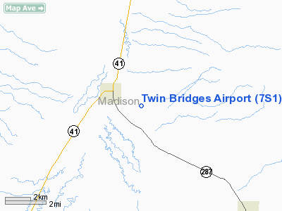
| From nearest city: | 2 nautical miles SE of Twin Bridges, MT |
| Location: | Madison County, MT |
| Magnetic Variation: | 17E (1985) |
Owner & Manager
| Ownership: | Publicly owned |
| Owner: | Madison Co & Town Of Twin Bridges |
| Address: | Box 278
Virginia City, MT 59775-0278 |
| Phone number: | 406-843-4277
(406) 596-1129 |
| Manager: | Ron Coleman |
| Address: | Po Box 235
Twin Bridges, MT 59774 |
| Phone number: | 406-684-5335
OR 596-1129 |
Airport Operations and Facilities
| Airport Use: | Open to public |
| Wind indicator: | Yes |
| Segmented Circle: | Yes |
| Control Tower: | No |
| Lighting Schedule: | DUSK-DAWN
MIRL RY 17/35 AND PAPI RY 17 & RY 34 OPER DUSK - 2000; AFTER 2000 ACTVT MIRL RY 17/35 AND PAPI RYS 17 & 35 - CTAF. |
| Beacon Color: | Clear-Green (lighted land airport) |
| Landing fee charge: | No |
| Sectional chart: | Great Falls |
| Region: | ANM - Northwest Mountain |
| Boundary ARTCC: | ZLC - Salt Lake City |
| Tie-in FSS: | GTF - Great Falls |
| FSS on Airport: | No |
| FSS Toll Free: | 1-800-WX-BRIEF |
| NOTAMs Facility: | GTF (NOTAM-d service avaliable) |
| Federal Agreements: | NGY |
Airport Communications
Airport Services
| Fuel available: | 100LLA |
| Airframe Repair: | MAJOR |
| Power Plant Repair: | MAJOR |
| Bottled Oxygen: | NONE |
| Bulk Oxygen: | NONE |
Runway Information
Runway 07/25
| Dimension: | 3400 x 110 ft / 1036.3 x 33.5 m |
| Surface: | TURF-GRVL, Fair Condition |
| |
Runway 07 |
Runway 25 |
| Longitude: | 112-18-44.1310W | 112-17-56.6800W |
| Latitude: | 45-31-57.9020N | 45-32-01.6500N |
| Elevation: | 4706.00 ft | 4777.00 ft |
| Alignment: | 83 | 127 |
| Traffic Pattern: | Left | Left |
| Obstruction: | 11 ft road, 264.0 ft from runway, 24:1 slope to clear | 10 ft fence, 56.0 ft from runway, 14:1 slope to clear |
|
Runway 17/35
| Dimension: | 4299 x 60 ft / 1310.3 x 18.3 m |
| Surface: | ASPH, Good Condition |
| Weight Limit: | Single wheel: 12500 lbs. |
| Edge Lights: | Medium |
| |
Runway 17 |
Runway 35 |
| Longitude: | 112-17-59.4860W | 112-18-02.0520W |
| Latitude: | 45-32-24.0290N | 45-31-41.6340N |
| Elevation: | 4777.00 ft | 4760.00 ft |
| Alignment: | 127 | 2 |
| Traffic Pattern: | Left | Left |
| Markings: | Basic, Good Condition | Basic, Good Condition |
| Crossing Height: | 29.00 ft | 35.00 ft |
| VASI: | 2-light PAPI on left side | 2-light PAPI on left side |
| Visual Glide Angle: | 3.00° | 3.00° |
| Obstruction: | , 50:1 slope to clear | 4 ft fence, 317.0 ft from runway, 29:1 slope to clear |
|
Radio Navigation Aids
| ID |
Type |
Name |
Ch |
Freq |
Var |
Dist |
| EKS | NDB | Ennis | | 286.00 | 15E | 31.9 nm |
| DLN | VOR/DME | Dillon | 077X | 113.00 | 18E | 20.0 nm |
| CPN | VOR/DME | Coppertown | 053X | 111.60 | 16E | 35.3 nm |
| HIA | VORTAC | Whitehall | 084X | 113.70 | 18E | 20.5 nm |
Remarks
- DEER ON & INVOF ARPT.
- 195 FT TALL TOWER 1.4 NM 'NE' OF RY 17 THRESHOLD.
- WX STATION ON ARPT; ACTIVATE-CTAF OR CALL 617-262-3825.
Images and information placed above are from
http://www.airport-data.com/airport/7S1/
We thank them for the data!
| General Info
|
| Country |
United States
|
| State |
MONTANA
|
| FAA ID |
7S1
|
| Latitude |
45-31-59.733N
|
| Longitude |
112-18-32.996W
|
| Elevation |
4772 feet
|
| Near City |
TWIN BRIDGES
|
We don't guarantee the information is fresh and accurate. The data may
be wrong or outdated.
For more up-to-date information please refer to other sources.
|
|


