 |
|
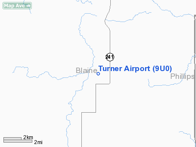
Location & QuickFacts
| FAA Information Effective: | 2008-09-25 |
| Airport Identifier: | 9U0 |
| Airport Status: | Operational |
| Longitude/Latitude: | 108-24-29.7484W/48-51-14.9547N
-108.408263/48.854154 (Estimated) |
| Elevation: | 3049 ft / 929.34 m (Surveyed) |
| Land: | 71 acres |
| From nearest city: | 1 nautical miles NE of Turner, MT |
| Location: | Blaine County, MT |
| Magnetic Variation: | 15E (1985) |
Owner & Manager
| Ownership: | Publicly owned |
| Owner: | Blaine County |
| Address: | Blaine County Arpt Commission
Chinook, MT 59523 |
| Phone number: | 406-357-3250 |
| Manager: | John Harmon |
| Address: | Po Box 165
Turner, MT 59542 |
| Phone number: | 406-379-2584
OR 379-2501 |
Airport Operations and Facilities
| Airport Use: | Open to public |
| Wind indicator: | Yes |
| Segmented Circle: | Yes |
| Control Tower: | No |
| Lighting Schedule: | DUSK-DAWN
MIRL RY 07/25 & VASI RY 25 OPER DUSK-2200; AFTER 2200 ACTVT MIRL RY 07/25 & VASI RY 25 - CTAF. |
| Beacon Color: | Clear-Green (lighted land airport)
BCN OTS INDEFLY. |
| Landing fee charge: | No |
| Sectional chart: | Billings |
| Region: | ANM - Northwest Mountain |
| Boundary ARTCC: | ZLC - Salt Lake City |
| Tie-in FSS: | GTF - Great Falls |
| FSS on Airport: | No |
| FSS Toll Free: | 1-800-WX-BRIEF |
| NOTAMs Facility: | GTF (NOTAM-d service avaliable) |
| Federal Agreements: | NGY |
Airport Communications
Airport Services
| Airframe Repair: | NONE |
| Power Plant Repair: | NONE |
| Bottled Oxygen: | NONE |
| Bulk Oxygen: | NONE |
Runway Information
Runway 07/25
| Dimension: | 3612 x 60 ft / 1100.9 x 18.3 m |
| Surface: | ASPH, Good Condition |
| Weight Limit: | Single wheel: 12500 lbs. |
| Edge Lights: | Medium |
| |
Runway 07 |
Runway 25 |
| Longitude: | 108-24-50.8300W | 108-23-57.2600W |
| Latitude: | 48-51-12.3600N | 48-51-16.8700N |
| Traffic Pattern: | Left | Left |
| Markings: | Basic, Good Condition | Basic, Good Condition |
| Crossing Height: | 0.00 ft | 38.00 ft |
| VASI: | | 2-light PAPI on left side |
| Visual Glide Angle: | 0.00° | 3.00° |
| Obstruction: | 10 ft road, 543.0 ft from runway, 34:1 slope to clear | 50 ft ant, 1325.0 ft from runway, 171 ft left of centerline, 22:1 slope to clear
+52' ANTENNA 150' RIGHT OF CNTRLN EXTDD. |
|
Runway 10/28
| Dimension: | 2190 x 90 ft / 667.5 x 27.4 m |
| Surface: | TURF, Fair Condition |
| |
Runway 10 |
Runway 28 |
| Longitude: | 108-24-53.6700W | 108-24-24.6400W |
| Latitude: | 48-51-20.5100N | 48-51-10.5200N |
| Elevation: | 3051.00 ft | 3049.00 ft |
| Traffic Pattern: | Left | Left |
| Obstruction: | 18 ft road, 411.0 ft from runway, 22:1 slope to clear | 5 ft fence, 328.0 ft from runway
65:1 |
|
Radio Navigation Aids
| ID |
Type |
Name |
Ch |
Freq |
Var |
Dist |
| MLK | NDB | Malta | | 272.00 | 17E | 34.6 nm |
Remarks
- EXISTED PRIOR TO 05/15/59
Images and information placed above are from
http://www.airport-data.com/airport/9U0/
We thank them for the data!
| General Info
|
| Country |
United States
|
| State |
MONTANA
|
| FAA ID |
9U0
|
| Latitude |
48-51-15.025N
|
| Longitude |
108-24-32.477W
|
| Elevation |
3049 feet
|
| Near City |
TURNER
|
We don't guarantee the information is fresh and accurate. The data may
be wrong or outdated.
For more up-to-date information please refer to other sources.
|
|


