 |
|
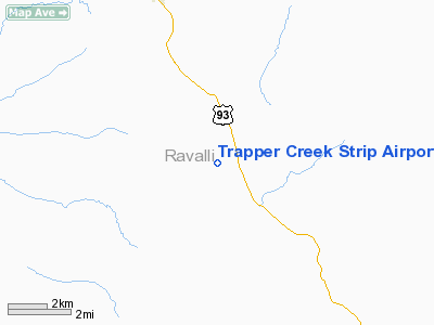
Trapper Creek Strip Airport |
Location & QuickFacts
| FAA Information Effective: | 2008-09-25 |
| Airport Identifier: | MT30 |
| Airport Status: | Operational |
| Longitude/Latitude: | 114-08-13.3050W/45-56-24.7120N
-114.137029/45.940198 (Estimated) |
| Elevation: | 4040 ft / 1231.39 m (Estimated) |
| Land: | 0 acres |
| From nearest city: | 1 nautical miles NW of Conner, MT |
| Location: | Ravalli County, MT |
| Magnetic Variation: | 17E (1985) |
Owner & Manager
| Ownership: | Privately owned |
| Owner: | Don Wanstraph |
| Address: | Box 477
Darby, MT 59829 |
| Phone number: | 406-821-3783 |
| Address: |
|
Airport Operations and Facilities
| Airport Use: | Private |
| Wind indicator: | Yes |
| Segmented Circle: | No |
| Control Tower: | No |
| Landing fee charge: | No |
| Sectional chart: | Great Falls |
| Region: | ANM - Northwest Mountain |
| Boundary ARTCC: | ZLC - Salt Lake City |
| Tie-in FSS: | GTF - Great Falls |
| FSS on Airport: | No |
| FSS Toll Free: | 1-800-WX-BRIEF |
Runway Information
Runway 16/34
| Dimension: | 1470 x 60 ft / 448.1 x 18.3 m |
| Surface: | TURF, |
| |
Runway 16 |
Runway 34 |
| Traffic Pattern: | Left | Left |
|
Radio Navigation Aids
| ID |
Type |
Name |
Ch |
Freq |
Var |
Dist |
| HMM | NDB | Hamilton | | 410.00 | 19E | 19.0 nm |
Remarks
- WATCH FOR WATER ON RWY.
- FILED FOR RECORD PURPOSES ONLY.
Images and information placed above are from
http://www.airport-data.com/airport/MT30/
We thank them for the data!
| General Info
|
| Country |
United States
|
| State |
MONTANA
|
| FAA ID |
MT30
|
| Latitude |
45-56-24.712N
|
| Longitude |
114-08-13.305W
|
| Elevation |
4040 feet
|
| Near City |
CONNER
|
We don't guarantee the information is fresh and accurate. The data may
be wrong or outdated.
For more up-to-date information please refer to other sources.
|
|


