 |
|
Location & QuickFacts
| FAA Information Effective: | 2008-09-25 |
| Airport Identifier: | 1S3 |
| Airport Status: | Operational |
| Longitude/Latitude: | 106-37-23.9000W/46-16-16.2000N
-106.623306/46.271167 (Estimated) |
| Elevation: | 2727 ft / 831.19 m (Surveyed) |
| Land: | 266 acres |
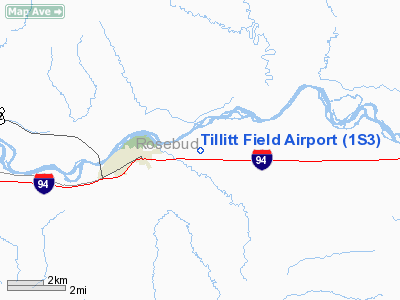
| From nearest city: | 3 nautical miles E of Forsyth, MT |
| Location: | Rosebud County, MT |
| Magnetic Variation: | 14E (1985) |
Owner & Manager
| Ownership: | Publicly owned |
| Owner: | County Of Rosebud |
| Address: | County Courthouse
Forsyth, MT 59327 |
| Phone number: | 406-356-7544 |
| Manager: | Brian Schwend |
| Address: | Po Box 45
Forsyth, MT 59327 |
| Phone number: | 406-346-7129
HOME 406-356-7544. |
Airport Operations and Facilities
| Airport Use: | Open to public |
| Wind indicator: | Yes |
| Segmented Circle: | Yes |
| Control Tower: | No |
| Lighting Schedule: | DUSK-DAWN
MIRL RY 08/26 OPERS DUSK-2200; AFT 2200 ACTVT - CTAF. ACTVT PAPI RYS 08 & 26 - CTAF. |
| Beacon Color: | Clear-Green (lighted land airport) |
| Landing fee charge: | No |
| Sectional chart: | Billings |
| Region: | ANM - Northwest Mountain |
| Boundary ARTCC: | ZLC - Salt Lake City |
| Tie-in FSS: | GTF - Great Falls |
| FSS on Airport: | No |
| FSS Toll Free: | 1-800-WX-BRIEF |
| NOTAMs Facility: | GTF (NOTAM-d service avaliable) |
| Federal Agreements: | NGY |
Airport Communications
| CTAF: | 122.800 |
| Unicom: | 122.800 |
Airport Services
| Fuel available: | 100LL |
| Airframe Repair: | MAJOR |
| Power Plant Repair: | MAJOR |
| Bottled Oxygen: | NONE |
| Bulk Oxygen: | NONE |
Runway Information
Runway 08/26
| Dimension: | 4796 x 75 ft / 1461.8 x 22.9 m |
| Surface: | ASPH, Good Condition |
| Surface Treatment: | Porous Friction Course |
| Weight Limit: | Single wheel: 12000 lbs.
Dual wheel: 16000 lbs. |
| Edge Lights: | Medium |
| |
Runway 08 |
Runway 26 |
| Longitude: | 106-37-59.9474W | 106-36-52.0850W |
| Latitude: | 46-16-18.8162N | 46-16-13.6929N |
| Elevation: | 2727.00 ft | 2726.00 ft |
| Alignment: | 96 | 127 |
| Traffic Pattern: | Left | Left |
| Markings: | Basic, Good Condition | Non-precision instrument, Good Condition |
| Crossing Height: | 29.00 ft | 29.00 ft |
| VASI: | 2-light PAPI on left side | 2-light PAPI on left side |
| Visual Glide Angle: | 3.00° | 3.00° |
| Obstruction: | 27 ft trees, 762.0 ft from runway, 53 ft left of centerline, 20:1 slope to clear | 15 ft road, 583.0 ft from runway, 25:1 slope to clear |
|
Radio Navigation Aids
| ID |
Type |
Name |
Ch |
Freq |
Var |
Dist |
| FOR | NDB | Forsyth | | 236.00 | 14E | 4.4 nm |
| HTN | NDB | Horton | | 320.00 | 15E | 29.7 nm |
| MLS | VORTAC | Miles City | 058X | 112.10 | 15E | 28.6 nm |
Images and information placed above are from
http://www.airport-data.com/airport/1S3/
We thank them for the data!
| General Info
|
| Country |
United States
|
| State |
MONTANA
|
| FAA ID |
1S3
|
| Latitude |
46-16-15.983N
|
| Longitude |
106-37-26.114W
|
| Elevation |
2727 feet
|
| Near City |
FORSYTH
|
We don't guarantee the information is fresh and accurate. The data may
be wrong or outdated.
For more up-to-date information please refer to other sources.
|
|


